Hinchinbrooke, Quebec
Hinchinbrooke is a rural community in southern Quebec, in the Châteauguay Valley, in the MRC de Le Haut-Saint-Laurent. The population as of the Canada 2011 Census was 2,242.
Hinchinbrooke | |
|---|---|
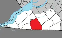 Location within Le Haut-Saint-Laurent RCM. | |
 Hinchinbrooke Location in southern Quebec. | |
| Coordinates: 45°03′N 74°06′W[1] | |
| Country | |
| Province | |
| Region | Montérégie |
| RCM | Le Haut-Saint-Laurent |
| Constituted | July 1, 1855 |
| Government | |
| • Mayor | Normand Crete |
| • Federal riding | Beauharnois—Salaberry |
| • Prov. riding | Huntingdon |
| Area | |
| • Total | 150.20 km2 (57.99 sq mi) |
| • Land | 149.30 km2 (57.65 sq mi) |
| Population (2016)[4] | |
| • Total | 2,103 |
| • Density | 14.1/km2 (37/sq mi) |
| • Pop 2011-2016 | |
| • Dwellings | 1,186 |
| Time zone | UTC−5 (EST) |
| • Summer (DST) | UTC−4 (EDT) |
| Postal code(s) | |
| Area code(s) | 450 and 579 |
| Highways | |
History
Since the 1980 dissolution of Huntingdon County, Hinchinbrooke is within Le Haut-Saint-Laurent Regional County Municipality.
Geography
The municipality is situated along the Canada–United States border. It is one of the two southernmost communities in Quebec, along with Elgin, with their tripoint with New York on the Châteauguay River being the southernmost point in the province.
Communities
The following locations reside within the municipality's boundaries:[1]
- Athelstan (45°02′09″N 74°10′39″W) – a hamlet situated on the western border with Elgin.
- Brooklet (45°00′25″N 74°02′51″W) – a hamlet situated in the southeast.
- Herdman (45°01′34″N 74°05′43″W) – a hamlet located along Quebec Route 202 in the south.
- Parc Davignon (45°00′02″N 74°04′50″W) – a cottage community along the US border.
- Powerscourt (45°00′23″N 74°09′26″W) – a hamlet situated on the southwest border with Elgin.
- Rockburn (45°01′19″N 74°00′28″W) – a hamlet located along Quebec Route 202 in the southeast.
Lakes & Rivers
The following waterways pass through or are situated within the municipality's boundaries:[1]
- Lac Moonlight (45°01′45″N 74°08′51″W) – a small lake in the southwest.
- Rivière Hinchinbrooke (45°02′21″N 74°11′04″W) – runs along the municipality's western border.
Demographics
Population
| 2021 | 2011 | |
|---|---|---|
| Population | 2,187 (+4.0% from 2016) | 2,242 (-5.4% from 2006) |
| Land area | 148.36 km2 (57.28 sq mi) | 149.32 km2 (57.65 sq mi) |
| Population density | 14.7/km2 (38/sq mi) | 15.0/km2 (39/sq mi) |
| Median age | 53.6 (M: 52.8, F: 54.4) | 49.9 (M: 49.3, F: 50.5) |
| Total private dwellings | 1,025 | 1,148 |
| Median household income | $.N/A |
|
|
|
Language
| Canada Census Mother Tongue - Hinchinbrooke, Quebec[8] | ||||||||||||||||||
|---|---|---|---|---|---|---|---|---|---|---|---|---|---|---|---|---|---|---|
| Census | Total | French |
English |
French & English |
Other | |||||||||||||
| Year | Responses | Count | Trend | Pop % | Count | Trend | Pop % | Count | Trend | Pop % | Count | Trend | Pop % | |||||
2016 |
2,100 |
915 | 43.57% | 1,045 | 49.76% | 40 | 1.90% | 90 | 4.29% | |||||||||
2011 |
2,230 |
940 | 42.15% | 1,145 | 51.35% | 35 | 1.57% | 110 | 4.93% | |||||||||
2006 |
2,360 |
1,055 | 44.70% | 1,065 | 45.13% | 20 | 0.85% | 220 | 9.32% | |||||||||
2001 |
2,370 |
1,135 | 47.89% | 1,065 | 44.94% | 45 | 1.90% | 125 | 5.27% | |||||||||
1996 |
2,390 |
880 | n/a | 36.82% | 1,355 | n/a | 56.69% | 35 | n/a | 1.46% | 120 | n/a | 5.02% | |||||
Economy
The primary industries in Hinchinbrooke are agriculture, with dairy cattle and apple farming being the most prevalent sub-sectors.
Notable residents
Sir William Hales Hingston, physician and mayor of Montreal from 1875 to 1877, was born in Hinchinbrooke.
See also
- Hinchinbrooke River
- Trout River
- Rivière aux Outardes
- Le Haut-Saint-Laurent Regional County Municipality
- Liste des municipalités locales de la Montérégie
- List of municipalities in Quebec
References
- "Reference number 273739 in Banque de noms de lieux du Québec". toponymie.gouv.qc.ca (in French). Commission de toponymie du Québec.
- Ministère des Affaires municipales, des Régions et de l'Occupation du territoire: Hinchinbrooke
- Riding history for Beauharnois—Salaberry, Quebec from the Library of Parliament
- "2011 Community Profiles". 2011 Canadian Census. Statistics Canada. March 21, 2019. Retrieved 2014-02-12.
- "2021 Community Profiles". 2021 Canadian Census. Statistics Canada. February 4, 2022. Retrieved 2022-04-27.
- "2006 Community Profiles". 2006 Canadian Census. Statistics Canada. August 20, 2019.
- "2001 Community Profiles". 2001 Canadian Census. Statistics Canada. July 18, 2021.
- Statistics Canada: 1996, 2001, 2006, 2011 census
External links
Adjacent Municipal Subdivisions | ||||||||||||||||
|---|---|---|---|---|---|---|---|---|---|---|---|---|---|---|---|---|
| ||||||||||||||||
| Cities | |
|---|---|
| Municipalities | |
| Parishes | |
| Townships | |
| |