Galain-Chazh
Galain-Chazh (Chechen: Галайн-ЧIаж, "gorge of Galay") is a historical region in the North Caucasus. Today, Galain-Chazh is a part of Galanchozhsky District, Chechnya.
Since the Middle Ages, Galain-Chazh has been known as the historical center and birthplace of the Galay teip, a clan of the Orstkhoy tukkhum. In 1944, the entire population was deported to Kazakhstan. Since then, there has been no permanent population in the region.
Galain-Chazh | |
|---|---|
 | |
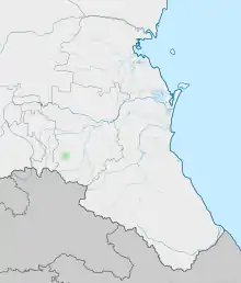
Location of Galain-Chazh | |
 Galain-Chazh Location of Galain-Chazh | |
| Coordinates: 42°53′0″N 45°18′0″E | |
| Country | Russia |
| Elevation | 1,500 m (4,900 ft) |
Name
The name Galain-Chazh roughly translates to English as "gorge of Galai". The name originated from the Galai clan, who settled in the gorge.[2]
Geography
Galain-Chazh is located in the center of Galanchozhsky District. The territory includes Galain-Am (Lake Galanchozh), which is also named after the Galai clan.
Galain-Chazh borders with Orstkhoy-Mokhk in the north, Akka in the west, Khaykharoy in north west, Nashkha in the east, and Terloy-Mokhk in the south.[3]
Auls
Galain-Chazh includes the following villages:[4]
- Aka-Bass,
- Ame,
- Amka,
- Chusha,
- Ei-Salashka,
- Iga-Yurt,
- Kerbeta,
- Kerbicha,
- Korga,
- Ochakh,
- Terkhie.
References
- Error: Unable to display the reference properly. See the documentation for details.
- "В Чеченской Республике восстановлены Чеберлоевский и Галанчожский районы". ИА Чечня Сегодня (in Russian).
- "Карта Чеченской республики подробная с районами, селами и городами. Схема и спутник онлайн". 1maps.ru.
- "Карта Чеченской республики подробная с районами, селами и городами. Схема и спутник онлайн". 1maps.ru.