Wellington Harbour
Wellington Harbour (Māori: Te Whanganui-a-Tara [tɛ ˈfaŋanʉi a taɾa], historically known as Port Nicholson) is a large natural harbour on the southern tip of New Zealand's North Island. New Zealand's capital city, Wellington, is located on parts of its western and southern sides. Lower Hutt is located on parts of its northern and eastern sides.[1]
| Wellington Harbour | |
|---|---|
| Port Nicholson | |
 Looking north-east over Wellington Harbour from above Cook Strait Left to right: Lambton Harbour, Miramar Peninsula and the harbour entrance | |
 Wellington Harbour Location in New Zealand | |
| Location | Wellington, New Zealand |
| Coordinates | 41°16′S 174°51′E |
| Type | Harbour |
| Native name | Te Whanganui-a-Tara (Māori) |
| River sources | Hutt River |
| Ocean/sea sources | Cook Strait |
The harbour, the sea area bounded by a line between Pencarrow Head to Petone foreshore, was officially named Port Nicholson until it assumed its current dual name in 1984.[2] It is now a regional park, overseen by Wellington Regional Council.[1]
In the Māori language the harbour is known as Te Whanganui-a-Tara, "the great harbour of Tara".[3] Another Māori name for Wellington, Pōneke, is said to be a transliteration of Port Nick (Port Nicholson).[4][5]
Geography
Aotea Quay
Wellington Harbour is an arm of Cook Strait, covering some 76 km², with a two-kilometre wide entrance at its southern end between Pencarrow Head and Palmer Head on the southern tip of Miramar Peninsula. It has a maximum length of over 11 kilometres and a width of 9.25 kilometres. The harbour has an entrance over 1.6 kilometres wide from shore to shore and as it is surrounded by hills over 300 meters high, it provides sheltered anchorage in a region where wind velocities may exceed 160 km/h. The depth of water over the great bulk of the harbour exceeds 20 metres or 10 fathoms.[6]
The harbour is of seismic origin, and a major earthquake fault lies along its western shore. At the northern end of the harbour lies the narrow triangular plain of the Hutt River, which largely follows the line of the earthquake fault to the north-east. The city of Lower Hutt is located on this plain.[1]
The central city suburbs spread around the hills overlooking the west and south-west of Wellington Harbour and its two large bays, Lambton Harbour and Evans Bay. Lambton Harbour is surrounded by the reclaimed land of Wellington's central business district and contains the majority of the city's port facilities. Evans Bay is an inlet between Mt Victoria and the Miramar Peninsula that serves as a flight path to low-lying Wellington Airport. The small Oriental Bay features beaches and cafes.[1]
To the east of the harbour lie several small bays, most of which are populated by small coastal communities. The largest of these suburban settlements is Eastbourne, directly to the east of the northern tip of the Miramar Peninsula.[1]
The small islands Matiu / Somes Island, Mākaro / Ward Island and Mokopuna Island are located in the harbour.[1]
The entrance to the harbour can be quite dangerous, especially since Cook Strait to the south is notoriously rough. Close to the harbour's entrance lies Barrett Reef, where rocks break the water's surface at low tide.[1]
History

Pre-European history
According to oral history, Wellington Harbour was first discovered by the Polynesian explorer Kupe.[1]
A traditional Māori name for the area, Te Upoko o te Ika a Maui, is derived from Māori legend and translates literally as "the head of Maui's fish".[7]
Te Whanganui a Tara, another Māori name from the area, translates literally as "the great harbour of Tara". It is believed to refer to Whatonga's son Tara, who was sent down from the Māhia Peninsula by his father to explore southern lands for their people to settle.[7]
Modern history
William Wakefield named the harbour Lambton Harbour in 1839 in honour of the Earl of Durham, who had the family name of "Lambton".[8]
Port Nicholson is said to have received its name from Captain James Herd, who sailed into the Harbour of Tara in 1826 and left it with its first European name, calling it after Sydney's Harbourmaster Captain John Nicholson[7] however, while Herd is attributed to the first charts describing Te Whanganui a Tara as "Port Nicholson" it is likely that Captain John Rodolphus Kent of the cutter Mermaid had previously named it after the harbormaster, his superior officer.[9]
The New Zealand Company established settlements in Petone and Wellington from 1840.[10]
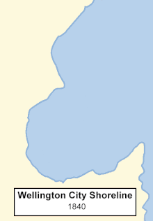
The 1855 Wairarapa earthquake uplifted the north-western side of the Wellington bay. This led to the reclamation of Wellington Harbour, which increased the availability of flat land for Wellington City.[11]
In 1968, the inter-island passenger ferry Wahine grounded at Barrett Reef, near the harbour entrance, during a storm. Fifty-one people died.[1]
Transport

Wellington Harbour is a significant port serving the lower North Island, with the Regional Council-owned company Centreport recording around 14,000 commercial shipping movements each year. Wellington Harbour, the region's third largest container port, is located in Wellington City.[12] There is a tanker terminal at Seaview in Lower Hutt.[1]
Wellington harbour ferries first began operating at the end of the 19th century and regular crossings from central Wellington to Days Bay continue today. The harbour is also used by inter-island ferries, linking Wellington to Picton. A project to develop a walking and cycling route around the harbour, the Great Harbour Way, is gathering momentum.[1]
Recreation

The Wellington South Coast and harbour entrance is exposed to open sea, providing places to dive and fish. There are also fishing spots at the rocks and reclamations within the harbour.[1]
Harbour beaches like Oriental Bay, Petone Bay, Days Bay and Hataitai Beach are suited to swimming and sunbathing.[1]
The harbour accommodates a range of activities, with five water ski lanes, an area for personal water craft and areas for windsurfing. Several rowing, waka ama and yachting clubs operate from the harbour.[1]
Small boat craft can anchor at Mākaro / Ward Island and Mokopuna Island and can also visit the Matiu / Somes Island reserve during daylight hours. Harbour cruises also travel regularly between the main Wellington waterfront, Matiu / Somes Island, Days Bay and Petone.[1]
Gallery
 HMS Indefatigable, 1945
.jpg.webp) MS Wanganella being towed from an entrance reef, 1947
MS Wanganella being towed from an entrance reef, 1947 QE2 slips out the entrance in a following breeze, 2006
 Tugs Kupe and Toia, 2006
 Lambton Harbour, 2007
 HMNZS Canterbury, 2007
 Aotea Quay, 2008
 Ferry and Barrett Reef just after low water, 2010
.jpg.webp) Aotea Quay, Queen Mary 2, 2011
Aotea Quay, Queen Mary 2, 2011 Pleasure craft, 2012
See also
References
- "Wellington Harbour". gw.govt.nz. Wellington Regional Council.
- "Place name detail: Wellington Harbour (Port Nicholson)". New Zealand Gazetteer. New Zealand Geographic Board. Retrieved 31 July 2021.
- David Allan Hamer & Roberta Nicholls, (editors). The Making of Wellington, 1800–1914, Victoria University Press, 1990 ISBN 0-86473-200-7
- F. L. Irvine-Smith. The Streets of My City, Wellington New Zealand, A.H. & A.W. Reed, Wellington New Zealand 1948.
- Tony Deverson and Graeme Kennedy (Ed.) The New Zealand Oxford Dictionary, Oxford University Press, 2005, ISBN 9780195584516
- A. H. McLintock, (editor). Port Nicholson (Wellington Harbour), An Encyclopaedia of New Zealand, published 1966. ISBN 978-0-478-18451-8
- "Wellington's Māori History". newzealand.com. Tourism New Zealand.
- "Wellington Waterfront History". wellingtonwaterfront.co.nz. Wellington Waterfront. Archived from the original on 5 April 2014.
- Johnson, David (1996). Wellington Harbour. Wellington Maritime Museum Trust. Wellington [N.Z.]: Wellington Maritime Museum Trust. ISBN 0-9583498-0-0. OCLC 45262694.
- Maclean, Chris (15 June 2008). "Wellington". Te Ara: the Encyclopedia of New Zealand. Retrieved 16 August 2008.
- "Wellington Waterfront Reclamation". wellingtonwaterfront.co.nz. Wellington Waterfront.
- "Centreport Continues its Big Ship Agenda". centreport.co.nz. Centreport.