Puerto Rico Highway 802
Puerto Rico Highway 802 (PR-802) is an east–west road between the municipalities of Corozal and Naranjito in Puerto Rico.[2] With a length of 6.6 kilometers (4.1 mi),[1] it begins at its intersection with PR-801 in Palmarito barrio in Corozal, and ends at its junction with PR-152 and PR-803 in Cedro Arriba barrio in Naranjito.[3]
 Puerto Rico Highway 802 in Palmarito, Corozal
Highway 802 | ||||
|---|---|---|---|---|
| Ruta 802 | ||||
| Route information | ||||
| Maintained by Puerto Rico DTPW | ||||
| Length | 6.6 km[1] (4.1 mi) | |||
| Major junctions | ||||
| West end | ||||
| East end | ||||
| Location | ||||
| Country | United States | |||
| Territory | Puerto Rico | |||
| Municipalities | Corozal, Naranjito | |||
| Highway system | ||||
| ||||

Major intersections
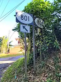 PR-801 at its junction with PR-802 in Palmarito, Corozal
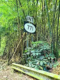 PR-802 near its junction with PR-771 in Maná, Corozal
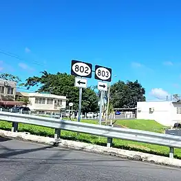 PR-152 at its junction with PR-802 and PR-803 in Cedro Arriba, Naranjito
| Municipality | Location | km[1] | mi | Destinations | Notes |
|---|---|---|---|---|---|
| Corozal | Palmarito | 0.0 | 0.0 | Western terminus of PR-802 | |
| Maná | 3.9 | 2.4 | |||
| Naranjito | Cedro Arriba | 6.6 | 4.1 | Eastern terminus of PR-802 | |
| 1.000 mi = 1.609 km; 1.000 km = 0.621 mi | |||||
See also
References
- Google (17 August 2020). "PR-802" (Map). Google Maps. Google. Retrieved 17 August 2020.
- National Geographic Maps (2011). Puerto Rico (Map). 1:125,000. Adventure Map (Book 3107). Evergreen, Colorado: National Geographic Maps. ISBN 978-1566955188. OCLC 756511572.
- "PR-802, Corozal, Puerto Rico". geoview.info. Retrieved 1 June 2021.
This article is issued from Wikipedia. The text is licensed under Creative Commons - Attribution - Sharealike. Additional terms may apply for the media files.