Puerto Rico Highway 807
Puerto Rico Highway 807 (PR-807) is a north–south road located in Corozal, Puerto Rico.[2] It begins at Calle San Manuel in downtown Corozal, passing through Dos Bocas barrio until its southern terminus at its junction with PR-805 on the Palos Blancos–Negros line.[3][4]
Highway 807 | ||||
|---|---|---|---|---|
| Ruta 807 | ||||
| Route information | ||||
| Maintained by Puerto Rico DTPW | ||||
| Length | 6.9 km[1] (4.3 mi) | |||
| Major junctions | ||||
| South end | ||||
| North end | Calle San Manuel in Corozal barrio-pueblo | |||
| Location | ||||
| Country | United States | |||
| Territory | Puerto Rico | |||
| Municipalities | Corozal | |||
| Highway system | ||||
| ||||

Major intersections
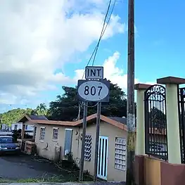
.jpg.webp) Signs for PR-159 and PR-807 in Corozal barrio-pueblo
Signs for PR-159 and PR-807 in Corozal barrio-pueblo
The entire route is located in Corozal.
| Location | km[1] | mi | Destinations | Notes | |
|---|---|---|---|---|---|
| Palos Blancos–Negros line | 6.9 | 4.3 | Southern terminus of PR-807 | ||
| Corozal barrio-pueblo | 0.0 | 0.0 | PR-Calle San Manuel – Pueblo | Northern terminus of PR-807 | |
| 1.000 mi = 1.609 km; 1.000 km = 0.621 mi | |||||
See also
References
- Google (29 February 2020). "PR-807" (Map). Google Maps. Google. Retrieved 29 February 2020.
- National Geographic Maps (2011). Puerto Rico (Map). 1:125,000. Adventure Map (Book 3107). Evergreen, Colorado: National Geographic Maps. ISBN 978-1566955188. OCLC 756511572.
- "Tránsito Promedio Diario (AADT)". Transit Data (Datos de Transito) (in Spanish). DTOP PR. p. 129. Archived from the original on 1 April 2019.
- "PR-807, Corozal, Puerto Rico". geoview.info. Retrieved 7 February 2020.
This article is issued from Wikipedia. The text is licensed under Creative Commons - Attribution - Sharealike. Additional terms may apply for the media files.