Quispamsis
Quispamsis (/kwɪs.pæm.sɪs/,[lower-alpha 1] sometimes shortened to /kwɪsˈpæm/) is a Kings County suburb of Saint John, New Brunswick, Canada. It is located 20 kilometres (12 mi) to the northeast in the lower Kennebecasis River valley. Its population was 18,768 as of the 2021 census.[1]
Quispamsis | |
|---|---|
Town | |
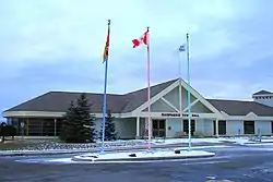 Quispamsis Town Hall | |
 Flag Seal  Coat of arms | |
| Nickname: Quispam | |
| Motto(s): | |
 Quispamsis | |
| Coordinates: 45.43216°N 65.94621°W | |
| Country | Canada |
| Province | New Brunswick |
| County | Kings County |
| Parish | Rothesay Parish |
| Incorporated (village) | 1966 |
| Incorporated (town) | December 22, 1982 |
| Electoral Districts Federal | Fundy Royal |
| Provincial | Quispamsis |
| Government | |
| • Type | Town Council |
| • Mayor | Libby O'Hara |
| • Councillors | List of Members
|
| • MP | Rob Moore (Con.) |
| • MLA | Blaine Higgs (PC) |
| Area | |
| • Land | 56.97 km2 (22.00 sq mi) |
| Population (2021)[1] | |
| • Total | 18,768 |
| • Density | 329.4/km2 (853/sq mi) |
| Demonym(s) | Quissi, Quispamsissi |
| Time zone | UTC-4 (AST) |
| • Summer (DST) | UTC-3 (ADT) |
| Canadian postal code | |
| Area code | 506 |
| Telephone Exchanges | 847, 848, 849 |
| NTS Map | 021H05 |
| GNBC Code | DAVTW |
| Website | quispamsis |
History
The original inhabitants of the area were the Maliseet First Nation, part of the Wabenaki Confederacy.[2] JP, The name, "Quispamsis" was translated from the Maliseet language and means, "little lake in the woods", the lake being present-day Ritchie Lake. Acadians, British pre-Loyalists and Loyalists settled in the area around 1783, with many receiving land grants along the Kennebecasis and Hammond Rivers.
Amalgamation
Following the December 1992 release of a government discussion paper entitled "Strengthening Municipal Government in New Brunswick's Urban Centres", a series of localized feasibility studies were commissioned by the Frank McKenna's Liberals targeting six geographic areas: Edmunston, Campbellton, Dalhousie, Miramichi, Moncton, and Saint John. In each instance, a panel composed of local representatives and expert consulting staff made specific recommendations for each urban-centred region.[3] The report for the Greater Saint John area, "A Community of Communities: Creating a stronger future" - often referred to simply as the Cormier Report - offered two potential solutions to the Province for consolidating the many municipalities in Greater Saint John, neither of which was ultimately adopted by government.
Option one offered by the Cormier Report was to create three communities with regionalization of some services. Under this option, the six Kennebecasis Valley communities (East Riverside-Kinghurst, Fairvale, Gondola Point, Quispamsis, Renforth, and Rothesay) plus the local service district of the Parish of Rothesay would be consolidated into one new municipality. The Town of Grand Bay and various unincorporated areas around Saint John would also be consolidated into the City of Saint John to form the second new municipality. The third municipality in this scenario would be Westfield, which would remain separate because it was more rural and less populated.[4] In this scenario, many services including water and sewerage, planning, and economic development would be regionalized across the three municipalities.
The second option offered by Cormier was a full consolidation of eight of the existing communities into one new city. In this scenario, only Westfield would remain a separate municipality.[5] Full consolidation was unpopular among residents outside the City of Saint John. Suburban residents stated generally that they were pleased with their communities as they were and that they liked their lower tax rates. As Cormier summarized it, residents "perceive Saint John as an expensive, poorly managed bureaucracy that does not serve its citizens well. They fear loss of control, loss of services, and loss of neighbourhood friendliness and sense of community."[6] Suburban residents' comments at public meetings support this description. One Fairvale resident stated that he resented the questionnaire Commissioner Cormier had circulated to residents that asked them to rank their order of preference for his five reorganization schemes because it meant that the worst that full amalgamation could do is fifth place. As the resident put it, "full amalgamation into one city would come about three million, nine hundred and fifty-sixth on anybody's choice. That would come just above amalgamation with Red China."[7]
Ultimately, neither of the two options was implemented. Rather, the provincial government chose to proceed with partial consolidations and opted to legislate cost sharing for five specific regional facilities.[8] Quispamsis amalgamated on January 1, 1998 with the nearby communities of Gondola Point and Wells to form the present town, covering an area of 60 km² and bordering the town of Rothesay to the southwest with the Hammond River along its northeastern boundary.
Occasional discussion about the possibility of further amalgamating Rothesay with Quispamsis has not proceeded beyond the discussion phase,[9] though the two municipalities do collaborate extensively to share services and facilities.[10] Notably, both towns' boundaries were also left largely unaltered by the 2023 New Brunswick local governance reform.[11]
Demographics
In the 2021 Census of Population conducted by Statistics Canada, Quispamsis had a population of 18,768 living in 6,855 of its 6,985 total private dwellings, a change of 2.9% from its 2016 population of 18,245. With a land area of 56.97 km2 (22.00 sq mi), it had a population density of 329.4/km2 (853.2/sq mi) in 2021.[12]
|
| ||||||||||||||||||||||||||||||
| Source: Statistic Canada[13][14] | |||||||||||||||||||||||||||||||
Parks
There are a number of recreational parks in the area. Parks open at dawn and closed at dusk. Parks include:
Arts and Culture Park (12 Landing Court) – includes walking trails, WiFi, picnic/chess tables, benches, stage and mezzanine. During the summer months there are outdoor movies and music free of charge and ice skating during the winter months.
Hammond River Park (28 Reynar Drive) – includes 40 acres, a fire pit, barbecue, picnic tables, hiking trails and a log cabin which is available for rent.
Off Leash Park (222 Vincent Road) – fenced-in area, trails and benches. This is an area for dog owners to let their dog run free.
Meenan's Cove Park (199 Model Farm Road) – includes picnic tables, barbecues, beach, boat dock, playground, ball field, walking trails and beach volleyball courts.
Ritchie Lake Park (Cedar Grove Drive) – includes picnic tables, beach and walking trails.
Quispamsis Qplex (20 Randy Jones Way) - includes two soccer fields, a baseball field, tennis courts, an arena, a swimming pool and a playground as well as many varied walking trails.
Gondola Point Beach - Gondola Point Beach is a supervised freshwater beach with changing rooms and picnic areas. It is situated on a sandbar overlooking the Kennebecasis River at the entrance to the Gondola Point Cable Ferry service in Quispamsis. In the summer of 2014 there was a section on the beach fenced off for a "dog beach".
Transport
The Gondola Point Ferry, linking Quispamsis with the Kingston Peninsula, was originally installed by William Pitt and is the first underwater cable ferry in the world.
The COMEX bus service run by Saint John Transit runs through the Kennebecasis Valley and shuttles commuters from Quispamsis to Saint John every day, Mondays to Fridays. There are a few "park and ride" locations for commuters to leave their car for the day to take the bus into Saint John and along with other standing bus stops along the way.[15]
Education
Quispamsis has a number of schools from grades K-12, these schools are:
| School | Grades |
|---|---|
| Quispamsis Elementary School | K-5 |
| Lakefield Elementary School | K-5 |
| Chris Saunders Memorial Elementary School | K-5 |
| École des Pionniers | K-5 |
| Valley Christian Academy | K-12 |
| Quispamsis Middle School | 6-8 |
| Kennebecasis Valley High School | 9-12 |
Notable people
- Randy Jones - Canadian former professional ice hockey player who played eight seasons in the National Hockey League (NHL) with the Philadelphia Flyers, Los Angeles Kings, Tampa Bay Lightning and Winnipeg Jets.
See also
Notes
- The name is traditionally pronounced with a weak stress on any syllable, on the first and the third syllables, or on all syllables; the pronunciation with a strong stress on the second syllable is a recent development and is found mostly in those who have never visited the town.
References
- "Profile table". Statistics Canada. Retrieved October 13, 2022.
- "About Quispamsis". Quispamsis. Retrieved October 13, 2022.
- Finn, Jean-Guy (2008). Building Stronger Local Governments and Regions: An Action Plan for the Future of Local Governance in New Brunswick. Report of the Commissioner on the Future of Local Governance (PDF). New Brunswick. p. 86. ISBN 978-1-55471-179-6.
- Cormier, E. F. (Skip) (1997). A Community of Communities: Creating a Stronger Future. Local Government Options for the Greater Saint John Area. New Brunswick: Department of Municipalities, Culture, and Housing. pp. 21–22.
- Cormier, E. F. (Skip) (1997). A Community of Communities: Creating a Stronger Future. Local Government Options for the Greater Saint John Area. New Brunswick: Department of Municipalities, Culture, and Housing. p. 23.
- E. F. (Skip), Cormier (1997). A Community of Communities: Creating a Stronger Future. Local Government Options for the Greater Saint John Area. New Brunswick: Department of Municipalities, Housing, and Culture. pp. 70–71.
- Trueman, Mac (November 20, 1996). "Uniting suburbs Saint John like merging Hong Kong and Red China Resident". Telegraph-Journal. p. 3. Retrieved July 7, 2022.
- Finn, Jean-Guy (2008). Building Stronger Local Governments and Regions: An Action Plan for the Future of Local Governance in New Brunswick. Report of the Commissioner on the Future of Local Governance (PDF). New Brunwick. p. 88. ISBN 978-1-55471-179-6.
- "2 southern N.B. towns consider amalgamation". CBC.ca. January 3, 2008. Retrieved November 9, 2010.
- Mcguire, Peter (September 18, 2010). "Time for the valley to take the plunge?". Telegraph-Journal. telegraphjournal.com. p. B1. Retrieved November 9, 2010.
- Working together for vibrant and sustainable communities: White Paper (PDF). Fredericton, New Brunswick: Province of New Brunswick. 2021. p. 54. ISBN 978-1-4605-2957-7.
- "Population and dwelling counts: Canada, provinces and territories, census divisions and census subdivisions (municipalities), New Brunswick". Statistics Canada. February 9, 2022. Retrieved February 21, 2022.
- "Community highlights for Quispamsis". Community Profiles, 2006 Census. Statistics Canada. Retrieved September 21, 2008.
- "Census Profile, 2016 Census: Quispamsis, New Brunswick". Statistics Canada. Retrieved August 14, 2019.
- "Public Transit". Town of Quispamsis. Retrieved August 14, 2019.
External links
Subdivisions of New Brunswick | |
|---|---|
| Cities | |
| Towns |
|
| Villages | |
| Regional municipality | |
| Rural communities | |
| Rural districts |
|
| Other administrative divisions | |
| |