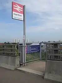
Angel Road railway station
Angel Road railway station is in the London Borough of Enfield at Edmonton in north east London. It is in Travelcard Zone 4, on the Tottenham Hale branch of the Lea Valley Lines. The station, and all trains serving it, is operated by Abellio Greater Anglia. It is partially located beneath the A406 road (which is named Angel Road at that point). Due to reconstruction of the A406 in the mid-1990s (involving grade-separation), the station no longer has an entrance on Angel Road, with the only access via a footpath running south from Conduit Lane to the north. The station is unstaffed.
| Angel Road | |
|---|---|
 The sole entrance on Conduit Lane | |
| Location | Edmonton |
| Local authority | Enfield |
| Managed by | Abellio Greater Anglia |
| Station code | AGR |
| Number of platforms | 2 |
| Fare zone | 4 |
| National Rail annual entry and exit | |
| 2004–05 | 17,074[1] |
| 2005–06 | |
| 2006–07 | |
| 2007–08 | |
| 2008–09 | |
| 2009–10 | |
| 2010–11 | |
| 2011–12 | |
| Key dates | |
| 1840 | Opened |
| Other information | |
| External links | |
References
- "Station usage estimates". Rail statistics. Office of Rail Regulation. Please note: Some methodology may vary year on year.
- "Estimates of station usage". Archived from the original on 2007-07-17. Retrieved 2013-06-27.
- Butt, R.V.J. (October 1995). The Directory of Railway Stations: details every public and private passenger station, halt, platform and stopping place, past and present (1st ed.). Sparkford: Patrick Stephens Ltd. ISBN 1-8526-0508-1. OCLC 60251199.
- Jowett, Alan (2000). Jowett's Nationalised Railway Atlas (1st ed.). Penryn, Cornwall: Atlantic Transport Publishers. ISBN 0-9068-9999-0. OCLC 228266687.
Other websites
- Train times and station information for Angel Road railway station from National Rail
- Timetables from 'one' Archived 2008-05-14 at the Wayback Machine
- grid reference TQ351922
Gallery
Wikimedia Commons has media related to Angel Road railway station.
 View southwards towards the A406 Angel Road (North Circular Road), no longer having an access to the station.
 View northwards towards Conduit Lane, visible far in the distance beyond the station footbridge.
 Signage on northbound platform with National Express East Anglia logo on right.
 View southwards from Conduit Lane, footpath visible to the right of the tracks.
This article is issued from Wikipedia. The text is licensed under Creative Commons - Attribution - Sharealike. Additional terms may apply for the media files.