Auenstein, Aargau
Auenstein is a municipality of the district Brugg in the canton of Aargau in Switzerland.
Auenstein | |
|---|---|
 Coat of arms | |
Location of Auenstein 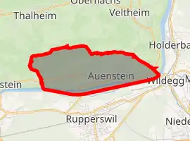 | |
 Auenstein Auenstein | |
| Coordinates: 47°25′N 8°08′E | |
| Country | Switzerland |
| Canton | Aargau |
| District | Brugg |
| Area | |
| • Total | 5.68 km2 (2.19 sq mi) |
| Elevation | 376 m (1,234 ft) |
| Population (2018-12-31)[2] | |
| • Total | 1,581 |
| • Density | 280/km2 (720/sq mi) |
| Time zone | UTC+01:00 (Central European Time) |
| • Summer (DST) | UTC+02:00 (Central European Summer Time) |
| Postal code(s) | 5105 |
| SFOS number | 4091 |
| Surrounded by | Biberstein, Möriken-Wildegg, Oberflachs, Rohr, Rupperswil, Thalheim, Veltheim |
| Twin towns | Ilsfeld (Germany) |
| Website | www SFSO statistics |

Castle Auenstein
It is about 3 kilometres (1.9 miles) northwest of Lenzburg.
References
- "Arealstatistik Standard - Gemeinden nach 4 Hauptbereichen". Federal Statistical Office. Retrieved 13 January 2019.
- "Ständige Wohnbevölkerung nach Staatsangehörigkeitskategorie Geschlecht und Gemeinde; Provisorische Jahresergebnisse; 2018". Federal Statistical Office. 9 April 2019. Retrieved 11 April 2019.
This article is issued from Wikipedia. The text is licensed under Creative Commons - Attribution - Sharealike. Additional terms may apply for the media files.