Ayent
Ayent is a municipality of the district Hérens in the canton of Valais in Switzerland.

Ayent
Ayent | |
|---|---|
 Coat of arms | |
Location of Ayent 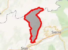 | |
 Ayent Ayent | |
| Coordinates: 46°17′N 7°24′E | |
| Country | Switzerland |
| Canton | Valais |
| District | Hérens |
| Area | |
| • Total | 55.0 km2 (21.2 sq mi) |
| Elevation | 967 m (3,173 ft) |
| Highest elevation (Wildhorn) | 3,247 m (10,653 ft) |
| Lowest elevation (hameau de la Maya) | 508 m (1,667 ft) |
| Population (2018-12-31)[2] | |
| • Total | 4,059 |
| • Density | 74/km2 (190/sq mi) |
| Time zone | UTC+01:00 (Central European Time) |
| • Summer (DST) | UTC+02:00 (Central European Summer Time) |
| Postal code(s) | 1966 |
| SFOS number | 6082 |
| Localities | Botyre, Luc, Saxonne, La Place, Blignou, Fortunoz, Saint-Romain, Signèse, Villa, Argnou, Anzère |
| Surrounded by | Arbaz, Grimisuat, Icogne, Lauenen (BE), Lenk im Simmental (BE), Saint-Léonard, Savièse, Sion |
| Twin towns | Saint-Brévin-les-Pins (France) |
| Website | www SFSO statistics |
Other websites
![]() Media related to Ayent at Wikimedia Commons
Media related to Ayent at Wikimedia Commons
- Official website (in French)
- Ayent in German, French and Italian in the online Historical Dictionary of Switzerland.
- "Arealstatistik Standard - Gemeinden nach 4 Hauptbereichen". Federal Statistical Office. Retrieved 13 January 2019.
- "Ständige Wohnbevölkerung nach Staatsangehörigkeitskategorie Geschlecht und Gemeinde; Provisorische Jahresergebnisse; 2018". Federal Statistical Office. 9 April 2019. Retrieved 11 April 2019.
This article is issued from Wikipedia. The text is licensed under Creative Commons - Attribution - Sharealike. Additional terms may apply for the media files.