Cerniat
Cerniat was a municipality in Gruyère in the canton of Fribourg in Switzerland. On 1 January 2014, the municipalities Cerniat and Charmey joined together to become the new municipality, Val-de-Charmey.[1]
Cerniat | |
|---|---|
 Cerniat | |
 Coat of arms | |
Location of Cerniat 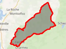 | |
 Cerniat Cerniat | |
| Coordinates: 46°38′N 7°9′E | |
| Country | Switzerland |
| Canton | Fribourg |
| District | Gruyère |
| Area | |
| • Total | 33.78 km2 (13.04 sq mi) |
| Elevation | 927 m (3,041 ft) |
| Population (Dec 2011) | |
| • Total | 346 |
| • Density | 10/km2 (27/sq mi) |
| Time zone | UTC+01:00 (Central European Time) |
| • Summer (DST) | UTC+02:00 (Central European Summer Time) |
| Postal code(s) | 1654 |
| SFOS number | 2126 |
| Surrounded by | Charmey, Châtel-sur-Montsalvens, Corbières, Crésuz, Hauteville, La Roche, Plaffeien, Plasselb, Villarbeney, Villarvolard |
| Website | www SFSO statistics |
References
- Nomenklaturen – Amtliches Gemeindeverzeichnis der Schweiz Archived 2015-11-13 at the Wayback Machine (in German) accessed 13 December 2014
This article is issued from Wikipedia. The text is licensed under Creative Commons - Attribution - Sharealike. Additional terms may apply for the media files.