Chelsea, Manhattan
Chelsea is a neighbourhood in Manhattan.
Chelsea | |
|---|---|
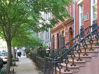 A Chelsea streetscape | |
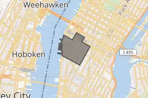 Location in New York City | |
| Coordinates: 40°44′47″N 74°00′05″W | |
| Country | |
| State | |
| City | New York City |
| Borough | Manhattan |
| Community District | Manhattan 4[1] |
| Area | |
| • Total | 0.774 sq mi (2.00 km2) |
| Population (2010) | |
| • Total | 47,325 |
| • Density | 61,000/sq mi (24,000/km2) |
| Ethnicity | |
| • White | 65.1% |
| • Hispanic | 14.6 |
| • Asian | 11.8 |
| • Black | 5.7 |
| • Others | 2.8 |
| Economics | |
| • Median income | $116,160 |
| Time zone | UTC−5 (Eastern) |
| • Summer (DST) | UTC−4 (EDT) |
| ZIP Codes | 10001, 10011 |
| Area code(s) | 212, 332, 646, and 917 |
| Website | |
Chelsea Historic District | |
U.S. Historic district | |
NYC Historic District
| |
 The Cushman Row, 406-418 W. 20th St., dates from 1840 | |
| Location | Roughly: West 19th – West 23rd Streets Eighth –Tenth Avenues[lower-alpha 1] |
| Coordinates | 40°44′43″N 74°00′08″W |
| Built | 1830 |
| Architect | Multiple |
| Architectural style | Greek Revival, Italianate, Georgian |
| NRHP reference No. | 77000954 (original) 82001190 (increase)[2] |
| Significant dates | |
| Added to NRHP | December 6, 1977 (original) December 16, 1982 (increase) |
| Designated NYCL | September 15, 1970 February 3, 1981 (extension) |
References
- "NYC Planning | Community Profiles". communityprofiles.planning.nyc.gov. New York City Department of City Planning. Archived from the original on March 23, 2019. Retrieved March 18, 2019.
- "National Register Information System". National Register of Historic Places. National Park Service. 2008-04-15.
- These are the boundaries of the historic district, not of the neighborhood. See NYCLPC map of Chelsea Historic District
Wikimedia Commons has media related to Chelsea, Manhattan.
Authority control | |
|---|---|
| General | |
| National libraries | |
| Other | |
This article is issued from Wikipedia. The text is licensed under Creative Commons - Attribution - Sharealike. Additional terms may apply for the media files.