Clugin
Clugin (Romansh: Clugen) was a municipality in the district of Hinterrhein in the canton of Graubünden in Switzerland.
Clugin | |
|---|---|
 Coat of arms | |
Location of Clugin 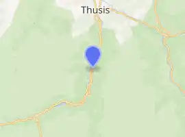 | |
 Clugin Clugin | |
| Coordinates: 46°37′N 9°26′E | |
| Country | Switzerland |
| Canton | Graubünden |
| District | Hinterrhein |
| Area | |
| • Total | 2.49 km2 (0.96 sq mi) |
| Elevation | 1,013 m (3,323 ft) |
| Population (Dec 2007) | |
| • Total | 34 |
| • Density | 14/km2 (35/sq mi) |
| Time zone | UTC+01:00 (Central European Time) |
| • Summer (DST) | UTC+02:00 (Central European Summer Time) |
| Postal code(s) | 7442 |
| SFOS number | 3704 |
| Surrounded by | Andeer, Casti-Wergenstein, Donat, Pignia |
| Website | www |
On 1 January 2009, the former municipalities of Clugin and Pignia merged into the municipality of Andeer.

Clugin
This article is issued from Wikipedia. The text is licensed under Creative Commons - Attribution - Sharealike. Additional terms may apply for the media files.