Fahrni
Fahrni is a municipality in the administrative district of Thun in the canton of Bern in Switzerland.
Fahrni | |
|---|---|
 Coat of arms | |
Location of Fahrni 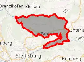 | |
 Fahrni Fahrni | |
| Coordinates: 46°47′N 7°40′E | |
| Country | Switzerland |
| Canton | Bern |
| District | Thun |
| Government | |
| • Mayor | Hans Ulrich Wenger |
| Area | |
| • Total | 6.67 km2 (2.58 sq mi) |
| Elevation | 849 m (2,785 ft) |
| Population (2018-12-31)[2] | |
| • Total | 809 |
| • Density | 120/km2 (310/sq mi) |
| Time zone | UTC+01:00 (Central European Time) |
| • Summer (DST) | UTC+02:00 (Central European Summer Time) |
| Postal code(s) | 3617 |
| SFOS number | 0925 |
| Surrounded by | Bleiken bei Oberdiessbach, Brenzikofen, Buchholterberg, Heimberg, Homberg, Steffisburg, Unterlangenegg |
| Website | www SFSO statistics |
References
- "Arealstatistik Standard - Gemeinden nach 4 Hauptbereichen". Federal Statistical Office. Retrieved 13 January 2019.
- "Ständige Wohnbevölkerung nach Staatsangehörigkeitskategorie Geschlecht und Gemeinde; Provisorische Jahresergebnisse; 2018". Federal Statistical Office. 9 April 2019. Retrieved 11 April 2019.
This article is issued from Wikipedia. The text is licensed under Creative Commons - Attribution - Sharealike. Additional terms may apply for the media files.