Glattfelden
Glattfelden is a municipality in the district of Bülach in the canton of Zurich in Switzerland.
%252C_Gottfried-Keller-Strasse_8_2011-09-15_13-45-24_ShiftN.jpg.webp)
Glattfelden
Glattfelden | |
|---|---|
 Coat of arms | |
Location of Glattfelden 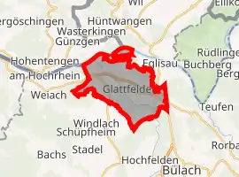 | |
 Glattfelden Glattfelden | |
| Coordinates: 47°34′N 8°30′E | |
| Country | Switzerland |
| Canton | Zurich |
| District | Bülach |
| Area | |
| • Total | 12.3 km2 (4.7 sq mi) |
| Elevation | 387 m (1,270 ft) |
| Population (2018-12-31)[2] | |
| • Total | 5,202 |
| • Density | 420/km2 (1,100/sq mi) |
| Time zone | UTC+01:00 (Central European Time) |
| • Summer (DST) | UTC+02:00 (Central European Summer Time) |
| Postal code(s) | 8192 |
| SFOS number | 0058 |
| Surrounded by | Bülach, Eglisau, Hochfelden, Hohentengen am Hochrhein (DE-BW), Hüntwangen, Stadel bei Niederglatt, Weiach |
| Website | www SFSO statistics |
References
- "Arealstatistik Standard - Gemeinden nach 4 Hauptbereichen". Federal Statistical Office. Retrieved 13 January 2019.
- "Ständige Wohnbevölkerung nach Staatsangehörigkeitskategorie Geschlecht und Gemeinde; Provisorische Jahresergebnisse; 2018". Federal Statistical Office. 9 April 2019. Retrieved 11 April 2019.
Other websites
![]() Media related to Glattfelden at Wikimedia Commons
Media related to Glattfelden at Wikimedia Commons
- Official Website of Glattfelden (in German)
This article is issued from Wikipedia. The text is licensed under Creative Commons - Attribution - Sharealike. Additional terms may apply for the media files.