Ingenbohl
Ingenbohl is a municipality in Schwyz District in the canton of Schwyz in Switzerland. It is located along the Lake Lucerne.
Ingenbohl | |
|---|---|
 | |
 Coat of arms | |
Location of Ingenbohl 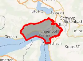 | |
 Ingenbohl Ingenbohl | |
| Coordinates: 46°59′N 8°36′E | |
| Country | Switzerland |
| Canton | Schwyz |
| District | Schwyz |
| Area | |
| • Total | 16.20 km2 (6.25 sq mi) |
| Elevation | 439 m (1,440 ft) |
| Population (2018-12-31)[2] | |
| • Total | 8,912 |
| • Density | 550/km2 (1,400/sq mi) |
| Time zone | UTC+01:00 (Central European Time) |
| • Summer (DST) | UTC+02:00 (Central European Summer Time) |
| Postal code(s) | 6440 |
| SFOS number | 1364 |
| Localities | Ingenbohl, Brunnen, Wilen, Schränggigen and Unterschönenbuch |
| Surrounded by | Emmetten (NW), Gersau, Lauerz, Morschach, Seelisberg (UR), Schwyz |
| Website | www SFSO statistics |
Villages
The municipality consists of the village of Ingenbohl and the hamlets of Brunnen, Wilen, Schränggigen and Unterschönenbuch.
References
- "Arealstatistik Standard - Gemeinden nach 4 Hauptbereichen". Federal Statistical Office. Retrieved 13 January 2019.
- "Ständige Wohnbevölkerung nach Staatsangehörigkeitskategorie Geschlecht und Gemeinde; Provisorische Jahresergebnisse; 2018". Federal Statistical Office. 9 April 2019. Retrieved 11 April 2019.
This article is issued from Wikipedia. The text is licensed under Creative Commons - Attribution - Sharealike. Additional terms may apply for the media files.