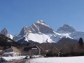
La Cluse
La Cluse is a former commune in the Hautes-Alpes department. It is now part of Le Dévoluy.
La Cluse | |
|---|---|
Part of Le Dévoluy | |
 | |
Location of La Cluse  | |
 La Cluse  La Cluse | |
| Coordinates: 44°38′25″N 5°50′56″E | |
| Country | France |
| Region | Provence-Alpes-Côte d'Azur |
| Department | Hautes-Alpes |
| Arrondissement | Gap |
| Canton | Saint-Étienne-en-Dévoluy |
| Commune | Le Dévoluy |
| Area 1 | 40.15 km2 (15.50 sq mi) |
| Population (2017)[1] | 55 |
| • Density | 1.4/km2 (3.5/sq mi) |
| Time zone | UTC+01:00 (CET) |
| • Summer (DST) | UTC+02:00 (CEST) |
| Postal code | 05250 |
| Elevation | 1,027–2,683 m (3,369–8,802 ft) (avg. 1,252 m or 4,108 ft) |
| 1 French Land Register data, which excludes lakes, ponds, glaciers > 1 km2 (0.386 sq mi or 247 acres) and river estuaries. | |
Population
| Year | Pop. | ±% |
|---|---|---|
| 1962 | 36 | — |
| 1968 | 39 | +8.3% |
| 1975 | 44 | +12.8% |
| 1982 | 40 | −9.1% |
| 1990 | 35 | −12.5% |
| 1999 | 54 | +54.3% |
| 2008 | 53 | −1.9% |
Transport
Road
The D937 road passes through the commune.
Location
The former commune borders the Drôme department.
This article is issued from Wikipedia. The text is licensed under Creative Commons - Attribution - Sharealike. Additional terms may apply for the media files.