La Piarre
La Piarre is a commune in the Hautes-Alpes department.
La Piarre | |
|---|---|
 | |
Location of La Piarre 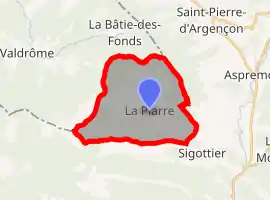 | |
 La Piarre  La Piarre | |
| Coordinates: 44°28′34″N 5°39′23″E | |
| Country | France |
| Region | Provence-Alpes-Côte d'Azur |
| Department | Hautes-Alpes |
| Arrondissement | Gap |
| Canton | Serres |
| Intercommunality | Serres |
| Government | |
| • Mayor (2008–2014) | Éric Oddou |
| Area 1 | 21.67 km2 (8.37 sq mi) |
| Population | 93 |
| • Density | 4.3/km2 (11/sq mi) |
| Time zone | UTC+01:00 (CET) |
| • Summer (DST) | UTC+02:00 (CEST) |
| INSEE/Postal code | 05102 /05700 |
| Elevation | 760–1,760 m (2,490–5,770 ft) (avg. 880 m or 2,890 ft) |
| 1 French Land Register data, which excludes lakes, ponds, glaciers > 1 km2 (0.386 sq mi or 247 acres) and river estuaries. | |
Population
| Year | Pop. | ±% |
|---|---|---|
| 1962 | 60 | — |
| 1968 | 77 | +28.3% |
| 1975 | 62 | −19.5% |
| 1982 | 61 | −1.6% |
| 1990 | 57 | −6.6% |
| 1999 | 63 | +10.5% |
| 2008 | 96 | +52.4% |
Transport
Road
The D27 road passes through the commune.
Location
The commune borders the Drôme department.
References
- "Populations légales 2019". The National Institute of Statistics and Economic Studies. 29 December 2021.
This article is issued from Wikipedia. The text is licensed under Creative Commons - Attribution - Sharealike. Additional terms may apply for the media files.