Laurel, Virginia
Laurel is a census-designated place (CDP) in Henrico County, Virginia. The population was 16,713 at the 2010 United States Census.[2] It is the county seat of Henrico County.
Laurel, Virginia | |
|---|---|
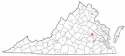 Location of Laurel, Virginia | |
| Coordinates: 37°38′2″N 77°30′24″W | |
| Country | |
| State | |
| County | |
| Area | |
| • Total | 5.5 sq mi (14.2 km2) |
| • Land | 5.5 sq mi (14.2 km2) |
| • Water | 0.0 sq mi (0.0 km2) |
| Elevation | 243 ft (74 m) |
| Population (2010) | |
| • Total | 16,713 |
| • Density | 3,000/sq mi (1,200/km2) |
| Time zone | UTC−5 (Eastern (EST)) |
| • Summer (DST) | UTC−4 (EDT) |
| FIPS code | 51-44280 |
| GNIS feature ID | 1469155[1] |
References
- "US Board on Geographic Names". United States Geological Survey. 2007-10-25. Retrieved 2008-01-31.
- "Profile of General Population and Housing Characteristics: 2010 Demographic Profile Data (DP-1): Laurel CDP, Virginia". U.S. Census Bureau, American Factfinder. Retrieved August 6, 2012.
This article is issued from Wikipedia. The text is licensed under Creative Commons - Attribution - Sharealike. Additional terms may apply for the media files.