Meiringen
Meiringen is a municipality in the administrative district of Interlaken-Oberhasli in the canton of Bern in Switzerland.

Meiringen
Meiringen | |
|---|---|
 Coat of arms | |
Location of Meiringen 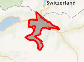 | |
 Meiringen Meiringen | |
| Coordinates: 46°43.643′N 8°11.24′E | |
| Country | Switzerland |
| Canton | Bern |
| District | Interlaken-Oberhasli |
| Government | |
| • Mayor | Hans Jakob Walther |
| Area | |
| • Total | 40.7 km2 (15.7 sq mi) |
| Elevation | 595 m (1,952 ft) |
| Population (2018-12-31)[2] | |
| • Total | 4,621 |
| • Density | 110/km2 (290/sq mi) |
| Time zone | UTC+01:00 (Central European Time) |
| • Summer (DST) | UTC+02:00 (Central European Summer Time) |
| Postal code(s) | 3860 |
| SFOS number | 0785 |
| Localities | Balm, Brünigen, Eisenbolgen, Hausen, Prasti, Sand, Stein, Unterbach, Unterheidon, Wylerli and Zaun |
| Surrounded by | Brienz, Brienzwiler, Grindelwald, Hasliberg, Innertkirchen, Lungern (OW), Schattenhalb |
| Website | www SFSO statistics |
Villages
Balm, Brünigen, Eisenbolgen, Hausen, Prasti, Sand, Stein, Unterbach, Unterheidon, Wylerli and Zaun.
References
- "Arealstatistik Standard - Gemeinden nach 4 Hauptbereichen". Federal Statistical Office. Retrieved 13 January 2019.
- "Ständige Wohnbevölkerung nach Staatsangehörigkeitskategorie Geschlecht und Gemeinde; Provisorische Jahresergebnisse; 2018". Federal Statistical Office. 9 April 2019. Retrieved 11 April 2019.
Other websites
 Media related to Meiringen at Wikimedia Commons
 Meiringen travel guide from Wikivoyage
- Official Website (in German)
This article is issued from Wikipedia. The text is licensed under Creative Commons - Attribution - Sharealike. Additional terms may apply for the media files.