Névache
Névache is a commune in the Hautes-Alpes department.
Névache | |
|---|---|
 A narrow valley in Névache | |
 Coat of arms | |
Location of Névache 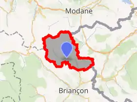 | |
 Névache  Névache | |
| Coordinates: 45°01′11″N 6°36′19″E | |
| Country | France |
| Region | Provence-Alpes-Côte d'Azur |
| Department | Hautes-Alpes |
| Arrondissement | Briançon |
| Canton | Briançon-2 |
| Intercommunality | Briançon |
| Government | |
| • Mayor (2014–2020) | Jean-Louis Chevalier[1] |
| Area 1 | 191.93 km2 (74.10 sq mi) |
| Population | 359 |
| • Density | 1.9/km2 (4.8/sq mi) |
| Time zone | UTC+01:00 (CET) |
| • Summer (DST) | UTC+02:00 (CEST) |
| INSEE/Postal code | 05093 /05100 |
| Elevation | 1,430–3,222 m (4,692–10,571 ft) (avg. 1,596 m or 5,236 ft) |
| 1 French Land Register data, which excludes lakes, ponds, glaciers > 1 km2 (0.386 sq mi or 247 acres) and river estuaries. | |
Population
| Year | Pop. | ±% |
|---|---|---|
| 1962 | 74 | — |
| 1968 | 128 | +73.0% |
| 1975 | 119 | −7.0% |
| 1982 | 191 | +60.5% |
| 1990 | 245 | +28.3% |
| 1999 | 290 | +18.4% |
| 2008 | 334 | +15.2% |
| 2012 | 366 | +9.6% |
Transport
Road
The D1T, D301T and D994G roads pass through the commune.
References
- "List of mayors of the Hautes-Alpes department". Prefecture of Hautes-Alpes (in French). 3 June 2014. Archived from the original on 10 January 2015. Retrieved 20 March 2015.
- "Populations légales 2019". The National Institute of Statistics and Economic Studies. 29 December 2021.
This article is issued from Wikipedia. The text is licensed under Creative Commons - Attribution - Sharealike. Additional terms may apply for the media files.