OpenStreetMap
OpenStreetMap is a free editable map of the whole world. It is made by people from the entire world.
.jpg.webp)
Steve Coast, 2009
OpenStreetMap's logo featuring a magnifier focused on geographical information. | |
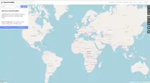 OSM homepage | |
Type of site | Collaborative mapping |
|---|---|
| Available in | UI: 93 languages[1] Map data: native language of respective settlement |
| Owner | OpenStreetMap Community. Project support by OpenStreetMap Foundation[2] |
| Created by | Steve Coast (User page in OSM) |
| URL | openstreetmap.org |
| Commercial | No |
| Registration | Required for contributors, not required for viewing |
| Users | 5,340,790[3] |
| Launched | 9 August 2004[4] |
| Current status | Active (click to see in detail) |
Content license | ODbL |
People make the maps using data from a GPS device and pictures from airplaces. Map vector information can be downloaded under the Open Database License,[5] and the map pictures can be downloaded under the Creative Commons Share-Alike license.
OpenStreetMap allows you to view, edit and use geographical data in a collaborative way from anywhere on Earth.
Sources
- "OpenStreetMap.org Github".
- "FAQ". OpenStreetMap Wiki. Retrieved 15 April 2011.
- "OpenStreetMap stats report". OpenStreetMap. OpenStreetMap Foundation. Retrieved 16 April 2019.
- "OpenStreetMap Wiki - History of OpenStreetMap".
- RWeait (12 September 2012). "OpenStreetMap data license is ODbL v1.0". OSM Foundation. Retrieved 5 November 2012.
Other websites
![]() Media related to OpenStreetMap at Wikimedia Commons
Media related to OpenStreetMap at Wikimedia Commons
- Openstreetmap.org, the official website for OpenStreetMap.
This article is issued from Wikipedia. The text is licensed under Creative Commons - Attribution - Sharealike. Additional terms may apply for the media files.