Saint-Cergue
Saint-Cergue is a municipality in the district of Nyon in the canton of Vaud in Switzerland.
Saint-Cergue | |
|---|---|
 | |
 Coat of arms | |
Location of Saint-Cergue 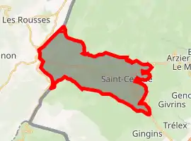 | |
 Saint-Cergue Saint-Cergue | |
| Coordinates: 46°27′N 6°9′E | |
| Country | Switzerland |
| Canton | Vaud |
| District | Nyon |
| Government | |
| • Mayor | Syndic Pierre Graber |
| Area | |
| • Total | 24.26 km2 (9.37 sq mi) |
| Elevation | 1,041 m (3,415 ft) |
| Population (2018-12-31)[2] | |
| • Total | 2,575 |
| • Density | 110/km2 (270/sq mi) |
| Demonym(s) | Saint-Cerguois |
| Time zone | UTC+01:00 (Central European Time) |
| • Summer (DST) | UTC+02:00 (Central European Summer Time) |
| Postal code(s) | 1264 Saint-Cergue 1265 La Cure |
| SFOS number | 5727 |
| Localities | La Cure, Saint-Cergue |
| Surrounded by | Arzier, Gingins, Givrins, Les Rousses (FR-39), Prémanon (FR-39), Trélex |
| Website | www Profile (in French), SFSO statistics |
References
- "Arealstatistik Standard - Gemeinden nach 4 Hauptbereichen". Federal Statistical Office. Retrieved 13 January 2019.
- "Ständige Wohnbevölkerung nach Staatsangehörigkeitskategorie Geschlecht und Gemeinde; Provisorische Jahresergebnisse; 2018". Federal Statistical Office. 9 April 2019. Retrieved 11 April 2019.
Other websites
![]() Media related to Saint-Cergue at Wikimedia Commons
Media related to Saint-Cergue at Wikimedia Commons
- Saint-Cergue - Official site (in French)
- Aerial views of Saint-Cergue on swisscastles.ch
- Saint-Cergue on MySwitzerland.com
- Saint-Cergue in German, French and Italian in the online Historical Dictionary of Switzerland.
This article is issued from Wikipedia. The text is licensed under Creative Commons - Attribution - Sharealike. Additional terms may apply for the media files.