Sils im Domleschg
Sils im Domleschg (Romansh: Seglias) is a municipality of the district of Hinterrhein in the canton of Graubünden in Switzerland.
Sils im Domleschg | |
|---|---|
 | |
 Coat of arms | |
Location of Sils im Domleschg 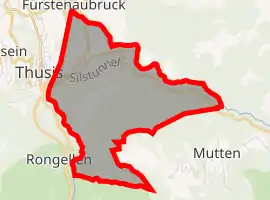 | |
 Sils im Domleschg Sils im Domleschg | |
| Coordinates: 46°42′N 9°27′E | |
| Country | Switzerland |
| Canton | Graubünden |
| District | Hinterrhein |
| Government | |
| • Mayor | Rudolf Hans Künzler |
| Area | |
| • Total | 9.28 km2 (3.58 sq mi) |
| Elevation | 633 m (2,077 ft) |
| Population (2018-12-31)[2] | |
| • Total | 943 |
| • Density | 100/km2 (260/sq mi) |
| Time zone | UTC+01:00 (Central European Time) |
| • Summer (DST) | UTC+02:00 (Central European Summer Time) |
| Postal code(s) | 7411 |
| SFOS number | 3640 |
| Localities | Freihof, Campi, Albula |
| Surrounded by | Fürstenau, Mutten, Rongellen, Scharans, Thusis, Vaz/Obervaz, Zillis-Reischen |
| Website | www SFSO statistics |
Villages
Freihof, Campi and Albula.
References
- "Arealstatistik Standard - Gemeinden nach 4 Hauptbereichen". Federal Statistical Office. Retrieved 13 January 2019.
- "Ständige Wohnbevölkerung nach Staatsangehörigkeitskategorie Geschlecht und Gemeinde; Provisorische Jahresergebnisse; 2018". Federal Statistical Office. 9 April 2019. Retrieved 11 April 2019.
This article is issued from Wikipedia. The text is licensed under Creative Commons - Attribution - Sharealike. Additional terms may apply for the media files.