Tulsa, Oklahoma
Tulsa is the second largest city in Oklahoma, United States. There are 387,807 people living in Tulsa. It is the 47th largest city in the United States. It is the county seat of Tulsa County; and the most densely populated county in Oklahoma. Tulsa has 563,299 people living in it.
Tulsa, Oklahoma | |
|---|---|
 Downtown Tulsa skyline | |
.svg.png.webp) Flag  Seal | |
| Nickname(s): "Oil Capital of the World", "Tulsey Town", "T-Town", "Buckle of the Bible Belt", "The 918" | |
| Motto(s): "A New Kind Of Energy" | |
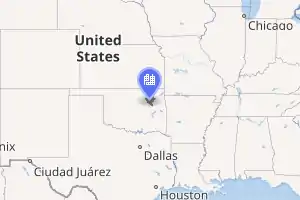 Interactive map of Tulsa | |
| Coordinates: 36°07′53″N 95°56′14″W | |
| Country | United States |
| State | Oklahoma |
| Counties | Osage, Rogers, Tulsa, Wagoner |
| Government | |
| • Type | Mayor-Council |
| • Mayor | G. T. Bynum (R) |
| Area | |
| • City | 201.77 sq mi (522.59 km2) |
| • Land | 197.48 sq mi (511.47 km2) |
| • Water | 4.30 sq mi (11.13 km2) |
| Elevation | 722 ft (194 m) |
| Population | |
| • City | 391,906 |
| • Estimate (2019) | 401,190 |
| • Rank | US: 47th |
| • Density | 2,031.57/sq mi (784.39/km2) |
| • Metro | 991,561 (US: 50th) |
| • CSA | 1,231,458 (US: 45th) |
| • Demonym | Tulsan |
| Time zone | UTC−6 (CST) |
| • Summer (DST) | UTC−5 (CDT) |
| ZIP Codes | ZIP Codes[3] |
| Area code(s) | 539/918 |
| FIPS code | 40-75000 |
| GNIS feature ID | 1100962[4] |
| Website | www.cityoftulsa.org |
In Tulsa
- Philbrook Museum - an art museum
- Gilcrease Museum
- Big Splash - a water amusement park
- Bell's Amusement Park(now closed)
- Southroads Mall
- Woodland Hills Mall
- LaFortune Park
Related pages
References
- "2019 U.S. Gazetteer Files". United States Census Bureau. Retrieved July 28, 2020.
- "U.S. Census website". United States Census Bureau. Retrieved July 21, 2015.
- "ZIP Code Lookup". USPS. Archived from the original on January 1, 2008. Retrieved August 30, 2014.
- U.S. Geological Survey Geographic Names Information System: Tulsa, Oklahoma
Other websites
- Official City Website
- Tulsa Chamber of Commerce
- Tulsa Convention & Visitors Bureau Archived 2007-12-12 at the Wayback Machine
- Official Tulsa Police Website
- Vision 2025
Wikimedia Commons has media related to Tulsa, Oklahoma.
Municipalities and communities of Tulsa County, Oklahoma, United States | ||
|---|---|---|
| Cities |  Tulsa County map | |
| Towns | ||
| CDPs |
| |
| Other communities |
| |
| Indian reservations |
| |
| Footnotes | ‡This populated place also has portions in an adjacent county or counties | |

This article is issued from Wikipedia. The text is licensed under Creative Commons - Attribution - Sharealike. Additional terms may apply for the media files.