U.S. Route 166
U.S. Route 166 (US 166) is a 164-mile (264 km) west–east United States highway. This route and US-266 are the only two remaining parts of historic U.S. Route 66 (which was decommissioned in 1985), since US-666 was renumbered to US-491 in 2003.
U.S. Route 166 | |
|---|---|
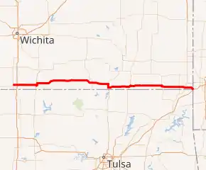 US 166 highlighted in red | |
| Route information | |
| Auxiliary route of [[Template:Infobox road/link/|]] | |
| Maintained by KDOT and MoDOT | |
| Length | 164.159 mi (264.188 km) |
| Existed | 1926–present |
| Major junctions | |
| West end | |
| |
| East end | |
| Location | |
| Country | United States |
| States | Kansas, Missouri |
| Counties | KS: Sumner, Cowley, Chautauqua, Montgomery, Labette, Cherokee MO: Newton |
| Highway system | |
| |

US-166 meets the old route of US-66, now designated US-69 Alternate, in Baxter Springs in the southeast corner of Kansas.
Major intersections
| State | County | Location | mi[1][2] | km | Destinations | Notes |
|---|---|---|---|---|---|---|
| Kansas | Sumner | | 0.000 | 0.000 | Western terminus; road continues as 160th Street South | |
| | 3.481 | 5.602 | Parclo interchange; I-35/Kansas Tpke. exit 4 | |||
| Cowley | Arkansas City | 20.540 | 33.056 | West end of US-77 concurrency | ||
| 22.993 | 37.004 | Roundabout; east end of US-77 concurrency; US-77 north serves South Central Kansas Medical Center | ||||
| | 40.883 | 65.795 | West end of K-15 concurrency | |||
| | 44.833 | 72.152 | East end of K-15 concurrency | |||
| Chautauqua | | 66.984 | 107.800 | Western terminus of US-166 Bus. | ||
| | 71.325 | 114.786 | Eastern terminus of US-166 Bus. | |||
| Montgomery | | 85.579 | 137.726 | Trumpet interchange; west end of US-75 concurrency | ||
| | 88.577 | 142.551 | East end of US-75 concurrency | |||
| Coffeyville | 106.083 | 170.724 | West end of US-169 concurrency | |||
| | 108.104 | 173.977 | Interchange; east end of US-169 concurrency | |||
| Labette | Edna | 120.743 | 194.317 | Southern terminus of K-101 | ||
| Chetopa | 135.054 | 217.348 | West end of US-59 concurrency | |||
| 136.548 | 219.753 | East end of US-59 concurrency | ||||
| Cherokee | | 150.694 | 242.518 | |||
| Baxter Springs | 156.181 | 251.349 | Former US-66 | |||
| | 158.017 | 254.304 | West end of US-400 concurrency | |||
| | 161.322 | 259.623 | Southern terminus of K-26 | |||
| 163.223– 0.000 | 262.682– 0.000 | Kansas–Missouri state line | ||||
| Missouri | Newton | | 0.406– 0.936 | 0.653– 1.506 | East end of US 400 concurrency; I-44 exit 1; eastern termini of US 166 and US 400 | |
1.000 mi = 1.609 km; 1.000 km = 0.621 mi
| ||||||
References
- Kansas Department of Transportation. "Pavement Management Information System". Archived from the original on 2009-04-30. Retrieved 2008-09-26.
- Missouri Department of Transportation (January 11, 2018). MoDOT HPMAPS (Map). Missouri Department of Transportation. Retrieved January 11, 2018.
Other websites
 Media related to U.S. Route 166 at Wikimedia Commons
- Endpoints of US highway 166
| |
Routes in italics are no longer a part of the system. Highlighted routes are considered main routes of the system. |
This article is issued from Wikipedia. The text is licensed under Creative Commons - Attribution - Sharealike. Additional terms may apply for the media files.