Vars, Hautes-Alpes
Vars is a commune in the Hautes-Alpes department.
Vars | |
|---|---|
 The mountainous landscape around Vars | |
 Coat of arms | |
Location of Vars 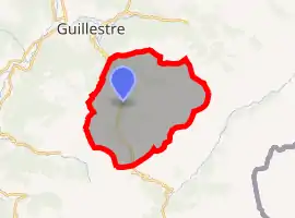 | |
 Vars  Vars | |
| Coordinates: 44°35′45″N 6°41′26″E | |
| Country | France |
| Region | Provence-Alpes-Côte d'Azur |
| Department | Hautes-Alpes |
| Arrondissement | Briançon |
| Canton | Guillestre |
| Intercommunality | Guillestre |
| Government | |
| • Mayor (2008–2014) | Pierre Eyméoud |
| Area 1 | 92.2 km2 (35.6 sq mi) |
| Population | 528 |
| • Density | 5.7/km2 (15/sq mi) |
| Time zone | UTC+01:00 (CET) |
| • Summer (DST) | UTC+02:00 (CEST) |
| INSEE/Postal code | 05177 /05560 |
| Elevation | 1,320–3,381 m (4,331–11,093 ft) (avg. 1,650 m or 5,410 ft) |
| 1 French Land Register data, which excludes lakes, ponds, glaciers > 1 km2 (0.386 sq mi or 247 acres) and river estuaries. | |
Ski resort
It is famous for its ski resort that has 185 kilometres of ski slopes.[2]
Population
| Year | Pop. | ±% |
|---|---|---|
| 1962 | 245 | — |
| 1968 | 433 | +76.7% |
| 1975 | 779 | +79.9% |
| 1982 | 897 | +15.1% |
| 1990 | 941 | +4.9% |
| 1999 | 637 | −32.3% |
| 2008 | 606 | −4.9% |
_-_panoramio.jpg.webp)
The landscape around Vars in the summer
Transport
Road
The D431 and D902 roads pass through Vars.
References
- "Populations légales 2019". The National Institute of Statistics and Economic Studies. 29 December 2021.
- "Vars: Plan des pistes". www.vars.com. Retrieved 2021-01-17.
This article is issued from Wikipedia. The text is licensed under Creative Commons - Attribution - Sharealike. Additional terms may apply for the media files.