Célé
The Célé is a river in southern France. It is a right tributary of the Lot river; it is the second largest tributary of the Lot, after the Truyère.
| Célé | |
|---|---|
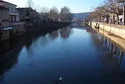 The Célé in the town of Figeac | |
  | |
| Location | |
| Country | France |
| Physical characteristics | |
| Source | |
| - location | Massif Central |
| Mouth | |
| - location | Lot |
| - coordinates | 44°28′28″N 1°38′55″E |
| Length | 104.4 km (64.9 mi) |
| Basin features | |
| Progression | Lot→ Garonne→ Atlantic Ocean |
Several communes have the name of the river in their names:Bagnac-sur-Célé, Marcilhac-sur-Célé, Sauliac-sur-Célé.
Geography
The Célé river has a length of 104.4 km (64.9 mi) and a drainage basin with an area of 1,289 km2 (498 sq mi).[1]
Its average yearly discharge (volume of water which passes through a section of the river per unit of time) is 17.90 cubic metres per second at Orniac.[2]
Course

The Célé starts in the Massif Central, in the "commune" of Calvinet (Cantal department), at an altitude of about 713 m (2,339 ft).[3]
The Célé flows to the west, in general, and passes through 2 regions, 2 departments and 26 communes:[1]
- Auvergne-Rhône-Alpes region
- Cantal: Calvinet, Saint-Constant, Maurs, Le Trioulou, Mourjou, Fournoulès, Cassaniouze
- Occitanie region
Finally, it flows, as a right tributary, into the Lot river, in Bouziès, in the Lot department, at 125 m (410 ft) of altitude.[4]
Main tributaries
The main tributaries of the Célé river are (only right tributaries because the left tributaries are small Streams):[1]
Right tributaries:
- Ressègue - 22.4 km
- Rance - 35.9 km
- Veyre - 32.9 km
- Bervezou - 24 km
- Drauzou - 22.6 km
Related pages
References
- "Le Célé (O8--0250)" (in French). SANDRE - Portail national d'accès aux référentiels sur l'eau. Retrieved 13 September 2016.
- "Le Célé à Orniac" (in French). Banque Hydro. Archived from the original on 20 February 2020. Retrieved 13 September 2016.
- "Source de Le Célé" (in French). Géoportail. Retrieved 13 September 2016.
- "Confluence de Le Célé" (in French). Géoportail. Retrieved 22 May 2014.
Other websites
- Banque Hydro - MEDDE, « Synthèse de la Banque Hydro - Le Célé à Orniac Archived 2021-04-16 at the Wayback Machine (in French)