Castlereagh River
The Castlereagh River is an inland river in New South Wales, Australia. It begins in the Warrumbungles, a mountain range, and flows east towards Coonabarabran.[1] It turns to the south, and then flows north west through Gilgandra and Coonamble, before joining the Macquarie River.[1] The length of the river is about 340 mi (547 km).[1]
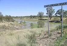
Castlereagh River, south of Walgett, New South Wales
The first Europen to see the Castlereagh River was George William Evans in 1818 during John Oxley's expedition.[1] It was later explored by Charles Sturt in 1829. The river is named after Lord Castlereagh, a British politician who was the Secretary of State for the Colonies.[1]
References
- "Castlereagh River". The Australian Encyclopaedia. Vol. II. The Grollier Society of Australia. 1958. p. 282.
This article is issued from Wikipedia. The text is licensed under Creative Commons - Attribution - Sharealike. Additional terms may apply for the media files.