Clayton, Oklahoma
Clayton is a town in Pushmataha County, Oklahoma, United States. The population was 1,012 at the 2010 census.[5]
Clayton, Oklahoma | |
|---|---|
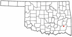 Location of Clayton, Oklahoma | |
| Coordinates: 34°35′16″N 95°21′25″W | |
| Country | United States |
| State | Oklahoma |
| County | Pushmataha |
| Area | |
| • Total | 1.74 sq mi (4.51 km2) |
| • Land | 1.72 sq mi (4.45 km2) |
| • Water | 0.02 sq mi (0.06 km2) |
| Elevation | 607 ft (185 m) |
| Population (2010) | |
| • Total | 821 |
| • Estimate (2018)[2] | 797 |
| • Density | 464.18/sq mi (179.20/km2) |
| Time zone | UTC-6 (Central (CST)) |
| • Summer (DST) | UTC-5 (CDT) |
| ZIP code | 74536 |
| Area code(s) | 539/918 |
| FIPS code | 40-14900[3] |
| GNIS feature ID | 1091403[4] |
Location of Clayton, Oklahoma
It is found at 34°35′16″N 95°21′25″W (34.587698, -95.357077).[6]
References
- "2018 U.S. Gazetteer Files". United States Census Bureau. Retrieved February 12, 2020.
- "Population and Housing Unit Estimates". Retrieved June 4, 2019.
- "U.S. Census website". United States Census Bureau. Retrieved January 31, 2008.
- "US Board on Geographic Names". United States Geological Survey. October 25, 2007. Retrieved January 31, 2008.
- "American FactFinder". United States Census Bureau. Archived from the original on September 11, 2013. Retrieved January 31, 2008.
- "US Gazetteer files: 2010, 2000, and 1990". United States Census Bureau. February 12, 2011. Retrieved April 23, 2011.
This article is issued from Wikipedia. The text is licensed under Creative Commons - Attribution - Sharealike. Additional terms may apply for the media files.