Hulme
Hulme is an inner city area and electoral ward of Manchester, England which is south of Manchester city centre and divided from it by the River Medlock. Historically a part of Lancashire, the name Hulme comes from the Old Norse word for a small island, or land surrounded by water or marsh, showing that it was probably settled by Norse invaders during the period of the Danelaw.
| Hulme | |
|---|---|
 The Hulme Arch Bridge, with the Beetham Tower in the background | |
| Area | 2.204 km2 (0.851 sq mi) [1] |
| Population | 8,932 [1] |
| • Density | 4,053/km2 (10,500/sq mi) |
| OS grid reference | SJ834963 |
| • London | 162 mi (261 km) SSE |
| Metropolitan borough | |
| Metropolitan county | |
| Region | |
| Country | England |
| Sovereign state | United Kingdom |
| Post town | MANCHESTER |
| Postcode district | M15 |
| Dialling code | 0161 |
| Police | Greater Manchester |
| Fire | Greater Manchester |
| Ambulance | North West |
| UK Parliament |
|
The part of Hulme nearest to Old Trafford is known as Cornbrook from the Corn Brook, a tributary of the River Irwell. The Bridgewater Canal passes through Hulme. Chorlton-on-Medlock is to the east, Moss Side to the south and Old Trafford to the west.

The former St Mary's Church, Chichester Road
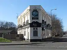
The Junction Hotel, Rolls Crescent
References
- Usual Resident Population in Manchester Archived 2008-01-04 at the Wayback Machine, Manchester City Council. Retrieved on 2008-02-10
Other websites
Wikimedia Commons has media related to Hulme, Greater Manchester.
- ALL FM, whose radio coverage includes Hulme
- The Hulme Tune show news Archived 2009-03-24 at the Wayback Machine
- Hulme Life - Manchester Community Initiative Archived 2012-04-14 at the Wayback Machine
- Hulme Residents Portal Archived 2012-03-23 at the Wayback Machine
- The old Hulme
- The People's Republic of Hulme - Archive Hour - BBC Radio 4
This article is issued from Wikipedia. The text is licensed under Creative Commons - Attribution - Sharealike. Additional terms may apply for the media files.