Jackson County, Iowa
Jackson County is a county in the U.S. state of Iowa. As of the 2010 census, the population was 19,848.[1] The county seat is Maquoketa.[2] The county was founded on December 21, 1837 and named after U.S. President Andrew Jackson.[3]
Jackson County | |
|---|---|
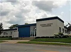 Jackson County Courthouse | |
 Location within the U.S. state of Iowa | |
 Iowa's location within the U.S. | |
| Coordinates: 42°10′13″N 90°34′30″W | |
| Country | |
| State | |
| Founded | 1837 |
| Named for | Andrew Jackson |
| Seat | Maquoketa |
| Largest city | Maquoketa |
| Area | |
| • Total | 650 sq mi (1,700 km2) |
| • Land | 6,969 sq mi (18,050 km2) |
| • Water | 69 sq mi (180 km2) 69.69%% |
| Population | |
| • Estimate (2017) | 19,366 |
| • Density | 31/sq mi (12/km2) |
| Time zone | UTC−6 (Central) |
| • Summer (DST) | UTC−5 (CDT) |
| Congressional district | 1st |
| Website | www |
Geography
The county has a total area of 650 square miles (1,700 km2).
Bordering counties
- Dubuque County (north)
- Jo Daviess County, Illinois (northeast)
- Carroll County, Illinois (east)
- Clinton County (south)
- Jones County (west)
Communities
Cities
Unincorporated communities
- Canton‡
- Cottonville
- Garryowen
- Green Island
- Nashville
- Otter Creek
- South Garry Owen
Ghost towns
- Alma
- Amoy
- America
- Bridgeport
- Brookfield
- Buckhorn
- Canton
- Carrollport
- Centerville
- Charleston
- Charkstown
- Cobb
- Coloma
- Copper Creek
- Cottonville
- Crabb
- Crabb's Mill
- Crabbtown
- Deventersville
- Duggan
- Duke
- Emeline
- Fremont
- Fulton
- Gordon's Ferry
- Hickory Grove
- Higginsport
- Hugo
- Hurstville
- Fairfield
- Farmers Creek
- Franklin
- Iron Hill
- East Iron Hills
- Isabel
- Lainsville
- Lowell
- Millrock
- Mount Algor
- Nashville
- New Castle
- New Rochester
- North Maquoketa
- Otter Creek
- Ozark
- Pass
- Prairie Springs
- Rolley
- Silsbee
- Smiths Ferry
- Springfield
- Spruce Mills
- Sterling
- Sullivan
- Summer Hill
- Sylva
- Tetes des Morts
- Union Center
- Van Buren
- Wagonersburgh
- Waterford
- Wickliffe
Townships
Jackson County is divided into 18 townships:
- Bellevue
- Brandon
- Butler
- Fairfield
- Farmers Creek
- Iowa
- Jackson
- Maquoketa
- Monmouth
- Otter Creek
- Perry
- Prairie Springs
- Richland
- South Fork
- Tete Des Morts
- Union
- Van Buren
- Washington
References
- "State & County QuickFacts". United States Census Bureau. Archived from the original on July 12, 2011. Retrieved July 18, 2014.
- "Find a County". National Association of Counties. Archived from the original on May 31, 2011. Retrieved 2011-06-07.
- Gannett, Henry (1905). The Origin of Certain Place Names in the United States. Govt. Print. Off. p. 167.
Other websites
Wikimedia Commons has media related to Jackson County, Iowa.
This article is issued from Wikipedia. The text is licensed under Creative Commons - Attribution - Sharealike. Additional terms may apply for the media files.