Loco, Oklahoma
Loco is a town in Oklahoma in the United States.
Loco, Oklahoma | |
|---|---|
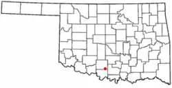 Location of Loco, Oklahoma | |
| Coordinates: 34°19′43″N 97°40′50″W | |
| Country | United States |
| State | Oklahoma |
| County | Stephens |
| Area | |
| • Total | 0.26 sq mi (0.68 km2) |
| • Land | 0.26 sq mi (0.68 km2) |
| • Water | 0.00 sq mi (0.00 km2) |
| Elevation | 968 ft (295 m) |
| Population (2010) | |
| • Total | 122 |
| • Estimate (2019)[2] | 118 |
| • Density | 450.38/sq mi (174.22/km2) |
| Time zone | UTC-6 (Central (CST)) |
| • Summer (DST) | UTC-5 (CDT) |
| ZIP code | 73442 |
| Area code(s) | 580 |
| FIPS code | 40-43450[3] |
| GNIS feature ID | 1094878[4] |
References
- "2019 U.S. Gazetteer Files". United States Census Bureau. Retrieved July 28, 2020.
- "Population and Housing Unit Estimates". United States Census Bureau. May 24, 2020. Retrieved May 27, 2020.
- "U.S. Census website". United States Census Bureau. Retrieved 2008-01-31.
- "US Board on Geographic Names". United States Geological Survey. 2007-10-25. Retrieved 2008-01-31.
This article is issued from Wikipedia. The text is licensed under Creative Commons - Attribution - Sharealike. Additional terms may apply for the media files.