Préizerdaul
Préizerdaul is a commune in Luxembourg. It is part of the canton of Redange.
Préizerdaul | |
|---|---|
 Coat of arms | |
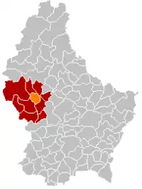 Map of Luxembourg with Préizerdaul highlighted in orange, and the canton in dark red | |
| Coordinates: 49.7942°N 5.9375°E | |
| Country | |
| Canton | Redange |
| Area | |
| • Total | 15.6 km2 (6.0 sq mi) |
| Area rank | 72nd of 102 |
| Highest elevation | 402 m (1,319 ft) |
| • Rank | 48th of 102 |
| Lowest elevation | 255 m (837 ft) |
| • Rank | 58th of 102 |
| Population (1 January 2019) | |
| • Total | 1,703 |
| • Rank | 91st of 102 |
| • Density | 110/km2 (280/sq mi) |
| • Density rank | 23rd of 102 |
| Time zone | UTC+1 (CET) |
| • Summer (DST) | UTC+2 (CEST) |
| LAU 2 | LU0000702 |
| Website | preizerdaul.lu |
As of 2019, 1,703 people live here.
Wikimedia Commons has media related to Préizerdaul.
This article is issued from Wikipedia. The text is licensed under Creative Commons - Attribution - Sharealike. Additional terms may apply for the media files.