Wakarusa River
The Wakarusa River is a tributary of the Kansas River. It is about 80.5 miles (129.6 km) long.[3] It is in eastern Kansas in the United States. It is south of Topeka and Lawrence.
| Wakarusa River | |
|---|---|
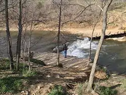 Falls of the Wakarusa River | |
| Location | |
| Country | United States |
| State | Kansas |
| Physical characteristics | |
| Source | |
| - location | Wabaunsee County, Kansas |
| - coordinates | 38°53′44″N 95°57′36″W |
| - elevation | 1,261 ft (384 m) |
| Mouth | Kansas River |
| - location | Eudora, Kansas |
| - coordinates | 38°57′22″N 95°04′56″W[1] |
| - elevation | 781 ft (238 m) |
| Length | 80.5 mi (129.6 km) |
| Discharge | |
| - location | USGS 06891500 near Lawrence, KS[2] |
| - average | 219 cu ft/s (6.2 m3/s) |
| - minimum | 0 cu ft/s (0 m3/s) |
| - maximum | 22,600 cu ft/s (640 m3/s) |
| Basin features | |
| River system | Wakarusa—Kansas—Missouri—Mississippi |
Related pages
- Bleeding Kansas Heritage Area
- California Road - Branch of the Oregon Trail to Lawrence, Kansas from Westport Landing.
- Clinton State Park - Provides recreational access to Clinton Lake.
- List of Kansas rivers
- Lakes, reservoirs, and dams in Kansas
References
- "Wakarusa River". Geographic Names Information System. United States Geological Survey. Retrieved 2015-10-01.
- "Water-Data Report 2012 - 06891500 Wakarusa River near Lawrence, KS" (PDF). U.S. Geological Survey. Retrieved 2015-11-06.
- U.S. Geological Survey. National Hydrography Dataset high-resolution flowline data. The National Map Archived 2017-08-23 at the Wayback Machine, accessed March 30, 2011
This article is issued from Wikipedia. The text is licensed under Creative Commons - Attribution - Sharealike. Additional terms may apply for the media files.