Amel-sur-l'Étang
Amel-sur-l'Étang (French pronunciation: [amɛl syʁ letɑ̃]) is a commune in the Meuse department in the Grand Est region in northeastern France.
Amel-sur-l'Étang | |
|---|---|
 The church in Amel-sur-l'Étang | |
.svg.png.webp) Coat of arms | |
Location of Amel-sur-l'Étang | |
 Amel-sur-l'Étang 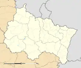 Amel-sur-l'Étang | |
| Coordinates: 49°16′02″N 5°38′57″E | |
| Country | France |
| Region | Grand Est |
| Department | Meuse |
| Arrondissement | Verdun |
| Canton | Bouligny |
| Intercommunality | Damvillers Spincourt |
| Government | |
| • Mayor (2020–2026) | Nicolas Birckel[1] |
| Area 1 | 14.74 km2 (5.69 sq mi) |
| Population (2021)[2] | 147 |
| • Density | 10.0/km2 (26/sq mi) |
| Time zone | UTC+01:00 (CET) |
| • Summer (DST) | UTC+02:00 (CEST) |
| INSEE/Postal code | 55008 /55230 |
| Elevation | 205–256 m (673–840 ft) (avg. 252 m or 827 ft) |
| 1 French Land Register data, which excludes lakes, ponds, glaciers > 1 km2 (0.386 sq mi or 247 acres) and river estuaries. | |
Population
| Year | Pop. | ±% p.a. |
|---|---|---|
| 1968 | 227 | — |
| 1975 | 192 | −2.36% |
| 1982 | 168 | −1.89% |
| 1990 | 132 | −2.97% |
| 1999 | 150 | +1.43% |
| 2009 | 174 | +1.50% |
| 2014 | 175 | +0.11% |
| 2020 | 144 | −3.20% |
| Source: INSEE[3] | ||
See also
References
- "Répertoire national des élus: les maires" (in French). data.gouv.fr, Plateforme ouverte des données publiques françaises. 13 September 2022.
- "Populations légales 2021". The National Institute of Statistics and Economic Studies. 28 December 2023.
- Population en historique depuis 1968, INSEE
Wikimedia Commons has media related to Amel-sur-l'Étang.
This article is issued from Wikipedia. The text is licensed under Creative Commons - Attribution - Sharealike. Additional terms may apply for the media files.