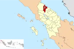
Deli Serdang Regency
Deli Serdang (Indonesian: Kabupaten Deli Serdang; Jawi: دلي سردڠ) is a regency in the Indonesian province of North Sumatra. It surrounds the city of Medan, and also borders to the west the city of Binjai, which is effectively a bedroom community for Medan. The entire regency lies within the Medan metropolitan area. It occupies an area of 2,497.72 km2 (964.38 sq miles). The capital of the district is Lubuk Pakam, which is located approximately 30 km east of Medan. The national census of 2000 recorded 1,573,987 people, but by 2010 the regency's population increased by 13.76% to 1,790,431,[2] and at the 2020 Census the total was 1,931,441.[3] The official estimate as at mid 2023 was 2,018,164 (comprising 1,014,629 males and 1,003,535 females).[1] Kualanamu International Airport is located in this regency.
Deli Serdang
دلي سردڠ 得力沙登 டெலி செர்டாங் | |
|---|---|
 Seal | |
| Motto: Bhinneka Perkasa Jaya | |
 | |
| Country | Indonesia |
| Province | North Sumatra |
| Regency seat | Lubuk Pakam |
| Government | |
| • Regent | Ashari Tambunan |
| • Vice Regent | Ali Yusuf Siregar |
| • Chairman of Council of Representatives | Zakky Shahri (Gerindra) |
| • Vice Chairmen of Council of Representatives | Amit Damanik (PDI-P), Tengku Ahmad Tala'a (Golkar) and Nusantara Tarigan (Nasdem) |
| Area | |
| • Total | 2,497.72 km2 (964.38 sq mi) |
| Population (mid 2023 estimate)[1] | |
| • Total | 2,018,164 |
| • Density | 810/km2 (2,100/sq mi) |
| Time zone | UTC+7 (WIB) |
| Website | www |
It is the most populous regency in Indonesia outside the island of Java. Its population is comparable to the country of Latvia.
Neighbouring areas
The external boundaries of the regency are with:
- To the north: the Langkat Regency and the Strait of Malacca.
- To the south: the Karo Regency and Simalungun Regency.
- To the east: the Serdang Bedagai Regency and the Strait of Malacca.
- To the west: the Karo Regency, Langkat Regency and the city of Binjai.
The city of Medan is an enclave within the regency.
Administrative districts
The regency is divided into twenty-two districts (kecamatan), tabulated below with their areas (in km2) and their 2010 Census[2] and 2020 Census[3] populations, and the official estimates as of mid 2023.[1] The table also includes the locations of the district administrative centres, the number of administrative villages within each district (totaling 380 rural desa, and 14 urban kelurahan), and its post code:
| Kode Wilayah | Name of District (kecamatan) | Area in km2 | Pop'n Census 2010 | Pop'n Census 2020 | Pop'n Estimate mid 2023 | Admin centre | No. of desa | No. of kelu- rahan | Post code |
|---|---|---|---|---|---|---|---|---|---|
| 12.07.21 | Patumbak | 46.79 | 88,961 | 97,994 | 101,784 | Patumbak | 8 | - | 20361 |
| 12.07.22 | Deli Tua | 9.36 | 60,624 | 59,292 | 61,860 | Deli Tua | 3 | 3 (a) | 20355 |
| 12.07.23 | Sunggal | 92.52 | 244,187 | 241,359 | 251,588 | Sunggal | 17 | - | 20351 |
| 12.07.24 | Hamparan Perak | 230.15 | 150,054 | 163,521 | 169,316 | Hamparan Perak | 20 | - | 20374 |
| 12.07.25 | Labuhan Deli | 127.23 | 60,190 | 67,129 | 69,977 | Helvetia | 5 | - | 20373 |
| 12.07.26 | Percut Sei Tuan | 190.79 | 384,672 | 402,468 | 423,020 | Tembung | 18 | 2 (b) | 20371 |
| 12.07.03 | Sibolangit | 179.96 | 19,654 | 19,980 | 20,630 | Bandar Baru | 30 | - | 20357 |
| 12.07.04 | Kutalimbaru | 174.92 | 35,870 | 36,238 | 37,539 | Kutalimbaru | 14 | - | 20354 |
| 12.07.05 | Pancur Batu | 122.53 | 84,919 | 93,470 | 97,064 | Pancur Batu | 25 | - | 20353 |
| 12.07.06 | Namo Rambe | 62.30 | 36,651 | 39,697 | 41,031 | Namo Rambe | 36 | - | 20356 |
| 12.07.07 | Biru-Biru (or Sibiru-Biru) | 89.69 | 34,020 | 39,083 | 40,848 | Biru-Biru | 17 | - | 20358 |
| Total Western half | 1,326.24 | 1,199,802 | 1,260,231 | 1,314,657 | 193 | 5 | |||
| 12.07.01 | Gunung Meriah | 76.65 | 2,472 | 3,193 | 3,373 | Gunung Meriah | 12 | - | 20583 |
| 12.07.20 | Sinembah Tanjung Muda Hulu | 223.38 | 12,333 | 13,554 | 14,069 | Tiga Juhar | 20 | - | 20582 |
| 12.07.08 | Sinembah Tanjung Muda Hilir | 190.50 | 30,563 | 33,159 | 34,290 | Talun Kenas | 15 | - | 20363 |
| 12.07.09 | Bangun Purba | 129.95 | 21,550 | 24,375 | 25,513 | Bangun Purba | 24 | - | 20581 |
| 12.07.19 | Galang | 150.29 | 61,508 | 70,136 | 73,583 | Galang | 28 | 1 (c) | 20585 |
| 12.07.02 | Tanjung Morawa | 131.75 | 192,759 | 223,450 | 235,558 | Tanjung Morawa | 25 | 1 (d) | 20362 |
| 12.07.27 | Batang Kuis | 40.34 | 56,270 | 65,075 | 68,554 | Batang Kuis | 11 | - | 20372 |
| 12.07.32 | Pantai Labu | 81.85 | 43,135 | 49,167 | 51,578 | Pantai Labu | 19 | - | 20553 |
| 12.07.33 | Beringin | 52.69 | 52,415 | 60,711 | 63,985 | Beringin | 11 | - | 20552 |
| 12.07.28 | Lubuk Pakam | 31.19 | 80,847 | 88,576 | 91,858 | Lubuk Pakam | 6 | 7 (e) | 20511 -20518 |
| 12.07.31 | Pagar Merbau | 62.89 | 36,777 | 39,814 | 41,146 | Pagar Merbau | 16 | - | 20551 |
| Total Eastern half | 1,171.48 | 590,629 | 671,210 | 703,507 | 187 | 9 |
Notes: (a) Deli Tua, Deli Tua Barat and Deli Tua Timur. (b) Kenangan and Kenangan Baru. (c) Galang Kota. (d) Pekan Tanjung Morawa.
(e) Cemara, Lubuk Pakam I, II Lubuk Pakam Pekan, Lubuk Pakam III, Paluh Kemiri, Petapahan and Syahmad.

London Sumatra (LONSUM) protests
Deli Serdang Regency contains three plantations owned by London Sumatra (LONSUM).[4]
On 21 June 2003, farmers and indigenous peoples in a number of villages within the district attempted to re-occupy lands which had been leased to LONSUM by the government.[5] Police fired upon the group, resulting in at least a dozen wounded and four deaths.[5]
Television
| Channel | Signal | Frequency | Name | Network | Company name | Owner | Status |
|---|---|---|---|---|---|---|---|
| 23 | 487.250-MHz | UHF | Indosiar | PT Indosiar Visual Mandiri | Elang Mahkota Teknologi | Nasional | |
| 25 | 503.250-MHz | MNCTV | PT Cipta Televisi Pendidikan Indonesia | Media Nusantara Citra | |||
| 27 | 519.250-MHz | Trans TV | PT Televisi Transformasi Indonesia | Trans Media | |||
| 29 | 535.250-MHz | ANTV | PT Cakrawala Andalas Televisi | Visi Media Asia | |||
| 31 | 551.250-MHz | GTV | PT Global Informasi Bermutu | Media Nusantara Citra | |||
| 33 | 567.250-MHz | RCTI | PT Rajawali Citra Televisi Indonesia | Media Nusantara Citra | |||
| 35 | 583.250-MHz | SCTV | PT Surya Citra Televisi | Elang Mahkota Teknologi | |||
| 37 | 599.250-MHz | tvOne | PT Lativi Media Karya | Visi Media Asia | |||
| 39 | 615.250-MHz | Metro TV | PT Media Televisi Indonesia | Media Group | |||
| 41 | 631.250-MHz | Trans7 | PT Duta Visual Nusantara Tivi Tujuh | Trans Media | |||
| 43 | 647.250-MHz | NET. | PT Net Mediatama Indonesia | Indika Group | |||
| 45 | 663.250-MHz | iNews | PT Deli Media Televisi | Media Nusantara Citra | |||
| 47 | 679.250-MHz | TVRI Nasional | TVRI | Lembaga Penyiaran Publik TVRI | Pemerintah Indonesia | ||
| TVRI Sumatra Utara | Pemeritah Sumatra Utara | Lokal | |||||
| 49 | 695.250-MHz | DAAI TV | PT Daya Angkasa Andalas Indah Televisi | Tau Chi Media | Berjaringan | ||
| 51 | 751.250-MHz | BeritaSatu | PT First Media News | Media Holdings Group | |||
| 50 | 703.250-MHz | TVRI Nasional | TVRI | Lembaga Penyiaran Publik TVRI | Pemerintah Indonesia | Nasional | |
| 53 | 727.250-MHz | RTV | PT Cahaya Nusantara Perkasa Televisi | Rajawali Corpora | Nasional | ||
| 54 | 735.250-MHz | Efarina TV | PT Efarina Televisi | Efarina Etham | |||
| 55 | 737.250-MHz | MYTV | PT Banten Media Global Televisi | Netwave Group dan Mayapada Group | |||
| 57 | 739.250-MHz | Info TV | PT Info Mayapada | Mayapada Group | |||
| 59 | 775.250-MHz | Kompas TV | PT Gramedia Media Nusantara | Kompas Gramedia | |||
See also
- Sultanate of Deli
- Sultanate of Serdang
References
- Badan Pusat Statistik, Jakarta, 28 February 2024, Kabupaten Deli Serdang Dalam Angka 2024 (Katalog-BPS 1102001.1207)
- Biro Pusat Statistik, Jakarta, 2011.
- Badan Pusat Statistik, Jakarta, 2021.
- "Welcome to Lonsum". www.londonsumatra.com.
- "WALHI - the National Human Rights Commission on Lonsum Bulukumba Incident Says: Human Rights Violations Found". Archived from the original on 2006-03-09. Retrieved 2005-08-01.
Capital: Medan | ||
| Regencies |
|  |
| Cities |
| |