Ayodhya division
Ayodhya division (formerly Faizabad division) is one of the 18 administrative geographical units (i.e. division) of the northern Indian state of Uttar Pradesh. Ayodhya city is the administrative headquarters of the division.[1] The government of Uttar Pradesh approved the renaming of the Faizabad division to Ayodhya division in November 2018.[2]
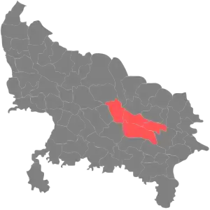
Ayodhya division
The division currently consists of the following 5 districts:-[3]
Demographics
Ayodhya division: mother-tongue of population, according to the 2011 Census.[4]
Awadhi (12.98%)
Hindi (81.52%)
Urdu (4.94%)
Others (0.56%)
The 2011 census did not use the new organisation. The districts at the time consisted of Barabanki, Faizabad (now called Ayodhya), Ambedkar Nagar, and Sultanpur.[4] The latter had different sub-districts than now.
| Ayodhya division: mother-tongue of population, according to the 2011 Census.[4] | |||||||
|---|---|---|---|---|---|---|---|
| Mother tongue code | Mother tongue | Districts | Ayodhya division | ||||
| Bara Banki | Ayodhya | Ambedkar Nagar | Sultanpur | Total people | Percentage | ||
| 002007 | Bengali | 635 | 584 | 303 | 597 | 2,119 | 0.02% |
| 004001 | Dogri | 0 | 831 | 0 | 0 | 831 | 0.01% |
| 006030 | Awadhi | 68,876 | 333,602 | 256,822 | 888,371 | 1,547,671 | 12.98% |
| 006102 | Bhojpuri | 2,141 | 804 | 39,100 | 2,889 | 44,934 | 0.38% |
| 006142 | Chhattisgarhi | 217 | 788 | 490 | 2,700 | 4,195 | 0.04% |
| 006240 | Hindi | 2,984,773 | 2,050,978 | 1,905,077 | 2,781,822 | 9,722,650 | 81.52% |
| 015043 | Odia | 84 | 557 | 504 | 628 | 1,773 | 0.01% |
| 016038 | Punjabi | 1,199 | 763 | 362 | 887 | 3,211 | 0.03% |
| 019014 | Sindhi | 0 | 2,432 | 4 | 28 | 2,464 | 0.02% |
| 022015 | Urdu | 200,893 | 77,484 | 193,932 | 116,980 | 589,289 | 4.94% |
| 028001 | Arabic/Arbi | 170 | 38 | 474 | 391 | 1,073 | 0.01% |
| 040001 | English | 763 | 53 | 42 | 39 | 897 | 0.01% |
| – | Others | 948 | 2,082 | 778 | 1,785 | 5,593 | 0.05% |
| Total | 3,260,699 | 2,470,996 | 2,397,888 | 3,797,117 | 11,926,700 | 100.00% | |
References
- "District Ayodhya - Government of Uttar Pradesh | City Of Lord Rama | India". Retrieved 8 March 2021.
- PTI (13 November 2018). "UP cabinet approves renaming of Faizabad as Ayodhya, Allahabad as Prayagraj". The Times of India. Retrieved 22 January 2021.
- "Administrative Setup | District Ayodhya - Government of Uttar Pradesh | India". Retrieved 5 October 2021.
- C-16 Population By Mother Tongue – Uttar Pradesh (Report). Office of the Registrar General & Census Commissioner, India. Retrieved 15 July 2020.
This article is issued from Wikipedia. The text is licensed under Creative Commons - Attribution - Sharealike. Additional terms may apply for the media files.