Gia Lai province
Gia Lai (Vietnamese: [jaː˧˧ laːj˧˧] ⓘ) is a northern mountainous province in the Central Highlands region, the Central of Vietnam. It borders Kon Tum in the north, Quảng Ngãi in the northeast, Bình Định in the east, Phú Yên in the southeast, Đắk Lắk in the south and Ratanakiri of Cambodia in the west.
Gia Lai province
Tỉnh Gia Lai | |
|---|---|
  .jpg.webp)    .jpg.webp) 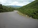     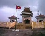 T'Nưng Lake • One Pillar Pagoda in Pleiku • Monument to Heroes and Martyrs Gia Lai • Great Solidarity Square • Minh Thành Temple • An Khê Mountain • Dams Đắk Plao • Đức An Lake • Pleiku City night • Museum Pleiku | |
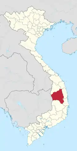 Location of Gia Lai within Vietnam | |
| Coordinates: 13°45′N 108°15′E | |
| Country | |
| Region | Central Highlands |
| Capital | Pleiku |
| Government | |
| • People's Council Chair | Dương Văn Trang |
| • People's Committee Chair | Phạm Thế Dũng |
| Area | |
| • Total | 15,510.13 km2 (5,988.49 sq mi) |
| Population (2022) | |
| • Total | 1,791,000 |
| • Density | 120/km2 (300/sq mi) |
| Demographics | |
| • Ethnicities | 39, including Vietnamese, Gia Rai, Ba Na, Xơ Đăng, Giẻ Triêng |
| GDP[2] | |
| • Total | VND 66.158 trillion US$ 2.873 billion |
| Time zone | UTC+7 (ICT) |
| Area codes | 269 (from 17 Jun 2017) 59 (until 16 Jul 2017) |
| ISO 3166 code | VN-30 |
| Website | gialai |
Gia Lai is the second-largest province of Vietnam. The name comes from the Jarai people, one of the local indigenous groups.
Geography
Gia Lai is a mountainous province located in the northern Central Highlands at an average altitude of 700 - 800 m above sea level with an area of 15,510.13 km2 (5,988.49 sq mi),[1] and an average population of 1,426,000 people (2017). Gia Lai borders Kon Tum Province to the north, Dak Lak Province to the south, Cambodia to the west, and Quang Ngai, Binh Dinh, and Phu Yen Provinces to the east. The province has 17 administrative units including Pleiku City, 2 towns of An Khe, Ayun Pa, and 14 districts including Chu Pah, Chu Prong, Dak Doa, Chu Se, Chu Puh, Phu Thien, Mang Yang, Krong Pa, Kong Chro, Kbang, Ia Pa, Ia Grai, Duc Co, Dak Po. Pleiku City is the economic, political, cultural, and social center of the province.[3]
- Ayun Hạ Lake
Administrative divisions
Gia Lai is composed of 17 district-level sub-divisions:
| Second Tier subdivisions |
Area (km2) |
Third-tier subdivisions | ||
|---|---|---|---|---|
| Ward | Township | Commune | ||
| Pleiku city | 266.62 | 14 | 9 | |
| An Khê town | 200.07 | 6 | 5 | |
| Ayun Pa town | 287.00 | 4 | 4 | |
| Chư Păh District | 988.66 | 2 | 13 | |
| Chư Prông District | 1687.50 | 1 | 19 | |
| Chư Pưh District | 716.95 | 1 | 8 | |
| Chư Sê District | 642.96 | 1 | 14 | |
| Đắk Đoa District | 988.66 | 1 | 16 | |
| Đắk Pơ District | 499.62 | 1 | 7 | |
| Đức Cơ District | 717.00 | 1 | 9 | |
| Ia Grai District | 1157.30 | 1 | 12 | |
| Ia Pa District | 870.90 | 9 | ||
| K'Bang District | 1845.00 | 1 | 13 | |
| Kông Chro District | 1442.00 | 1 | 13 | |
| Krông Pa District | 1623.60 | 1 | 13 | |
| Mang Yang District | 1126.10 | 1 | 11 | |
| Phú Thiện District | 501.91 | 1 | 9 | |
They are further subdivided into 15 commune-level towns (or townlets), 184 communes, and 24 wards.
References
- Biểu số 4.4: Hiện trạng sử dụng đất vùng Tây Nguyên năm 2022 [Table 4.4: Current land use status in the Central Highlands in 2022] (PDF) (Decision 3048/QĐ-BTNMT) (in Vietnamese). Ministry of Natural Resources and Environment (Vietnam). 18 October 2023. – the data in the report are in hectares, rounded to integers
- "Tình hình kinh tế, xã hội Gia Lai năm 2018". UBND tỉnh Gia Lai. Retrieved 10 May 2020.
- "gialai overview". Pleikutravel.Gialai.
Places adjacent to Gia Lai province | |
|---|---|