List of islands of South America
The following are lists of the islands of South America by country.

A composite satellite photograph of South America in orthographic projection
Argentina
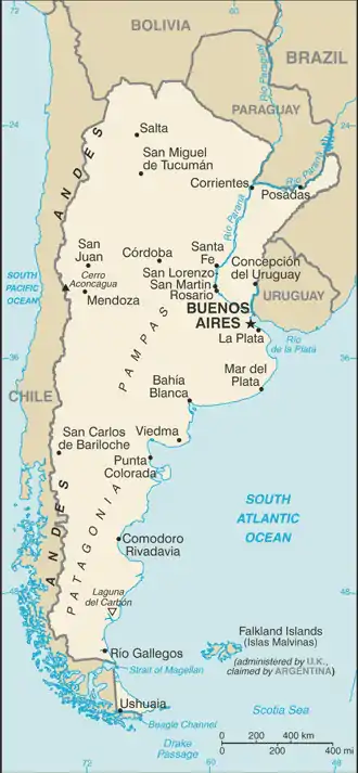
A map of Argentina
Atlantic Ocean islands
- Isla Apipé
- Isla Bermejo
- Isla de los Estados
- Isla de San Martín
- Isla del Cerrito
- Isla Martín García
- Isla Trinidad (Buenos Aires)
- Patagonic Archipelago
Lake islands
- Isla Huemul
- Isla Victoria
River islands
- Islands of the Paraná River delta
- Islas del Ibicuy
Bolivia
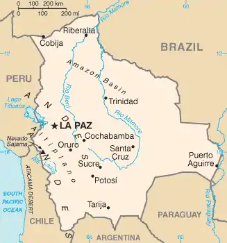
A map of Bolivia
Bolivia is a landlocked country with no ocean islands.
Lake islands
- Isla del Pescado (Incahuasi Island)
- Isla del Sol
- Isla de la Luna
Brazil
.png.webp)
A map of Brazil
Atlantic Ocean islands
- Arquipelago de Fernando de Noronha
- Arquipélago de São Pedro e São Paulo (Saint Peter and Paul Rocks)
- Atol das Rocas (Rocas Atoll)
- Ilha de Boipeba
- Ilha de Maraca
- Ilha da Queimada Grande
- Ilha de Santa Bárbara
- Ilha de Santa Catarina
- Ilha de Santo Amaro
- Ilha de São Luís
- Ilha Grande
- Ilha Itaparica
- Ilha Tinhare
- Ilha Trindade
- Ilha dos Lobos
- Ilhabela archipelago
- Ilhas Cagarras archipelago
- Ilhas Martim Vaz archipelago
- Vitória archipelago
River Islands
Fluvial-maritime
- Marajó Archipelago
Chile
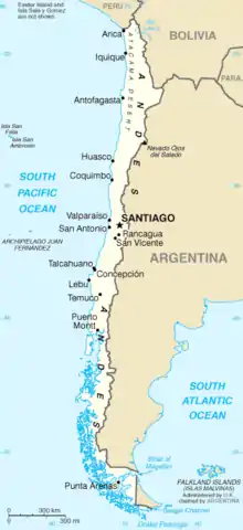
A map of Chile
Pacific Ocean islands
- Archipiélago de Chiloé
- Isla de Chiloé
- Isla Guafo
- Isla Lemuy
- Isla Quinchao
- Archipiélago de las Guaitecas
- Archipiélago Guayaneco
- Archipiélago Juan Fernández (also considered part of Oceania)
- Isla Chañaral
- Isla de Pascua (Easter Island) (also considered part of Oceania)
- Isla del Rey
- Isla Magdalena
- Isla Mancera
- Isla Mocha
- Isla Quiriquina
- Isla Salas y Gómez
- Islas Desventuradas
- Merino Jarpa Island
- Patagonic Archipelago
- Archipelago de La Reina Adelaida (Queen Adelaide Archipelago)
- Isla Cochrane
- Isla Contreras
- Isla Juan Guillermo
- Isla Pacheco
- Isla Ramirez
- North Rennell Island
- South Rennell Island
- Archipiélago de los Chonos
- Isla Benjamin
- Isla Cuptana
- Isla Guamblin
- Isla James
- Isla Melchor
- Isla Rivero
- Isla Simpson
- Isla Traiguen
- Isla Victoria
- Archipiélago de Tierra del Fuego
- Isla Dawson
- Isla Desolación
- Isla Gordon
- Isla Grande de Tierra del Fuego (divided with Argentina)
- Isla Magdalena
- Islas Hermite
- Isla Hermite
- Isla Hornos – location of Cape Horn (Cabo de Hornos)
- Isla Hoste
- Isla Navarino
- Isla Santa Inés
- Islas Picton, Lennox y Nueva
- Islas Wollaston
- Londonderry Island
- Isla Angamos
- Isla Aracena
- Isla Campana
- Isla Chatham
- Isla Clarence
- Isla Diego de Almagro
- Isla Duque de York
- Isla Esmeralda
- Isla Farrel
- Isla Guarello
- Isla Hanover
- Isla Jorge Montt
- Isla Juan Guillermos
- Isla Madre de Dios
- Isla Manuel Rodriguez
- Isla Mornington
- Isla Patricio Lynch
- Isla Pratt
- Isla Riesco
- Isla Serrano
- Isla Stosch
- Isla Wellington
- Islas Diego Ramírez
- Islote Águila (Águila Islet) – southernmost point of Chile
- Islas Ildefonso
- Archipelago de La Reina Adelaida (Queen Adelaide Archipelago)
Lake islands
- Isla Gabriela
- Isla Guapi
- Isla Fresia
- Isla Central
River islands
- Isla Teja
- Isla del Rey
- Isla Mancera
- Isla Haverbeck
- Isla Mota
- Isla Guapi
- Isla Lemuy
- Isla Orrego
Colombia
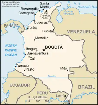
A map of Colombia
Caribbean Sea islands
- Rosario Islands
- Isla Grande
- Isla Marina
- Isla de Roberto
- Isla Rosario
- Isla del Tesoro
- Fuerte Island
- Tierra Bomba Island
- Isla del Pirata
- Tortuguilla Island
- Isla de Salamanca
San Andrés and Providencia Department:
- Acuario Cay (also known as Rose Cay)
- Alice Shoal
- Bajo Nuevo Bank
- Bayley Islet
- Basalt Islet
- Brothers Cay
- Crab Cay
- Cayos de Albuquerque
- North Cay
- South Cay
- Córdoba Cay (also known as Haynes Cay)
- Easy Cay
- Grunt Cay
- Cayos de Este Sudeste
- Bolívar Cay (also known as Courtown or West Cay)
- East Cay
- Palm Cay
- Providencia Island
- Quita Sueño Bank
- Rocky Cay
- Roncador Bank
- Roncador Cay
- San Andrés Island
- Santa Catalina Island
- Santander Cay (also known as Cotton Cay)
- Serrana Bank
- Serranilla Bank
- Sucre Islet (also known as Johnny Cay)
- Boquerón Island
- Cabruna Island
- Ceycén Island
- Mangle Island
- Maravilla Island
- Múcura Island
- Palma Island
- Panda Island
- Santa Cruz del Islote
- Tintipán Island
Pacific Ocean islands
- Coco Island
- Gorgona Island
- El Horno Islet
- Gorgonilla Island
- El Viudo Islet
- Micay Island
- Cacagual Island
- Bocagrande Island
- El Bajito Island
- El Gallo Island
- El Morro Island
- La Viciosa Island
- Sanquianga Island
- Tumaco Island
- Ají Island
- La Palma Island
- Malpelo Island
Lake islands
- Lake Tota
- Cerro Chiquito Island
- Santa Helena Island
- San Pedro Island
- La Cocha Lake
- La Corota Island
River islands
- Baranoa Island
- Curvaratá Island
- Loreto Island
- Porvenir Island
- Tigre Island
- Yaguas Muñoz Island
|
|
|
|
|
|
|
Ecuador
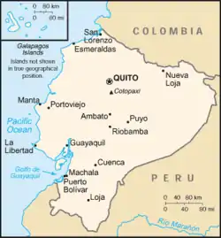
A map of Ecuador
Pacific Ocean islands
- Galápagos Islands
- Bartolomé Island
- Baltra Island
- Darwin Island
- Española Island
- Fernandina Island
- Floreana Island
- Genovesa Island
- Isabela Island
- Marchena Island
- Rábida Island
- Pinzón Island
- Santa Fe Island
- Santa Cruz Island
- Santiago Island
- Wolf Island
- La Plata Island
- Puná Island
- Salango Island
Lake Islands
- Cuicocha Lake
- Teodoro Wolf Island
- Yerovi Island
Falkland Islands

A map of the Falkland Islands
Atlantic Ocean islands
- Falkland Islands (also claimed by Argentina)
French Guiana
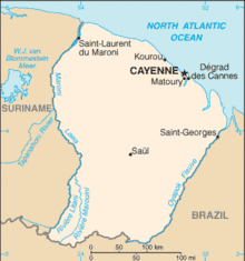
A map of French Guiana
- Îles du Salut
- Constable Islands
- Remire Islands
- Îlet la Mère
- Palasisi, island in the Litani River[1]
- Île Portal, island in the Maroni River[2]
Paraguay
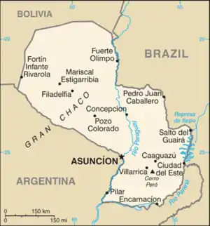
A map of Paraguay
Paraguay is a landlocked country with no ocean islands and only a few very small inland islands.
South Georgia and the South Sandwich Islands

Atlantic Ocean islands
- South Georgia (also claimed by Argentina)
- South Sandwich Islands (also claimed by Argentina)
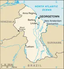
Suriname
.png.webp)
A map of Suriname
- Diitabiki
- Kasuela
- Kwana Island
- Langatabiki
- Manlobi
- Nason
- Stoelmanseiland
- Stoneiland
Uruguay
A map of Uruguay
- Brazilian Island
- Gorriti Island
- Juncal Island
- Isla de Flores
- Isla de las Gaviotas
- Isla de Lobos
- Timoteo Domínguez Island
- Vizcaíno Island
Venezuela
A map of Venezuela
Caribbean Sea islands
- Archipiélago Las Aves
- Isla La Blanquilla
- Archipiélago Los Monjes
- Archipiélago Los Roques
- Isla de Aves
- Isla de Coche
- Isla de Cubagua
- Isla de Patos
- Isla de Toas
- Isla de Zapara
- Isla La Orchila
- Isla La Sola
- Isla La Tortuga
- Isla Margarita
- Isla San Carlos
- Islas Caracas
- Islas los Frailes
- Islas los Hermanos
- Islas los Testigos
River islands
- Ankoko Island (also claimed by Guyana)
See also
- List of islands by area
- List of islands by highest point
- List of islands by population
- List of islands in lakes
- List of river islands
- List of islands in the Atlantic Ocean
- List of Caribbean islands
- List of islands in the Pacific Ocean
- Topic outline of South America
References
- Duin, Renzo Sebastiaan (2009). Wayana Socio-political Landscapes: Multi-scalar Regionality and Temporality in Guiana (PDF). University of Florida. p. 138.
- "Les enfants de l'île Portal". Media Part (in French). Retrieved 7 March 2021.
External links
- Island Directory @ United Nations Environment Programme
 Wikimedia Atlas of South America
- World island information @ WorldIslandInfo.com
List of islands of the Americas | ||
|---|---|---|
| ||
| .svg.png.webp) | |
| Sovereign states |
| |
| ||
This article is issued from Wikipedia. The text is licensed under Creative Commons - Attribution - Sharealike. Additional terms may apply for the media files.