List of airports in New Brunswick
This is a list of airports in New Brunswick. It includes all Nav Canada certified and registered water and land airports, aerodromes and heliports in the Canadian province of New Brunswick.[1][2] Airport names in italics are part of the National Airports System.[3]
New Brunswick
List of airports and heliports
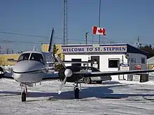
St. Stephen Airport
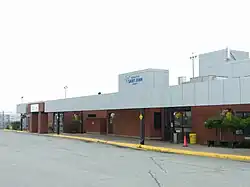
Saint John Airport
.jpg.webp)
Greater Moncton Roméo LeBlanc International Airport
Miramichi Airport
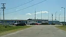
Fredericton International Airport
Downs Gulch Aerodrome
The list is sorted by the name of the community served; click the sort buttons in the table header to switch listing order.
| Community | Airport name | ICAO | TC LID | IATA | Coordinates |
|---|---|---|---|---|---|
| Bathurst | Bathurst Airport | CZBF | ZBF | 47°37′46″N 065°44′25″W | |
| Boston Brook | Boston Brook Airport | CCJ3 | 47°26′54″N 067°37′29″W | ||
| Brockway | Brockway Airport | CCX3 | 45°34′00″N 067°06′00″W | ||
| Bouctouche | Bouctouche Aerodrome | CDT5 | 46°30′34″N 064°41′38″W | ||
| Charlo | Charlo Airport | CYCL | YCL | 47°59′27″N 066°19′49″W | |
| Chipman | Chipman Airport | CCS4 | 46°08′55″N 065°54′15″W | ||
| Clearwater | Clearwater Aerodrome | CDJ4 | 46°42′48″N 066°49′42″W | ||
| Cormier-Village | Cormier Aerodrome | CRM4 | 46°10′51″N 064°22′32″W | ||
| Cumberland Bay | Cumberland Bay Water Aerodrome | CCB7 | 46°00′21″N 065°54′19″W | ||
| Doaktown | Doaktown Airport | CDU6 | 46°33′09″N 066°05′38″W | ||
| Downs Gulch | Downs Gulch Aerodrome | CDV2 | 47°45′11″N 067°25′36″W | ||
| Edmundston | Edmundston Airport | CYES | 47°29′24″N 068°28′54″W | ||
| Florenceville-Bristol | Bristol Aerodrome | CDA6 | 46°27′34″N 067°33′53″W | ||
| Florenceville-Bristol | Florenceville Airport | CCR3 | 46°25′34″N 067°37′41″W | ||
| Fredericton | Fredericton International Airport (Greater Fredericton International Airport) | CYFC | YFC | 45°52′08″N 066°32′14″W | |
| Fredericton | Fredericton (RCMP) Heliport | CRC2 | 45°55′54″N 066°40′00″W | ||
| Fredericton | Scottsfield Airpark | CCF9 | 45°57′37″N 067°05′43″W | ||
| Grand Falls | Grand Falls Airport | CCK3 | 47°04′30″N 067°41′06″W | ||
| Grand Manan Island | Grand Manan Airport | CCN2 | 44°42′48″N 066°47′47″W | ||
| Havelock | Havelock Airport | CCS5 | 45°59′11″N 065°18′07″W | ||
| Juniper | Juniper Airport | CCE3 | 46°33′48″N 067°10′06″W | ||
| Kars | Kars/Jenkins Cove Water Aerodrome | CJO3 | 45°35′38″N 065°57′25″W | ||
| Keswick River | Weyman Airpark | CCG3 | 46°02′15″N 066°51′32″W | ||
| Miramichi | Miramichi Airport | CYCH | YCH | 47°00′28″N 065°26′57″W | |
| Moncton | Greater Moncton Roméo LeBlanc International Airport (Moncton/Greater Moncton Roméo LeBlanc International Airport) | CYQM | YQM | 46°06′44″N 064°40′43″W | |
| Moncton | Moncton/McEwen Aerodrome | CCG4 | 46°09′14″N 064°46′07″W | ||
| Moncton | Moncton/Sailsbury Heliport | CDB5 | 46°02′58″N 065°03′45″W | ||
| Oromocto (CFB Gagetown) | Gagetown Heliport | CYCX | YCX | 45°50′16″N 066°26′12″W | |
| Pokemouche | Pokemouche Airport | CDA4 | N/A | 47°42′58″N 064°52′54″W | |
| Saint John | Saint John Airport | CYSJ | YSJ | 45°18′57″N 065°53′25″W | |
| Saint John | Saint John (Regional Hospital) Heliport | CSN6 | 45°18′08″N 066°05′17″W | ||
| Saint-Léonard | Saint-Léonard Aerodrome | CYSL | YSL | 47°09′27″N 067°50′05″W | |
| St. Stephen | St. Stephen Airport | CCS3 | 45°12′25″N 067°14′59″W | ||
| Sevogle River | Sevogle Airport | CCM3 | 47°11′00″N 066°09′00″W | ||
| Shediac Bridge-Shediac River | Shediac Bridge Aerodrome | CSB5 | 46°15′17″N 064°34′36″W | ||
| Sussex | Sussex Aerodrome | CCY3 | 45°41′11″N 065°32′31″W | ||
| Upper Kent | Upper Kent Aerodrome | CCH2 | 46°35′15″N 067°43′09″W | ||
| Woodstock | Woodstock Aerodrome | CCD3 | 46°09′00″N 067°33′00″W | ||
| Woodstock | Woodstock/Snokist Heliport | CSN4 | 46°12′10″N 067°39′34″W |
Defunct airports
| Community | Airport name | ICAO | TC LID | IATA | Coordinates |
|---|---|---|---|---|---|
| Blissville | Blissville Airport | CCH3 | YYS | 45°36′24″N 066°32′40″W | |
| Pennfield Ridge | RCAF Station Pennfield Ridge | 45°07′38″N 066°41′40″W | |||
| Scoudouc | RCAF Station Scoudouc | 46°10′13″N 64°35′17″W | |||
| Saint-Quentin | Saint-Quentin Aerodrome | CDC4 | 47°31′16″N 067°25′18″W |
References
- Canada Flight Supplement. Effective 0901Z 16 July 2020 to 0901Z 10 September 2020.
- Nav Canada's Water Aerodrome Supplement. Effective 0901Z 26 March 2020 to 0901Z 22 April 2021.
- National Airports System
| By name |
|
|---|---|
| By location indicator | |
| By province/territory | |
| By area | |
| National Airports System | |
| Related |
|
| |
This article is issued from Wikipedia. The text is licensed under Creative Commons - Attribution - Sharealike. Additional terms may apply for the media files.