Klaten Regency
Klaten Regency (Javanese: ꦏ꧀ꦭꦛꦺꦤ꧀, romanized: Klathèn) is a regency in Central Java province in Indonesia. It covers an area of 701.52 km2 and had a population of 1,130,047 at the 2010 Census[2] and 1,260,506 at the 2020 Census;[3] the official estimate as at mid 2023 was 1,284,386 (comprising 639,130 males and 645,256 females).[1] Its administrative centre is in the town of the same name; the town extends over 35.85 km2 to encompass three of the regency's districts, with a combined total of 135,681 inhabitants in mid 2023; a fourth district (Kalikotes) is part of its urban area.
Klaten Regency
Kabupaten Klaten | |
|---|---|
_from_Klaten%252C_Central_Java%252C_Indonesia_10.jpg.webp) | |
 Coat of arms | |
| Motto(s): Tumenga Tata Anggatra Rahardja (Looking in harmony, building prosperity) | |
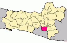
 Klaten Regency Location of Klaten Regency, Indonesia | |
| Coordinates: 7°38′56″S 110°38′9″E | |
| Country | Indonesia |
| Province | Central Java |
| Government | |
| • Regent | Sri Mulyani |
| Area | |
| • Total | 701.52 km2 (270.86 sq mi) |
| Population (mid 2023 estimate) | |
| • Total | 1,284,386 |
| • Density | 1,800/km2 (4,700/sq mi) |
| [1] | |
| Time zone | UTC+7 (WIB) |
| Area code | 0272 |
| Website | klatenkab.go.id |
Geography and Climate
Geography
Klaten borders Boyolali Regency in the North, Sukoharjo Regency and Wonogiri Regency in the East, and the Special Region of Yogyakarta to the South and West. Candi Prambanan, one of the biggest Hindu structures in Indonesia, is in the regency.
The 2006 Yogyakarta earthquake damaged the area, located near the active Mount Merapi volcano in central Java. The 2010 eruptions of Mount Merapi had a great impact on Klaten and its surrounding areas. A few of the victims who were affected by the eruption came from the regency of Klaten. The volcanic eruptions were so loud they caused panic and a rush for residents to seek refuge.
Klaten has a humid (> 0.65 p/pet) climate. The landscape is mostly covered with rainfed croplands, residential areas, and isolated stands of trees. The climate is classified as a Tropical Monsoon (short dry season, monsoon rains other months), with a tropical moist forest biozone. The soil in the area is high in nitosols, and andosols (nt), soil with deep, clay-enriched lower horizon with shiny ped surfaces.[4]
Climate
Klaten has a tropical monsoon climate (Am) according to the Köppen climate classification. The average temperature varies little from month to month. October is the warmest with an average temperature of 26.5 °C. July is coldest with an average temperature of 24.8 °C. The wet season has a rainfall peak around January. The dry season centers around August, which has the most sunshine.
| Climate data for Klaten | |||||||||||||
|---|---|---|---|---|---|---|---|---|---|---|---|---|---|
| Month | Jan | Feb | Mar | Apr | May | Jun | Jul | Aug | Sep | Oct | Nov | Dec | Year |
| Mean daily maximum °C (°F) | 28.9 (84.0) |
29.1 (84.4) |
29.5 (85.1) |
30.5 (86.9) |
30.2 (86.4) |
30.2 (86.4) |
29.6 (85.3) |
30.4 (86.7) |
30.8 (87.4) |
31.2 (88.2) |
30.1 (86.2) |
29.5 (85.1) |
30.0 (86.0) |
| Daily mean °C (°F) | 25.4 (77.7) |
25.5 (77.9) |
25.8 (78.4) |
26.3 (79.3) |
26.0 (78.8) |
25.5 (77.9) |
24.8 (76.6) |
25.3 (77.5) |
26.0 (78.8) |
26.5 (79.7) |
26.0 (78.8) |
25.8 (78.4) |
25.7 (78.3) |
| Mean daily minimum °C (°F) | 22.0 (71.6) |
22.0 (71.6) |
22.1 (71.8) |
22.1 (71.8) |
21.8 (71.2) |
20.8 (69.4) |
20.1 (68.2) |
20.2 (68.4) |
21.3 (70.3) |
21.9 (71.4) |
22.0 (71.6) |
22.1 (71.8) |
21.5 (70.8) |
| Average rainfall mm (inches) | 307 (12.1) |
292 (11.5) |
267 (10.5) |
196 (7.7) |
127 (5.0) |
79 (3.1) |
35 (1.4) |
34 (1.3) |
30 (1.2) |
91 (3.6) |
195 (7.7) |
249 (9.8) |
1,902 (74.9) |
| Source: Climate-Data.org[5] | |||||||||||||
Administrative

The regency government of Klaten was established on 28 October 1950. Its 26 districts (kecamatan) are subdivided into 391 rural villages (desa) and 10 urban villages (kelurahan ). The area includes tourist sites, places of interest, traditional arts, traditional events, and handicraft centers.[6]
Administrative districts
Klaten Regency is divided into twenty-six districts (kecamatan), tabulated below with their areas and their populations at the 2010 Census[2] and the 2020 Census,[3] together with the official estimates as at mid 2023.[1] The table also includes the locations of the district administrative centres, the number of administrative villages in each district (totaling 391 rural desa and 10 urban kelurahan), and its postcode.
| Kode Wilayah | Name of District (kecamatan) | Area in km2 | Pop'n Census 2010 | Pop'n Census 2020 | Pop'n Estimate mid 2023 | Admin centre | No. of villages | Post code |
|---|---|---|---|---|---|---|---|---|
| 33.10.01 | Prambanan | 26.09 | 46,262 | 52,592 | 53,839 | Prambanan | 16 | 57454 |
| 33.10.02 | Gantiwarno | 26.44 | 33,735 | 38,144 | 38,987 | Gantiwarno | 16 | 57455 |
| 33.10.03 | Wedi | 26.26 | 46,527 | 51,442 | 52,270 | Wedi | 19 | 57461 |
| 33.10.04 | Bayat | 42.10 | 52,718 | 61,191 | 63,021 | Bayat | 18 | 57462 |
| 33.10.05 | Cawas | 35.94 | 49,840 | 56,101 | 57,266 | Cawas | 20 | 57463 |
| 33.10.06 | Trucuk | 34.69 | 69,022 | 77,206 | 78,665 | Trucuk | 18 | 57467 (a) |
| 33.10.23 | Kalikotes | 14.11 | 32,316 | 37,051 | 38,023 | Kalikotes | 7 | 57451 |
| 33.10.07 | Kebonarum | 10.42 | 17,638 | 19,289 | 19,525 | Kebonarum | 7 | 57486 |
| 33.10.08 | Jogonalan | 27.59 | 52,688 | 59,628 | 60,962 | Jogonalan | 18 | 57452 |
| 33.10.09 | Manisrenggo | 30.60 | 38,097 | 43,242 | 44,247 | Manisrenggo | 16 | 57485 |
| 33.10.10 | Karangnongko | 29.49 | 32,132 | 36,304 | 37,098 | Karangnongko | 14 | 57483 |
| 33.10.22 | Ngawen | 18.45 | 39,946 | 45,235 | 46,255 | Ngawen | 13 | 57466 |
| 33.10.11 | Ceper | 25.77 | 57,958 | 64,305 | 65,366 | Ceper | 18 | 57465 |
| 33.10.12 | Pedan | 20.00 | 42,164 | 46,942 | 47,764 | Pedan | 14 | 57468 |
| 33.10.13 | Karangdowo | 30.83 | 38,117 | 42,515 | 43,283 | Karangdowo | 19 | 57464 |
| 33.10.14 | Juwiring | 30.90 | 53,087 | 57,764 | 58,386 | Juwiring | 19 | 57472 |
| 33.10.15 | Wonosari | 33.38 | 56,903 | 62,115 | 62,842 | Juwiring | 18 | 57473 |
| 33.10.16 | Delanggu | 20.03 | 38,911 | 41,041 | 41,110 | Delanggu | 16 | 57471 |
| 33.10.17 | Polanharjo | 25.22 | 36,058 | 40,065 | 40,743 | Polanharjo | 18 | 57474 |
| 33.10.18 | Karanganom | 25.62 | 40,312 | 45,219 | 46,111 | Karanganom | 19 | 57475 |
| 33.10.19 | Tulung | 34.44 | 44,974 | 51,850 | 53,296 | Tulung | 18 | 57482 |
| 33.10.20 | Jatinom | 37.11 | 52,249 | 58,953 | 60,219 | Jatinom | 18 (b) | 57481 |
| 33.10.21 | Kemalang | 60.19 | 34,006 | 38,547 | 39,427 | Kemalang | 13 | 57484 |
| 33.10.26 | Klaten Selatan (South Klaten) | 15.09 | 40,699 | 44,316 | 44,802 | Klaten Selatan | 12 (c) | 57421 - 57426 |
| 33.10.25 | Klaten Tengah (Central Klaten) | 9.59 | 39,522 | 40,421 | 41,067 | Klaten Tengah | 9 (d) | 57411 - 57419 |
| 33.10.24 | Klaten Utara (North Klaten) | 11.17 | 44,266 | 49,028 | 49,812 | Klaten Utara | 8 (e) | 57432 - 57438 |
| Totals | 701.52 | 1,130,047 | 1,260,506 | 1,284,386 | Klaten | 401 |
Notes: (a) except the desa of Wonosari (which has a postcode of 57473). (b) including kelurahan of Jatinom. (c) including kelurahan of Gayamprit.
(d) including 6 kelurahan of Bareng, Buntalan, Kabupaten, Klaten, Mojayan and Tonggalan. (e) including 2 kelurahan of Bareng Lor and Gergunung.
Place of Interest
Tourist objects in Klaten Regency are
- Sewu Prambanan Temple, is a traditional cultural tourism, and traditional ceremony that is potential.
- Deles Indah Nature [id], is located in the' slope of Mount Merapi, exactly in Sidorejo Village of Kemalang District [id].
- Jombor [id] swamp, is located in Krakitan Village [id] of Bayat District [id].
- Nilo and Ponggok Water source, is located in a fishing area of Janti, Janti Village [id], Polanharjo District [id] and Pongkok water source in Dukuh Nganjat [id] Pongkok Village [id] of Polanharjo District.
- Ki Ageng Pandanaran Graveyard in Paseban Village, Bayat District.
In addition there is a ceremonial festival using kue apam in Jatinom [id] each year.
Footnotes
- Badan Pusat Statistik, Jakarta, 28 February 2024, Kabupaten Klaten Dalam Angka 2024 (Katalog-BPS 1102001.3310)
- Biro Pusat Statistik, Jakarta, 2011.
- Badan Pusat Statistik, Jakarta, 2021.
- "Archived copy". Archived from the original on 2012-04-23. Retrieved 2011-11-15.
{{cite web}}: CS1 maint: archived copy as title (link) - "Climate: Klaten". Climate-Data.org. Retrieved 14 November 2020.
- "Visiting Klaten City in Central Java Province". www.indonesia-tourism.com. Retrieved 2020-06-03.
External links
- (in Indonesian) Official website
- (in Indonesian) twitter account for information and community in Klaten
- (in Indonesian) Photos around Klaten
- (in Indonesian) Forum Komunitas dan Komunikasi Warga Klaten
Regencies and cities of Central Java | ||
|---|---|---|
Capital: Semarang | ||
| Regencies |
|  |
| Cities | ||
See also: List of populated places in Central Java • List of regencies and cities of Indonesia | ||