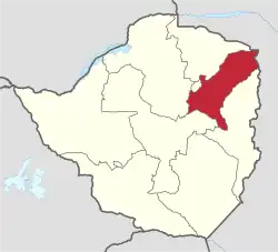
Mashonaland East Province
Mashonaland East, informally Mash East, is a province of Zimbabwe. It has an area of 32,230 km2 and a population of approximately 1.73 million (2022).[2] Marondera is the capital of the province.
Mashonaland East | |
|---|---|
 Mashonaland East, Province of Zimbabwe | |
| Country | Zimbabwe |
| Capital | Marondera |
| Area | |
| • Total | 32,230 km2 (12,440 sq mi) |
| Population (2022 census) | |
| • Total | 1,731,173 |
| • Density | 54/km2 (140/sq mi) |
| HDI (2018) | 0.539[1] low · 7th |
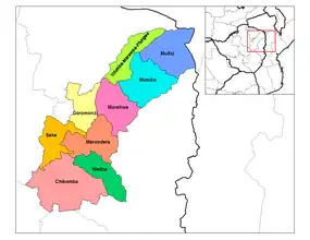
Districts of Mashonaland East
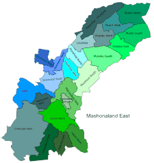
Constituencies
Demographics
| Census | Population[2] |
|---|---|
| 2002 | 1,127,413 |
| 2012 | 1,344,955 |
| 2022 | 1,731,173 |
Geography
Districts
Mashonaland East is divided into nine districts:
- Chikomba
- Goromonzi
- Marondera
- Mudzi
- Murehwa (Mrehwa)
- Mutoko
- Seke
- Uzumba-Maramba-Pfungwe (UMP)
- Wedza (Hwedza)
Education
Notes
- "Sub-national HDI - Area Database - Global Data Lab". hdi.globaldatalab.org. Retrieved 13 September 2018.
- "Zimbabwe: Administrative Division (Provinces and Districts) - Population Statistics, Charts and Map". www.citypopulation.de. Retrieved 17 February 2024.
External links
- "Base map of Mashonaland East Province" (PDF). United Nations Office for the Coordination of Humanitarian Affairs (OCHA). Archived from the original (PDF) on 19 April 2014.
This article is issued from Wikipedia. The text is licensed under Creative Commons - Attribution - Sharealike. Additional terms may apply for the media files.