Nachol Upazila
Nachole (Bengali: নাচোল) is an upazila of Chapai Nawabganj District in the Division of Rajshahi, Bangladesh.[1]
Nachole
নাচোল | |
|---|---|
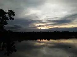 Pond in Chandpara | |
.svg.png.webp) | |
| Coordinates: 24°43.8′N 88°25.2′E | |
| Country | |
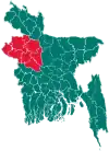
| Division | Rajshahi |
| District | Chapai Nawabganj |
| Area | |
| • Total | 283.67 km2 (109.53 sq mi) |
| Population (2011) | |
| • Total | 146,627 |
| • Density | 520/km2 (1,300/sq mi) |
| Time zone | UTC+6 (BST) |
| Website | nachol |
Geography
Nachole is located at 24.7292°N 88.4194°E. It has 32,922 households and total area 283.67 km2.[2]
Nachole Upazila is bounded by Gomostapur Upazila on the north-west, Niamatpur Upazila in Naogaon District, on the north-east, Tanore Upazila in Rajshahi District on the south-east and Chapai Nawabganj Sadar Upazila on the south west.[3]
Demographics
According to the 2011 Bangladesh census, Nachole Upazila had 32,922 households and a population of 146,627. 32,453 (22.13%) were under 10 years of age. Nachole had a literacy rate (age 7 and over) of 45.47%, compared to the national average of 51.8%, and a sex ratio of 1011 females per 1000 males. 17,364 (11.84%) lived in urban areas.[4] Ethnic population was 7,870 (5.37%), of which Santal were 3,785 and Barman 1,351.[5]
Administration
Nachol Upazila is divided into Nachol Municipality and four union parishads: Fatehpur, Kosba, Nachol, and Nezampur. The union parishads are subdivided into 201 mauzas and 191 villages.[4]
Unions of Nachole:[6]
| Name of Union | Area (acre) | Male Population | Female Population |
|---|---|---|---|
| Kosba | 15183 | 16463 | 16686 |
| Fatehpur | 18279 | 16715 | 16465 |
| Nachole | 15186 | 17300 | 17637 |
| Nijampur | 18489 | 13836 | 14161 |
Nachol Municipality is subdivided into 9 wards and 10 mahallas.[4]
The first elected mayor of the municipality was Abdul Malek Chowdhury (2010-2015). At present, the mayor is Abdur Rashid Khan Jhalu.
Education
Nachole Upazila has an average literacy rate of 45.5% (7+ years).[7] It has 7 college (including 1 government college), 3 technical college, 34 secondary school(including 1 government school), 77 primary school and 18 madrasa.
See also
References
- Mazharul Islam Taru (2012), "Nachole Upazila", in Sirajul Islam and Ahmed A. Jamal (ed.), Banglapedia: National Encyclopedia of Bangladesh (Second ed.), Asiatic Society of Bangladesh
- "Archived copy" (PDF). Archived from the original (PDF) on 2016-03-09. Retrieved 2017-01-09.
{{cite web}}: CS1 maint: archived copy as title (link) - "Nachole Upazila". Banglapedia. Retrieved 15 November 2018.
- "Bangladesh Population and Housing Census 2011 Zila Report – Chapai Nawabganj" (PDF). bbs.gov.bd. Bangladesh Bureau of Statistics.
- "Community Tables: Chapai Nawabganj district" (PDF). bbs.gov.bd. Bangladesh Bureau of Statistics. 2011.
- "Archived copy" (PDF). Archived from the original (PDF) on 2016-03-09. Retrieved 2017-01-09.
{{cite web}}: CS1 maint: archived copy as title (link) - "Archived copy" (PDF). Archived from the original (PDF) on 2016-03-09. Retrieved 2017-01-09.
{{cite web}}: CS1 maint: archived copy as title (link)
External links
- Official website (in Bengali)
| Upazila/Thana: |
| |
|---|---|---|