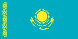
Outline of Kazakhstan
The following outline is provided as an overview of and topical guide to Kazakhstan:
.svg.png.webp)
.svg.png.webp)
The Republic of Kazakhstan is a landlocked sovereign country located across both Central Asia and Eastern Europe.[1] Ranked as the ninth largest country in the world as well as the world's largest landlocked country,[2] it has a territory of 2,727,300 km2 (greater than Western Europe). It is bordered by Russia, Kyrgyzstan, Turkmenistan, Uzbekistan and China. The country also borders on a significant part of the Caspian Sea.
Vast in size, the land in Kazakhstan is very diverse in types of terrain: flatlands, steppes, taigas, rock-canyons, hills, deltas, mountains, snow-capped mountains, and deserts. Kazakhstan has the 62nd largest population in the world, with a population density of less than 6 people per square kilometre (15 per sq. mi.).
Kazakhstan declared itself an independent country on December 16, 1991, the last Soviet republic to do so. Its communist-era leader, Nursultan Nazarbayev, became the country's new president. Since independence, Kazakhstan has pursued a balanced foreign policy and worked to develop its economy, especially its hydrocarbon industry. While the country's economic outlook is improving, President Nazarbayev maintains strict control over the country's politics. Several opposition leaders and journalists have been killed in recent years, and Western observers generally do not consider Kazakhstan's elections to be free and fair. Nevertheless, Kazakhstan's international prestige is building.[3] It is now considered to be the dominant state in Central Asia.[4] The country belongs to many international organizations, including the United Nations, NATO's Partnership for Peace, the Commonwealth of Independent States, and the Shanghai Cooperation Organisation. In 2010, Kazakhstan will chair the Organization for Security and Cooperation in Europe. In 2011, it formed a customs union with Russia and Belarus.
Kazakhstan is ethnically and culturally diverse, in part due to the mass deportations of many ethnic groups to the country during Stalin's rule. Kazakhs are the largest group, followed by Russians. Kazakhstan allows freedom of religion, and many different beliefs are represented in the country. Islam is the primary religion, followed by Orthodox Christianity. The official language is Kazakh, though Russian is still commonly and most widely used for everyday communication.
General reference
- Pronunciation:
- Common English country name: Kazakhstan
- Official English country name: The Republic of Kazakhstan
- Adjectives: Kazakhstani, Kazakh
- Demonym(s):
- Etymology: Name of Kazakhstan
- International rankings of Kazakhstan
- ISO country codes: KZ, KAZ, 398
- ISO region codes: See ISO 3166-2:KZ
- Internet country code top-level domain: .kz
Geography of Kazakhstan
- Kazakhstan is: a landlocked country
- Location:
- Kazakhstan is a region or subregion of:
- Northern Hemisphere and Eastern Hemisphere
- Eurasia
- Asia
- Europe
- Eastern Europe (a small portion only; 381,567 km2)
- Eurasia
- Northern Hemisphere and Eastern Hemisphere
- Time zones:
- Extreme points of Kazakhstan
- High: Khan Tengri 7,010 m (22,999 ft)
- Low: Caspian Depression −132 m (−433 ft)
- Land boundaries: 12,185 km
- Kazakhstan is a region or subregion of:
 Russia 6,846 km
 Uzbekistan 2,203 km
 China 1,533 km
 Kyrgyzstan 1,224 km
 Turkmenistan 379 km
- Coastline: none[5]
- Population of Kazakhstan: 18,177,700 – 62nd most populous country
- Area of Kazakhstan: 2,724,900 km2
- Atlas of Kazakhstan
Environment of Kazakhstan
- Climate of Kazakhstan
- Environmental issues in Kazakhstan
- Renewable energy in Kazakhstan
- Protected areas of Kazakhstan
- Wildlife of Kazakhstan
- Fauna of Kazakhstan
- Birds of Kazakhstan
- Mammals of Kazakhstan
- Fauna of Kazakhstan
Natural geographic features of Kazakhstan
- Islands of Kazakhstan
- Lakes of Kazakhstan
- Rivers of Kazakhstan
- List of World Heritage Sites in Kazakhstan
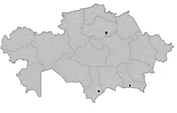
Administrative divisions of Kazakhstan
Provinces of Kazakhstan
|
 Provinces of Kazakhstan |
Notes:
- (1) Almaty and Nur-Sultan cities have the status of State importance and do not relate to any province.
- (2) Baikonur city has a special status because it is currently being leased to Russia with Baikonur cosmodrome through the year 2050.
Districts of Kazakhstan
| Province | District(s) |
|---|---|
| Akmola Province |
|
| Aktobe Province |
|
| Almaty Province |
|
| Atyrau Province |
|
| East Kazakhstan Province |
|
| Karagandy Province |
|
| Kostanay Province |
|
| Kyzylorda Province |
|
| North Kazakhstan |
|
| Pavlodar Province |
|
| South Kazakhstan Province |
|
| West Kazakhstan Province |
|
| Zhambyl Province |
|
Municipalities of Kazakhstan
Municipalities of Kazakhstan
- Capital of Kazakhstan: Capital of Kazakhstan
- Cities of Kazakhstan
Demography of Kazakhstan
Government and politics of Kazakhstan
- Form of government: presidential republic
- Capital of Kazakhstan: Capital of Kazakhstan
- Elections in Kazakhstan
- Political parties in Kazakhstan
- Taxation in Kazakhstan
Branches of the government of Kazakhstan
Executive branch of the government of Kazakhstan
Legislative branch of the government of Kazakhstan
Judicial branch of the government of Kazakhstan
Court system of Kazakhstan
Foreign relations of Kazakhstan
Foreign relations of Kazakhstan
- Diplomatic missions in Kazakhstan
- Diplomatic missions of Kazakhstan
International organization membership
The Republic of Kazakhstan is a member of:[1]
Law and order in Kazakhstan
Law of Kazakhstan
- Constitution of Kazakhstan
- Human rights in Kazakhstan
- Law enforcement in Kazakhstan
Military of Kazakhstan
History of Kazakhstan
Culture of Kazakhstan
- Cuisine of Kazakhstan
- Languages of Kazakhstan
- Media in Kazakhstan
- National symbols of Kazakhstan
- People of Kazakhstan
- Prostitution in Kazakhstan
- Public holidays in Kazakhstan
- Religion in Kazakhstan
- Buddhism in Kazakhstan
- Christianity in Kazakhstan
- Hinduism in Kazakhstan
- Islam in Kazakhstan
- Judaism in Kazakhstan
- List of World Heritage Sites in Kazakhstan
Art in Kazakhstan
- Cinema of Kazakhstan
- Literature of Kazakhstan
- Music of Kazakhstan
- Television in Kazakhstan
Economy and infrastructure of Kazakhstan
- Economic rank, by nominal GDP (2007): 55th (fifty-fifth)
- Agriculture in Kazakhstan
- Banking in Kazakhstan
- Communications in Kazakhstan
- Companies of Kazakhstan
- Currency of Kazakhstan: Tenge
- ISO 4217: KZT
- Energy in Kazakhstan
- Health care in Kazakhstan
- Mining in Kazakhstan
- Kazakhstan Stock Exchange
- Tourism in Kazakhstan
- Transport in Kazakhstan
- Airports in Kazakhstan
- Rail transport in Kazakhstan
- Roads in Kazakhstan
Education in Kazakhstan
Health in Kazakhstan
See also
- Index of Kazakhstan-related articles
- List of Kazakhstan-related topics
- List of international rankings
- Member states of the United Nations
- Outline of Asia
- Outline of geography
References
- "Kazakhstan". The World Factbook. United States Central Intelligence Agency. July 2, 2009. Retrieved July 23, 2009.
- Agency of Statistics of the Republic of Kazakhstan (ASRK). 2005. Main Demographic Indicators. Available at http://www.stat.kz Archived 2010-03-14 at the Wayback Machine
- Zarakhovich, Yuri (September 27, 2006). "Kazakhstan Comes on Strong", Time Magazine.
- Medvedev Visit Underscores Kazakh Victory Over Uzbekistan For Regional Dominance Archived 2008-05-28 at the Wayback Machine Radio Free Europe/Radio Liberty
- Kazakhstan borders the Caspian Sea and the Aral Sea, remnants of the ancient Paratethys Sea.
External links
- Government of Kazakhstan
- President of the Republic of Kazakhstan
- Atlas of Kazakhstan
- BBC News Country Profiles – Kazakhstan
- CIA World Factbook – Kazakhstan
- U.S. Department of State – Kazakhstan includes links to various reports
- Kazakhstan at Curlie
- The World Bank – Kazakhstan development issues
- Library of Congress – A Country Study: Kazakhstan last updated March 1996
- Kazakhstan: Humanitarian Country Profile – UN Office for the Coordination of Humanitarian Affairs
 Kazakhstan travel guide from Wikivoyage