Rocky Prairie
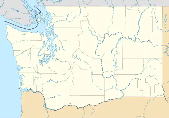
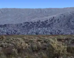
Rocky Prairie is a Puget prairie that is about 56 miles (90 km) southwest of Seattle, Washington, United States, and about 10 miles (16 km) south of Washington's capital city of Olympia. It sits very close to the Millersylvania State Park, the community of Maytown, and the city of Tenino.
| Rocky Prairie | |
|---|---|
| Rocky Prairie Natural Area Preserve | |
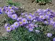
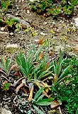
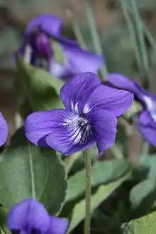
 Balsamorhiza deltoidea at Rocky Prairie | |
 Rocky Prairie | |
| Location | Thurston County, Washington |
| Nearest town | Tenino, Washington |
| Coordinates | 46°55′12.20″N 122°51′40.29″W |
| Area | 810 acres (330 ha) |
| Designation | Nature reserve |
| Owner | Washington Natural Areas Program Washington State Department of Natural Resources |
| Website | Rocky Prairie Natural Area Preserve |
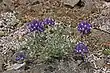
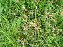
Old Highway 99 runs through Rocky Prairie. The part of the prairie west of the highway is called West Rocky Prairie. Both the west and east sides of the prairie have various plant and animal species. Many of the plant species are flowering plants. Both sides also have areas of Mima mounds (not to be confused with the Mima mounds at Mima Mounds Natural Area Preserve about 10.5 kilometers or 6.5 miles to the west).
Rocky Prairie is divided into several different properties. The two land owners west of Old Highway 99 are the Washington State Department of Fish and Wildlife and the Port of Tacoma. A major land owner east of Old Highway 99 is the Washington State Department of Natural Resources. There is also another property on the east side owned by Thurston County which has a gravel pit located on it. Some of the prairie on the east side is private property, and has pastures and houses on it.

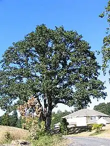
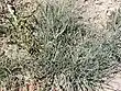
In West Rocky Prairie, the property that belongs to the Washington State Department of Fish and Wildlife is called the West Rocky Prairie Wildlife Area. The size of the property is 810 acres (330 hectares).[1][2] Part of the property is wooded, and part of it is in the prairie. The West Rocky Prairie Unit has over 300 acres (120 hectares) of woods, 360 acres (150 hectares) of wetlands, 40 acres (16 hectares) of Quercus garryana (Garry oak trees), and 300 acres (120 hectares) of Mima mounds.[3]
Plant species
| Rocky Prairie plant species (Click "show" to display table) | ||||||
|---|---|---|---|---|---|---|
| Division | Class | Order | Family | Genus and species | Common name(s) | |
| Pinophyta | Pinopsida | Pinales | Pinaceae | Pseudotsuga menziesii var. menziesii English translation: False hemlock spruce - Archibald Menzies - variety[4] |
Coast Douglas-fir Pacific Douglas-fir |
 |
| Apiales | Apiaceae | Lomatium triternatum[5] English translation: Small border - three leaves[4] |
Nineleaf biscuitroot | 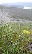 | ||
| Apiales | Apiaceae | Lomatium utriculatum[5] English translation: Small border - inflated[4] |
Common lomatium Spring gold |
 | ||
| Asparagales | Asparagaceae | Camassia quamash[5] English translation: Sweet - sweet[4] |
Camas Common camas Common camash Small camas Quamash |
_Greene.jpg.webp) | ||
| Asparagales | Iridaceae | Sisyrinchium angustifolium[5] English translation: Pig snout - narrow leaf[4] |
Narrow-leaf blue-eyed-grass | 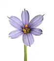 | ||
| Asterales | Asteraceae | Achillea millefolium[5] English translation: Achilles - thousand leaves[4] |
Common yarrow Yarrow |
.jpg.webp) | ||
| Asterales | Asteraceae | Antennaria microphylla[5] English translation: Antenna - small leaf[4] |
Dwarf everlasting Littleleaf pussytoes Pink pussytoes Rosy pussytoes Small pussytoes |
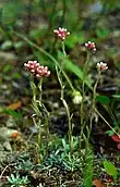 | ||
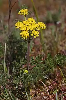
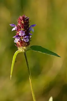
| Asterales | Asteraceae | Balsamorhiza deltoidea[5] English translation: Balsam root - triangle shaped[4] |
Deltoid balsamroot |  | ||
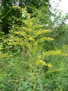
| Asterales | Asteraceae | Solidago canadensis[5] English translation: Heal (to make well) - Canadian[4] |
Canada goldenrod Canadian goldenrod |
 | ||
| Asterales | Asteraceae | Solidago spathulata[5] English translation: Heal (to make well) - small spathe[4] |
Coast goldenrod Dune goldenrod |
|||
| Asterales | Campanulaceae | Campanula rotundifolia[5] English translation: Little bell - round leaf[4] |
Harebell | 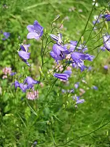 | ||
| Asterales | Campanulaceae | Howellia aquatilis[6] | Water howellia |  | ||
| Asterales | Asteraceae | Erigeron speciosus[5] English translation: Early old man - spectacular[4] |
Aspen fleabane Garden fleabane Showy fleabane |
 | ||
| Asterales | Asteraceae | Eriophyllum lanatum[5] English translation: Woolly leaf - woolly[4] |
Common woolly sunflower Oregon sunshine |
 | ||
| Asterales | Asteraceae | Microseris laciniata[5] English translation: Small lettuce like plant - narrow lobes[4] |
Cutleaf silverpuffs Cut leaf microseris |
 | ||
| Asterales | Asteraceae | Sericocarpus rigidus[5] | Columbian whitetop aster | 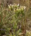 | ||
| Asterales | Asteraceae | Hieracium albertinum[5] | Houndstongue hawkweed Western hawkweed |
 | ||
| Caryophyllales | Caryophyllaceae | Cerastium arvense[5] English translation: Horn - farmland[4] |
Field chickweed |  | ||
| Dipsacales | Caprifoliaceae | Symphoricarpos albus[5] English translation: Fruit clusters - white[4] |
Common snowberry | 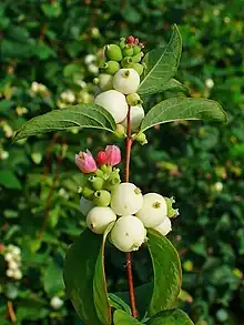 | ||
| Ericales | Ericaceae | Arctostaphylos uva-ursi[5] English translation: Bear, bunch of grapes - bear's grape[4] |
Kinnikinnick Pinemat manzanita |
 | ||
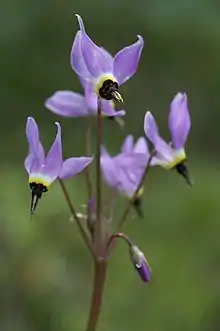
| Ericales | Primulaceae | Dodecatheon hendersonii[5] English translation: Twelve gods - Louis Forniquet Henderson[4] |
Broad-leaved shooting star Henderson's shooting star Mosquito bills Sailor caps |
 | ||
| Fabales | Fabaceae | Lupinus albicaulis[5] English translation: Wolf - white stems[4] |
Sicklekeel lupine | 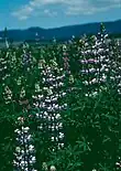 | ||
| Fabales | Fabaceae | Lupinus lepidus[5] English translation: Wolf - elegant[4] |
Dwarf lupine Pacific lupine Prairie lupine |
 | ||
| Fagales | Fagaceae | Quercus garryana[3] English translation: Oak - Nicholas Garry[4] |
Garry oak Oregon oak Oregon white oak |
 | ||
| Lamiales | Lamiaceae | Prunella vulgaris[5] English translation: Quinsey - common[4] |
Blue curls Brownwort Carpenter's herb Common self-heal Heal-all Heart-of-the-earth Woundwort |
 | ||
| Lamiales | Orobanchaceae | Castilleja levisecta[5] | Golden Indian paintbrush Golden paintbrush |
 | ||
| Liliales | Melanthiaceae | Toxicoscordion venenosum[5] English translation: Toxic garlic - venomous[4] |
Death camas Meadow death camas |
 | ||
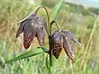
| Liliales | Liliaceae | Fritillaria affinis[5] English translation: Dice box - similar[4] |
Checker lily Chocolate lily |
 | ||
| Malpighiales | Violaceae | Viola adunca[5] English translation: Violet - hooked[4] |
Early blue violet Hookedspur violet Sand violet Western dog violet |
 | ||
| Poales | Juncaceae | Luzula campestris[5] English translation: Lucciola - plains[4] |
Field wood-rush Good Friday grass Sweep's brush |
 | ||
| Poales | Poaceae | Festuca idahoensis[5] English translation: Straw - Idaho[4] |
Blue hunchgrass Idaho fescue |
 | ||
| Poales | Poaceae | Danthonia californica[5] English translation: Étienne Danthoine - California[4] |
California oatgrass | 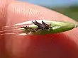 | ||
| Ranunculales | Ranunculaceae | Aquilegia formosa[5] English translation: Eagles' claw - beautiful[4] |
Crimson columbine Red columbine Western columbine |
 | ||
| Ranunculales | Ranunculaceae | Delphinium nuttallii[5] English translation: Dolphin - Thomas Nuttall[4] |
Nuttall's larkspur | 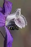 | ||
| Ranunculales | Ranunculaceae | Ranunculus occidentalis[5] English translation: Little frog - western[4] |
Western buttercup | 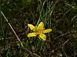 | ||
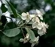
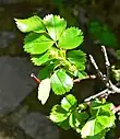
| Rosales | Rosaceae | Malus fusca[7] English translation: Apple - dusky[4] |
Oregon crabapple Pacific crabapple |
 | ||
| Rosales | Rosaceae | Potentilla gracilis[5] English translation: Potent, small - graceful[4] |
Graceful cinquefoil Slender cinquefoil |
 | ||
| Rosales | Rosaceae | Rosa pisocarpa[5] English translation: Rose - pea-like fruit[4] |
Cluster rose Swamp rose |
 | ||
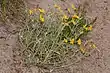
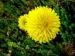
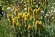
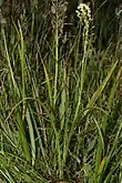
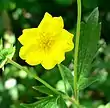
| Photographs shown were not necessarily taken at Rocky Prairie, and most likely were not taken there. Photographs of similar types of plants may be substituted if that species/subspecies photo is not available. | ||||||
Animal species
| Rocky Prairie animal species (Click "show" to display table) | ||||||
|---|---|---|---|---|---|---|
| Phylum | Class | Order | Family | Genus and species | Common name(s) | |
| Arthropoda | Insecta | Hymenoptera | Apidae | Bombus californicus[8] | California bumble bee |  |
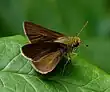
| Arthropoda | Insecta | Lepidoptera | Hesperiidae | Euphyes propertius[6] | Propertius duskywing | _(7437712788).jpg.webp) |
| Arthropoda | Insecta | Lepidoptera | Hesperiidae | Euphyes vestris[6] | Dun sedge skipper Dun skipper Sedge witch |
 |
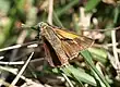
| Arthropoda | Insecta | Lepidoptera | Hesperiidae | Hesperia comma[6] | Common branded skipper Holarctic grass skipper |
_female.jpg.webp) |
| Arthropoda | Insecta | Lepidoptera | Hesperiidae | Hesperia juba[6] | Jagged-border skipper Juba skipper Yuba skipper |
 |
| Arthropoda | Insecta | Lepidoptera | Hesperiidae | Ochlodes sylvanoides ssp. orecoastus[6] | Coastal woodland skipper | 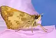 |
| Arthropoda | Insecta | Lepidoptera | Hesperiidae | Polites mardon[6] | Mardon skipper | 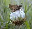 |
| Arthropoda | Insecta | Lepidoptera | Hesperiidae | Polites sonora[6] | Sonoran skipper Western long dash |
 |
| Arthropoda | Insecta | Lepidoptera | Lycaenidae | Icaricia icarioides ssp. blackmorei[6] | Puget blue | 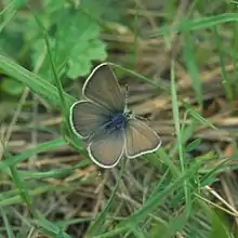 |
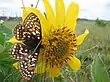
| Arthropoda | Insecta | Lepidoptera | Nymphalidae | Euphydryas editha ssp. taylori[6] | Taylor's checkerspot Whulge checkerspot |
 |
| Arthropoda | Insecta | Lepidoptera | Nymphalidae | Speyeria zerene ssp. bremnerii[6] | Valley silverspot | 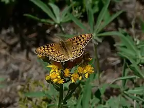 |
| Chordata | Amphibia | Anura | Ranidae | Rana pretiosa[9] | Oregon spotted frog | 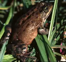 |
| Chordata | Aves | Anseriformes | Anatidae | Branta canadensis | Canada goose | .jpg.webp) |
| Chordata | Aves | Accipitriformes | Accipitridae | Haliaeetus leucocephalus[6] | Bald eagle | .jpg.webp) |
| Chordata | Aves | Passeriformes | Turdidae | Turdus migratorius | American robin | 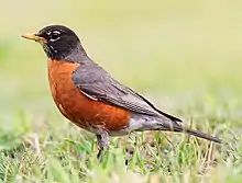 |
| Chordata | Mammalia | Artiodactyla | Cervidae | Odocoileus hemionus ssp. columbianus | Columbian black-tailed deer | 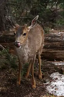 |
| Chordata | Mammalia | Rodentia | Geomyidae | Thomomys mazama ssp. tumuli[10] | Tenino pocket gopher |  |
| Chordata | Mammalia | Rodentia | Sciuridae | Tamiasciurus douglasii | Douglas squirrel | 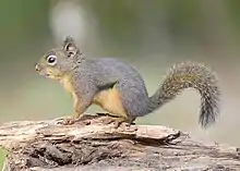 |
| Photographs shown in animal species chart were not necessarily taken at Rocky Prairie, and most likely were not taken there. Photographs of similar types of animals may be substituted if that species/subspecies photo is not available. | ||||||
Climate
The closest weather station to Rocky Prairie with a long period of record collection is at the Olympia Regional Airport in Tumwater, a suburb of Olympia. Under the Köppen climate classification system, the climate of the Olympia area is classified as Csb.[11] The C means that it is a temperate climate, meaning that the winters are chilly to mild. The s means that it is a Mediterranean climate, meaning that the summers are dry. The b means that the summers are warm but not hot. This type of climate is also called a warm-summer Mediterranean climate. In this type of climate, the winters are rainy. The area south of Olympia is in hardiness zone 8A.
| Climate data for the Olympia Regional Airport (metric units) Averages are for the most recent 50-year period as of 2019, 1969-2018 | |||||||||||||
| Jan | Feb | Mar | Apr | May | Jun | Jul | Aug | Sep | Oct | Nov | Dec | Year | |
| Average high °C | 7.4 | 9.6 | 12.2 | 15.0 | 18.8 | 21.7 | 25.2 | 25.4 | 22.1 | 15.9 | 10.2 | 7.0 | 15.9 |
| Average mean °C | 3.8 | 4.9 | 6.8 | 8.8 | 12.2 | 15.0 | 17.6 | 17.7 | 14.8 | 10.1 | 6.1 | 3.5 | 10.1 |
| Average low °C | 0.1 | 0.2 | 1.3 | 2.7 | 5.6 | 8.3 | 10.0 | 10.0 | 7.5 | 4.3 | 2.0 | 0.1 | 4.4 |
| Precipitation (cm) | 19.51 | 13.79 | 13.80 | 8.98 | 5.75 | 4.07 | 1.57 | 2.75 | 5.54 | 11.82 | 21.37 | 19.39 | 128.34 |
| Source for data to create chart: NOAA - National Centers for Environmental Information | |||||||||||||
| Climate data for the Olympia Regional Airport (standard units) Averages are for the most recent 50-year period as of 2019, 1969-2018 | |||||||||||||
| Jan | Feb | Mar | Apr | May | Jun | Jul | Aug | Sep | Oct | Nov | Dec | Year | |
| Average high °F | 45.3 | 49.3 | 54.0 | 59.0 | 65.9 | 71.0 | 77.3 | 77.8 | 71.8 | 60.5 | 50.4 | 44.6 | 60.6 |
| Average mean °F | 38.8 | 40.8 | 44.2 | 47.9 | 54.0 | 59.0 | 63.7 | 63.9 | 58.7 | 50.2 | 43.0 | 38.4 | 50.2 |
| Average low °F | 32.2 | 32.4 | 34.4 | 36.8 | 42.0 | 47.0 | 50.0 | 50.0 | 45.6 | 39.8 | 35.5 | 32.1 | 39.9 |
| Precipitation (inches) | 7.68 | 5.43 | 5.43 | 3.54 | 2.26 | 1.60 | 0.62 | 1.08 | 2.18 | 4.66 | 8.41 | 7.63 | 50.53 |
| Source for data to create chart: NOAA - National Centers for Environmental Information | |||||||||||||
Early history
Rocky Prairie and the other local prairies were formed around 17,000 BP (before present) during the Vashon Glaciation. The Vashon Glaciation was the time period in which the Cordilleran Ice Sheet extended south of the present-day US–Canadian border into Western Washington. The Vashon Glaciation was part of the Fraser Glaciation (the ice that had pushed through the Fraser River basin in British Columbia). This occurred during the Wisconsin Glaciation, the time period when ice sheets covered much of Canada and the northern United States. The Wisconsin Glaciation occurred during the last glacial period, a time when the Earth was more glaciated. This was the most recent glaciation of the Pleistocene Ice Age (the current ice age). The Pleistocene Ice Age is part of an even longer ice age called the Late Cenozoic Ice Age, which began 33.9 million BP with the formation of the Antarctic Ice Cap and continues to present day.

During the Vashon Glaciation, the Cordilleran Ice Sheet covered parts of Alaska and Canada. The portion that extended south of the Canadian border is called the Puget Lobe. Rocky Prairie was almost at the edge of where the glacier stopped, and was only under ice for a short period of time.
Pollen data collected from Battleground Lake (a lake about 123 kilometers (76 miles)to the southeast of Rocky Prairie) show that from 20,000 - 16,000 BP, annual temperatures in the area were about 6 ± 1 °C (10.8 ± 1.8 °F) colder than in present times (present times as of 1990).[12] Annual precipitation was around 1 meter (39 in) less,[12] meaning that precipitation was only about 24.5% of what it is in present times (present times as of 1990). At the glacier's edge, the wall of ice was around 200 meters (660 feet) high.[13]
As the glaciers melted, they left behind sand and gravel. The sand and gravel drains water making the soils dry, particularly in the summer. Many of the plants that grew on these prairies were used as food or medicine by the early inhabitants. With the eventual encroachment of forest, the early inhabitants had to burn the prairies in order to maintain them. The practice went on for millennia, and is still continued today by conservation organizations. In current times, burning is also a way of controlling invasive non-native species.
Recent history
With the arrival of European settlers in the mid-1800s, new immigrants introduced plant species from where they came from so they could feel more at home. Many of these plants reproduced quickly, took over, and began replacing native species. A very problematic species on prairie lands in Thurston County is Cytisus scoparius (Scotch broom). Non-native grasses have also been a problem. Most of the grass on the prairies is non-native.
Thurston County has seen explosive growth since the 1970s, and the trend is expected to continue for the foreseeable future. Between 1970 and 2010, the population density of Thurston County grew from just 41.1 persons/km2 (106.5 persons/mi2) to 134.9 persons/km2 (349.4 persons/mi2). The average rate of growth during those years was 2.3 person/km2 (6.1 persons/mi2) per year, which is 4.3 times the global average on land.
The explosive growth is causing prairie and other natural lands to quickly shrink.
Proposed development
The Port of Tacoma owns a property on West Rocky Prairie that borders on the West Rocky Prairie Unit (the state owned property). The size of the property is 746.56 acres (302.12 hectares).[14]
On July 17, 2006, the Port of Olympia and the Port of Tacoma made an agreement to build a railway logistics center.[15] The next day, the Port of Tacoma purchased the property at Rocky Prairie from Citifor, Inc. for a price of over US$21 million (about $70,000 per hectare or $28,000 per acre).[15] Later that year, local groups got together to block the proposal.[15]
In 2008, there were several meetings with the public in which the Thurston County commissioners and representatives from the ports were present. Many citizens had the opportunity to speak in front of the public and voice their opinion about the proposal. Almost everyone that spoke was opposed to the proposal. On June 30, 2008, the Port of Tacoma and the Port of Olympia dropped the proposal to put in the logistics center.[15]
The Port of Tacoma decided to sell the property.[15] In April 2010, a developer from southern California made a down payment on the property.[15] They formed a company called Maytown Sand and Gravel, LLC.[15] After about a year, the property went back to the Port of Tacoma.[15] The company had defaulted on their loan.[15]
In 2019, the Port of Tacoma is selling the property to NorthPoint Development, LLC, a development company centered in Riverside, Missouri for a price of $24 million (about $79,000 per hectare or $32,000 per acre).[16] The company is trying to get Thurston County to change the zoning of the property to industrial.[9]
The current proposal is to have a logistics center on West Rocky Prairie. There would be six million square feet of warehouses (which is about 56 hectares or 138 acres).[9] There would be a massive increase in truck and freight train traffic,[17] and numerous negative secondary environmental impacts.
References
- "Wildlife Areas | Washington Department of Fish & Wildlife". wdfw.wa.gov. Retrieved 5 September 2023.
- Black Hills Audubon Society (2016). "West Rocky Prairie 2016" (PDF). Washington Department of Fish and Wildlife. Retrieved 5 September 2023.
- "West Rocky Prairie". capitollandtrust.org. Capitol Land Trust. Retrieved 5 September 2023.
- "Welcome to Botanary, the Botanical Dictionary". davesgarden.com. Retrieved 2019-09-06.
- Davenport, Roberta. "Rocky Prairie Restoration and Native Plant Propagation Project" (PDF). cascadiaprairieoak.org. Retrieved 2019-09-06.
- Washington Wildlife & Recreation Coalition - West Rocky Prairie https://wildliferecreation.org/projects/west-rocky-prairie/
- "Geocaching - The Official Global GPS Cache Hunt Site". www.geocaching.com. 2012. Retrieved 5 September 2023.
- "Recovery Plan for Castilleja levisecta". Westside Prairie. 28 May 2015. Retrieved 5 September 2023.
- "South Thurston County Threatened by Huge Industrial Development – Black Hills Audubon Society". 17 April 2019. Retrieved 5 September 2023.
- "Endangered and Threatened Wildlife and Plants; Designation of Critical Habitat for Mazama Pocket Gophers" (PDF). National Archives Federal Register: 19711–19757. 9 April 2014. Docket #: FWS-R1-ES-2013-0021. Retrieved 5 September 2023.
- Henderson, Martha L. (14 April 2005). "Agricultural Spaces and Places Across America" (PDF). Evergreen State College. p. 19. Retrieved 5 September 2023.
- Whitlock, Cathy (1992). "Vegetational and Climatic History of the Pacific Northwest during the Last 20,000 Years: Implications for Understanding Present-day Biodiversity" (PDF). The Northwest Environmental Journal. 8 (5). OCLC 11193852. Retrieved 18 November 2016.
- Porter, Stephen C.; Swanson, Terry W. (20 April 1998). "Radiocarbon Age Constraints on Rates of Advance and Retreat of the Puget Lobe of the Cordilleran Ice Sheet during the Last Glaciation" (PDF). Quaternary Research. 50 (3): 205. Bibcode:1998QuRes..50..205P. CiteSeerX 10.1.1.588.6032. doi:10.1006/qres.1998.2004. OCLC 960783893. S2CID 53075285. Retrieved 18 November 2016.
- Thurston County Assessor's Office - A+ Parcel Look-Up System https://tcproperty.co.thurston.wa.us/propsql/basic.asp?pn=12602340100
- "A History of Efforts to Protect West Rocky Prairie". Friends of Rocky Prairie. Archived from the original on 18 May 2019. Retrieved 5 September 2023.
- "History". Friends of Rocky Prairie. Retrieved 5 September 2023.
- "Traffic". Friends of Rocky Prairie. Retrieved 5 September 2023.