Villar-d'Arêne
Villar-d'Arêne (French pronunciation: [vilaʁ daʁɛn]; Occitan: Vilars d'Arena) is a commune in the Hautes-Alpes department in southeastern France, between Grenoble and Briançon. It is in the French Alps, in Massif des Écrins. Near this village located in the Romanche valley, there is La Grave and Col du Lautaret. The access of the valley and its communes is departmental route 1091 (ex-national route 91) (Grenoble – Le Bourg-d'Oisans – Briançon).
Villar-d'Arêne | |
|---|---|
.JPG.webp) A general view of the village from the nearby hillside | |
 Coat of arms | |
Location of Villar-d'Arêne | |
 Villar-d'Arêne 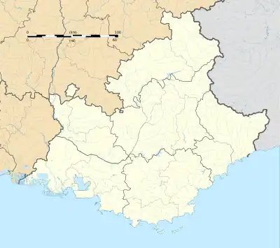 Villar-d'Arêne | |
| Coordinates: 45°02′37″N 6°20′15″E | |
| Country | France |
| Region | Provence-Alpes-Côte d'Azur |
| Department | Hautes-Alpes |
| Arrondissement | Briançon |
| Canton | Briançon-1 |
| Intercommunality | Briançonnais |
| Government | |
| • Mayor (2020–2026) | Olivier Fons[1] |
| Area 1 | 77.51 km2 (29.93 sq mi) |
| Population (2021)[2] | 283 |
| • Density | 3.7/km2 (9.5/sq mi) |
| Time zone | UTC+01:00 (CET) |
| • Summer (DST) | UTC+02:00 (CEST) |
| INSEE/Postal code | 05181 /05480 |
| Elevation | 1,519–3,883 m (4,984–12,740 ft) (avg. 1,650 m or 5,410 ft) |
| 1 French Land Register data, which excludes lakes, ponds, glaciers > 1 km2 (0.386 sq mi or 247 acres) and river estuaries. | |
Climate
| Climate data for Villar-d'Arêne (1991−2020 normals) | |||||||||||||
|---|---|---|---|---|---|---|---|---|---|---|---|---|---|
| Month | Jan | Feb | Mar | Apr | May | Jun | Jul | Aug | Sep | Oct | Nov | Dec | Year |
| Record high °C (°F) | 12.9 (55.2) |
14.9 (58.8) |
16.8 (62.2) |
21.7 (71.1) |
25.6 (78.1) |
32.5 (90.5) |
31.1 (88.0) |
30.1 (86.2) |
27.0 (80.6) |
21.7 (71.1) |
19.1 (66.4) |
13.1 (55.6) |
32.5 (90.5) |
| Mean daily maximum °C (°F) | 2.4 (36.3) |
3.3 (37.9) |
6.4 (43.5) |
10.8 (51.4) |
14.5 (58.1) |
19.0 (66.2) |
21.5 (70.7) |
20.6 (69.1) |
17.0 (62.6) |
12.7 (54.9) |
6.6 (43.9) |
3.1 (37.6) |
11.5 (52.7) |
| Daily mean °C (°F) | −3.7 (25.3) |
−3.6 (25.5) |
0.2 (32.4) |
5.1 (41.2) |
8.6 (47.5) |
12.3 (54.1) |
14.1 (57.4) |
13.6 (56.5) |
10.5 (50.9) |
7.0 (44.6) |
1.6 (34.9) |
−2.4 (27.7) |
5.3 (41.5) |
| Mean daily minimum °C (°F) | −9.8 (14.4) |
−10.6 (12.9) |
−6 (21) |
−0.6 (30.9) |
2.7 (36.9) |
5.5 (41.9) |
6.8 (44.2) |
6.5 (43.7) |
3.9 (39.0) |
1.3 (34.3) |
−3.4 (25.9) |
−7.8 (18.0) |
−1.0 (30.3) |
| Record low °C (°F) | −26.8 (−16.2) |
−29.6 (−21.3) |
−25.7 (−14.3) |
−18.1 (−0.6) |
−8.7 (16.3) |
−6.1 (21.0) |
−1.2 (29.8) |
−2 (28) |
−7.3 (18.9) |
−11.4 (11.5) |
−21.7 (−7.1) |
−25.1 (−13.2) |
−29.6 (−21.3) |
| Average precipitation mm (inches) | 44.3 (1.74) |
44.1 (1.74) |
52.6 (2.07) |
65.7 (2.59) |
95.4 (3.76) |
77.0 (3.03) |
70.4 (2.77) |
81.9 (3.22) |
58.1 (2.29) |
92.0 (3.62) |
102.2 (4.02) |
77.5 (3.05) |
861.2 (33.9) |
| Average precipitation days (≥ 1.0 mm) | 6.8 | 6.6 | 7.3 | 7.9 | 11.5 | 10.6 | 8.9 | 9.3 | 7.4 | 7.8 | 8.4 | 8.5 | 100.8 |
| Source: Météo-France[3] | |||||||||||||
Population
| Year | Pop. | ±% |
|---|---|---|
| 1962 | 146 | — |
| 1968 | 160 | +9.6% |
| 1975 | 155 | −3.1% |
| 1982 | 184 | +18.7% |
| 1990 | 178 | −3.3% |
| 1999 | 219 | +23.0% |
| 2008 | 284 | +29.7% |
| 2013 | 324 | +14.1% |
| 2014 | 330 | +1.9% |
Sights
References
- "Répertoire national des élus: les maires". data.gouv.fr, Plateforme ouverte des données publiques françaises (in French). 2 December 2020.
- "Populations légales 2021". The National Institute of Statistics and Economic Studies. 28 December 2023.
- "Fiche Climatologique Statistiques 1991-2020 et records" (PDF) (in French). Météo-France. Retrieved 29 August 2023.
Wikimedia Commons has media related to Villar-d'Arêne.
This article is issued from Wikipedia. The text is licensed under Creative Commons - Attribution - Sharealike. Additional terms may apply for the media files.