West Halmahera Regency
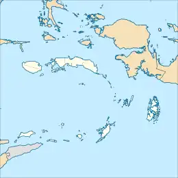
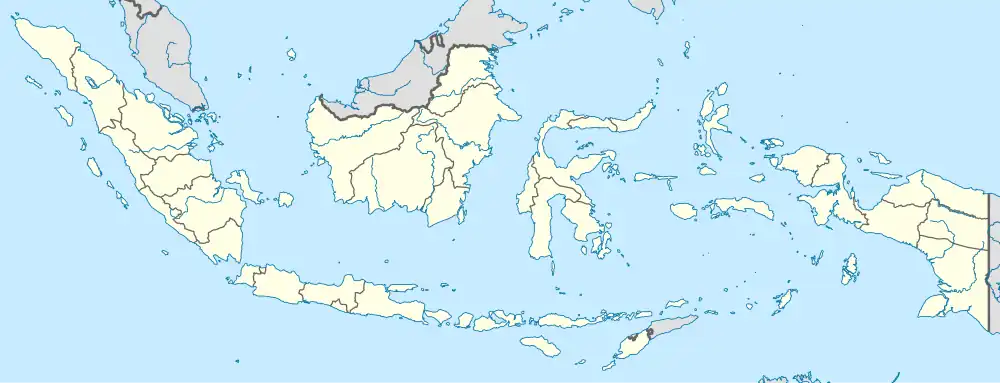
West Halmahera Regency (Indonesian: Kabupaten Halmahera Barat) is a regency (on Halmahera Island) in North Maluku Province of Indonesia. The regency was created on 25 February 2003 from the western districts of the former North Maluku Regency, and is now bounded by North Halmahera Regency to the north and east, while to the south it borders both East Halmahera Regency and that portion of the city of Tidore on the mainland of Halmahera. It covers an area of 2,239.11 km2, and it had a population of 100,424 people at the 2010 Census[2] and 132,349 at the 2020 Census;[3] the official estimate as at mid 2023 was 137,543 (comprising 70,281 males and 67,262 females).[1] The capital lies at Jailolo (town).
West Halmahera Regency
Kabupaten Halmahera Barat | |
|---|---|
 Coat of arms | |
| Motto: Ino Fo Makati Nyinga | |
| Coordinates: 1.4171°N 127.5526°E | |
| Country | |
| Province | |
| Capital | Jailolo |
| Government | |
| • Regent | Danny Missy |
| • Vice Regent | Ahmad Zakir Mando |
| Area | |
| • Total | 2,239.11 km2 (864.53 sq mi) |
| Population (mid 2023 estimate) | |
| • Total | 137,543 |
| • Density | 61/km2 (160/sq mi) |
| [1] | |
| Time zone | UTC+9 (IEST) |
| Area code | (+62) 922 |
| Website | halbarkab |
Administration
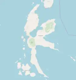
At the time of the 2020 Census the regency was divided into eight districts (kecamatan), but a ninth district - Loloda Tengah - has subsequently been created from the northern part of Loloda District. The districts are tabulated below with their areas and their populations at the 2010 Census[2] and 2020 Census,[3] together with the official estimates as at mid 2023.[1] The table also includes the locations of the district administrative centres, the number of administrative villages (all classed as rural desa) in each district, and their postal codes.
| Kode Wilayah | Name of District (kecamatan) | English name | Area in km2 | Pop'n Census 2010 | Pop'n Census 2020 | Pop'n Estimate mid 2023 | Admin centre | No. of villages | Post codes |
|---|---|---|---|---|---|---|---|---|---|
| 82.01.05 | Jailolo Selatan (a) | South Jailolo | 221.01 | 14,144 | 24,409 | 24,680 | Domato | 22 | 97751 |
| 82.01.01 | Jailolo | (North) Jailolo | 305.60 | 27,541 | 34,757 | 36,854 | Acango | 34 | 97752 |
| 82.01.04 | Sahu | (West) Sahu | 125.87 | 9,223 | 11,842 | 12,352 | Susupu | 19 | 97753 |
| 82.01.09 | Sahu Timur | East Sahu | 266.29 | 8,015 | 11,066 | 11,331 | Akelamo | 18 | 97758 |
| 82.01.08 | Ibu Selatan | South Ibu | 375.38 | 10,335 | 15,004 | 15,673 | Talaga | 16 | 97756 |
| 82.01.03 | Ibu | (Central) Ibu | 114.62 | 9,351 | 12,280 | 12,920 | Tongute Sungi | 17 | 97754 |
| 82.01.07 | Tabaru | North Ibu | 207.97 | 7,773 | 9,335 | 9,898 | Duono | 16 | 97757 |
| 82.01.02 | Loloda (b) | (South) Loloda | 359.02 | 10,626 | 13,656 | 9,191 | Kedi | 27 | 97755 |
| 82.01.10 | Loloda Tengah (b) | Central Loloda | 177.28 | (c) | (c) | 4,644 | Barataku | (c) | 97755 |
| Totals | 2,239.11 | 100,424 | 132,349 | 137,543 | Jailolo | 169 |
Notes: (a) including 37 offshore islands. (b) including 80 offshore islands in Loloda and Loloda Tengah Districts together. The largest island is Nusa Kahatola, west of Kedi village. (c) included in the figure for Loloda District, of which it was formerly a part.
Regencies and cities of North Maluku | ||
|---|---|---|
Capital: Sofifi | ||
| Regencies |
| |
| Cities | ||
References
- Badan Pusat Statistik, Jakarta, 28 February 2024, Kabupaten Halmahera Barat Dalam Angka 2024 (Katalog-BPS 1102001.8201)
- Biro Pusat Statistik, Jakarta, 2011.
- Badan Pusat Statistik, Jakarta, 2021.