Blansko District
Blansko District (Czech: okres Blansko) is a district in the South Moravian Region of the Czech Republic. Its capital is the town of Blansko.
Blansko District
Okres Blansko | |
|---|---|
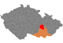 Location in the South Moravian Region within the Czech Republic | |
| Coordinates: 49°28′N 16°38′E | |
| Country | |
| Region | South Moravian |
| Capital | Blansko |
| Area | |
| • Total | 862.43 km2 (332.99 sq mi) |
| Population (2022)[2] | |
| • Total | 107,912 |
| • Density | 130/km2 (320/sq mi) |
| Time zone | UTC+1 (CET) |
| • Summer (DST) | UTC+2 (CEST) |
| Municipalities | 116 |
| * Towns | 8 |
| * Market towns | 9 |
Administrative division
Blansko District is divided into two administrative districts of municipalities with extended competence: Blansko and Boskovice.
List of municipalities
Towns are marked in bold and market towns in italics:
Adamov - Bedřichov - Benešov - Blansko - Borotín - Bořitov - Boskovice - Brťov-Jeneč - Bukovina - Bukovinka - Býkovice - Černá Hora - Černovice - Cetkovice - Chrudichromy - Crhov - Deštná - Dlouhá Lhota - Doubravice nad Svitavou - Drnovice - Habrůvka - Hodonín - Holštejn - Horní Poříčí - Horní Smržov - Jabloňany - Jedovnice - Kněževes - Knínice - Kořenec - Kotvrdovice - Kozárov - Krasová - Křetín - Krhov - Křtěnov - Křtiny - Kulířov - Kunčina Ves - Kunice - Kuničky - Kunštát - Lazinov - Lažany - Letovice - Lhota Rapotina - Lhota u Lysic - Lhota u Olešnice - Lipovec - Lipůvka - Louka - Lubě - Ludíkov - Lysice - Makov - Malá Lhota - Malá Roudka - Míchov - Milonice - Němčice - Nýrov - Obora - Okrouhlá - Olešnice - Olomučany - Ostrov u Macochy - Pamětice - Petrov - Petrovice - Prostřední Poříčí - Rájec-Jestřebí - Ráječko - Roubanina - Rozseč nad Kunštátem - Rozsíčka - Rudice - Šebetov - Sebranice - Šebrov-Kateřina - Senetářov - Skalice nad Svitavou - Skrchov - Sloup - Šošůvka - Spešov - Štěchov - Stvolová - Sudice - Suchý - Sulíkov - Světlá - Svinošice - Svitávka - Tasovice - Uhřice - Újezd u Boskovic - Újezd u Černé Hory - Úsobrno - Ústup - Valchov - Vanovice - Vavřinec - Vážany - Velenov - Velké Opatovice - Vilémovice - Vísky - Voděrady - Vranová - Vysočany - Závist - Zbraslavec - Žďár - Žďárná - Žernovník - Žerůtky
Geography

The landscape is rugged and it has mostly the character of highlands. The territory extends into four geomorphological mesoregions: Drahany Highlands (most of the territory), Upper Svratka Highlands (northwest), Boskovice Furrow (a strip from southwest to northeast) and Svitavy Uplands (north). The highest point of the district is a contour line on the hill Skalky in Benešov with an elevation of 728 m (2,388 ft), the lowest point is the river bed of the Svitava in Adamov at 246 m (807 ft).
The most important river is the Svitava, which flows across the entire territory from north to south. A notable river is also the Punkva, the longest underground river in the country. There are not many bodies of water, the most notable are Letovice Reservoir and Olšovec Pond.
Most of the Moravian Karst Protected Landscape Area lies in the district, in its southern part. It includes the Macocha Gorge and cave systems.
Demographics
|
|
| ||||||||||||||||||||||||||||||||||||||||||||||||||||||
| Source: Censuses[3][4] | ||||||||||||||||||||||||||||||||||||||||||||||||||||||||
Most populated municipalities
| Name | Population[2] | Area (km2) |
|---|---|---|
| Blansko | 19,715 | 45 |
| Boskovice | 11,661 | 28 |
| Letovice | 6,669 | 51 |
| Adamov | 4,429 | 4 |
| Rájec-Jestřebí | 3,672 | 16 |
| Velké Opatovice | 3,536 | 26 |
| Jedovnice | 2,805 | 14 |
| Kunštát | 2,788 | 24 |
| Černá Hora | 2,139 | 16 |
| Lysice | 1,877 | 11 |
Economy
The largest employers with its headquarters in Blansko District and at least 500 employers are:[5]
| Economic entity | Location | Number of employees | Activity |
|---|---|---|---|
| Blansko Hospital | Blansko | 500–999 | Health care |
| Boskovice Hospital | Boskovice | 500–999 | Health care |
| Jednota, spotřební družstvo v Boskovicích | Boskovice | 500–999 | Retail sale |
| Minerva Boskovice | Boskovice | 500–999 | Manufacture of sewing machines |
| P-D Refractories CZ | Velké Opatovice | 500–999 | Manufacture of refractory products |
Transport
There are no motorways passing through the district. The most important road is the I/43 (part of European route E461) from Brno to Svitavy.
Sights

The most important monuments in the district, protected as national cultural monuments, are:[6]
- Kunštát Castle
- Lysice Castle
- Rájec nad Svitavou Castle in Rájec-Jestřebí
- Church of the Name of the Virgin Mary in Křtiny
- Zwettl Altar in Adamov
- Stará huť ironworks in Adamov
The best-preserved settlements and landscapes, protected as monument reservations and monument zones, are:[7]
The most visited tourist destination is the Macocha Gorge.[8]
References
- "Small Lexicon of Municipalities of the Czech Republic – 2022". Czech Statistical Office. 2022-12-15.
- "Population of Municipalities – 1 January 2022". Czech Statistical Office. 2022-04-29.
- "Historický lexikon obcí České republiky 1869–2011 – Okres Blansko" (in Czech). Czech Statistical Office. 2015-12-21. pp. 1–2.
- "Population Census 2021: Population by sex". Public Database. Czech Statistical Office. 2021-03-27.
- "Registr ekonomických subjektů". Business Register (in Czech). Czech Statistical Office. Retrieved 2023-02-15.
- "Výsledky vyhledávání: Národní kulturní památky, okres Blansko". Ústřední seznam kulturních památek (in Czech). National Heritage Institute. Retrieved 2023-02-15.
- "Výsledky vyhledávání: Památkové rezervace, Památkové zóny, okres Blansko". Ústřední seznam kulturních památek (in Czech). National Heritage Institute. Retrieved 2023-02-15.
- "Turisté mají v České republice nejraději zoologické zahrady, technické památky, koupání a Pražský hrad" (in Czech). CzechTourism. 2022-06-24. Retrieved 2023-02-15.
External links
- Blansko District profile on the Czech Statistical Office's website