Blockhouse on Signal Mountain (Oklahoma)
Blockhouse on Signal Mountain is located along Mackenzie Hill Road within the West Range of the Fort Sill Military Reservation inceptively declared as Camp Wichita during May 1868 within the current administrative division of Comanche County, Oklahoma.[2][3] The blockhouse was established in 1871 pursuant to the Medicine Lodge Treaty of 1867.[4]
Blockhouse on Signal Mountain | |
 Blockhouse on Signal Mountain | |
 | |
| Nearest city | Lawton, Oklahoma[1] |
|---|---|
| Coordinates | 34.67433°N 98.49058°W |
| Area | 15 acres (6.1 ha) |
| Built | 1871 |
| Part of | Fort Sill, Oklahoma (ID66000629) |
| NRHP reference No. | 78002228 |
| Added to NRHP | November 29, 1978 |
The stone structure was constructed on the summit of Wichita Mountain's Signal Mountain encompassing a terrestrial elevation of 1,750 feet (530 m).[5] The shelter has a dimension of 14 feet (4.3 m) by 16 feet (4.9 m) with a structural exterior consisting of native stone collected within the vicinity of the Wichita Mountains. The four wall dwelling was erected as some of the first limestone architecture as part of Fort Sill's Old Post Corral or United States Army Quartermaster Corps fortification foraged during the American Indian Wars on the American frontier.[6]
The observation post was settled as a meteorological observatory and signal station.[7] The elevated station provided support for military communications between Signal Mountain, Medicine Bluffs, Mountain Scott, and Fort Reno geographically positioned north of the Canadian River within the Great Plains.[8][9] The Fort Sill, Indian Territory signal station officially commenced atmospheric observations and telegraphic communications on June 23, 1875 with meteorological reports beginning on September 9, 1875.[10][11]
The Army Signal Corps employed flag semaphore, heliograph, and signal lamp before implementing the signal field wire lines enabling electric telegraphic communications. The optical communication applied visible light along a visual topographical line of sight for distant information exchange. The semaphore communications served as an intelligence assessment of the Wichita Mountains cadastre while protecting the westward movement prairie trails as an integration of the Westward Expansion Trails.[12]
The mountainous altitude served as an observation of the Plains Indians equine flights disrupting the manifest destiny of westbound wagon trains ostracizing the Reconstruction era at the crest of the progressive Gilded Age. The high ground outpost continually anticipated the spontaneous mobilization of the Old Post Redoubt troops into the rugged terrain of southwestern Indian Territory.[13][14][15]
The geology of Oklahoma elevation features an area reconnaissance potentially revealing the disturbance of the prairie by bison hunting and horse breed herds reciprocative to the Oklahoma red beds and the shortgrass prairie of the Comanche, Kiowa, and Wichita Indian reservation within Southwestern Oklahoma.[16][17]
Native Raids on Military Supply Wagon Trains
The stone lookout station was decisively undisputed at the Fort Sill outpost after Sheridan's campaign during the winter of 1868 to 1869 and the realization of cultural assimilation of Native Americans.[18][19]
During the commencement of 1870s, the Southern Plains tribes organized native raids on Indian Territory forts and military supply trains exemplifying the prairie plains as treacherous grounds for American frontier expeditions.[20][21][22] The Army on the Frontier chartered a defense line of forts throughout Indian Territory and Texas as a deterence for the safeguard of American pioneer, homesteading, and Territorial evolution of the United States.[23][24][25]
| Supply Trains on Oklahoma and Texas Prairies |
| ☆ Comanche and Kiowa conduct a skirmish at Camp Supply on June 11, 1870 in the Indian Territory often referred to as the Cherokee Outlet. [26][27] |
| ☆ Comanche and Kiowa conduct a skirmish known as the Warren Wagon Train raid occurring on May 18, 1871 in Young County, Texas.[28] The Texas native raids culminated into what is known today as the Comanche Wars and Texas–Indian wars.[29] |
| ☆ During September 1874, Captain Wyllys Lyman guided a provisions train grouped as thirty-six empty wagons to Camp Supply for the replenishment of supply provisions.[30][31] The wagon train was to collect provisions at Camp Supply and return to Nelson Miles Headquarters Dugout located near the Washita River with the North Fork Red River situated 25 miles (40 km) south of the headquarters encampment.[32][33] On September 9, 1874, Lyman's wagon train commenced the return by prairie trail when the double column train with sixty soldiers encountered a skirmish with tribal bands of Cheyenne, Comanche, and Kiowa consequently regressing into a battle from September 9 to September 14, 1874.[34]
The five day siege is often referred to as the Battle of Lyman's Wagon Train transpiring in the Texas Panhandle within the proximity of Fort Elliott and the east coordinate of Roger Mills County, Oklahoma.[35][36] The Plains Indians conflict was the third major battle of the Red River War occurring along the Historic Trails of the Southern Great Plains.[37][38][39] |
Listing as National Register of Historic Places
Blockhouse on Signal Mountain was established as National Register of Historic Places with the National Park Service on November 29, 1978.[40][41]
See also

| ☆ George Armstrong Custer | ☆ Randolph B. Marcy |
| ☆ George B. Davis | ☆ Richard Henry Pratt |
| ☆ Benjamin Grierson | ☆ Hugh L. Scott |
| ☆ William Babcock Hazen | ☆ Philip Sheridan |
| ☆ Ranald S. Mackenzie | ☆ Joshua W. Sill |
Southern Frontier Forts of Indian Territory
| △ Fort Arbuckle | △ Fort McCulloch |
| △ Fort Cobb | △ Fort Washita |
Exploratory Prairie Routes of Indian Territory
| ◎ California Road | ◎ Dodge-Leavenworth Expedition of 1834 |
| ◎ Josiah Gregg | ◎ Jean-Baptiste Bénard de la Harpe |
Indian Peace Commission and Southern Plains Tribal Agency
| ◇ Indian agent | ◇ James M. Haworth |
| ◇ Indian Peace Commission | ◇ Lawrie Tatum |
Preservation of American Bison
References
- Bentley, Bill F. (January 30, 1979). "Historic Blockhouse Named to Register". The Lawton Constitution, Vol. 77, No. 127, Ed. 1 Tuesday, January 30, 1979. Lawton, Oklahoma: The Lawton Constitution.
- Dinges, Bruce J. "Camp Wichita". The Encyclopedia of Oklahoma History and Culture. Oklahoma Historical Society.
- Vaupel, Barbara. "Medicine Bluff at Ft. Sill 1870's" [40" x 30" Oil on Canvas Artist Painting with Narrative]. Oklahoma Senate Artwork. Oklahoma Senate.
- "Medicine Lodge Treaty". National Park Service ~ Fort Larned National Historic Site Kansas. U.S. Department of the Interior.
- Signal Mountain in Geonames.org (cc-by)
- Hughes, Michael A. "Military, Nineteenth Century". The Encyclopedia of Oklahoma History and Culture. Oklahoma Historical Society.
- "Meteorological Observations at Military Stations ~ Public Resolution No. 12" (PDF). USLaw.Link. 41st Congress, Session II ~ 16 Stat. 369. United States Government Publishing Office. February 9, 1870.
- "Signal Mountain". Geographic Names Information System. United States Geological Survey, United States Department of the Interior.
- "Medicine Bluffs". Geographic Names Information System. United States Geological Survey, United States Department of the Interior.
- Chief Signal Officer of the Army (November 1, 1876). "Fort Sill, Indian Territory" [Annual Report of the Chief Signal Officer to the Secretary of War for the Year 1876]. Washington, D.C.: United States Government Printing Office. p. 89 – via HathiTrust Digital Library.
- A Manual of Military Telegraphy for the Signal Service, United States Army at the HathiTrust Digital Library
- "Capt. Randolph Marcy's Exploration Route through Collingsworth County ~ Texas Historic Marker: 13474" [Near Wellington in Collingsworth County, Texas - The American South (West South Central)]. HMDB.org. The Historical Marker Database. 2006.
- "Enchanted Rock - Fredericksburg - Gillespie County ~ Marker Number: 10035" [1936 Texas Centennial - Historical Marker - Bronze Plaque]. Texas Historic Sites Atlas. Texas Historical Commission. 1936.
- "Nine Miles West is the Enchanted Rock" [Llano in Llano County, Texas - The American South (West South Central)]. HMDB.org. The Historical Marker Database.
- "Enchanted Rock State Natural Area History". Texas Parks and Wildlife ~ Texas State Parks. Texas Parks and Wildlife Department (TPWD).
- "Comanches and Horses". National Park Service. United States Department of the Interior.
- Catlin, George (1834). "Comanche Feats of Horsemanship". Smithsonian American Art Museum. Smithsonian Institution.
- Taylor, Morris F. (1973). "The Carr-Penrose Expedition: General Sheridan's Winter Campaign, 1868-1869". The Chronicles of Oklahoma. Oklahoma Historical Society. 51 (2 - Summer 1973): 159–176. LCCN 23027299. OCLC 655582328.
- Motes, Kevin D. (2013). ""The Indian Character": Cross-cultural Relations in Indian Territory after the Civil War". The Chronicles of Oklahoma. Oklahoma Historical Society. 91 (3 - Fall 2013): 296–315. LCCN 23027299. OCLC 655582328.
- Kalisch, Philip A.; Kalisch, Beatrice J. (1972). "Indian Territory Forts, 1839-1865" [Indian Territory Forts: Charnel Houses of the Frontier, 1839-1865]. The Chronicles of Oklahoma. Oklahoma Historical Society. 50 (1 - Spring 1972): 65–81. LCCN 23027299. OCLC 655582328.
- "The Most Dangerous Prairie in Texas" [Fort Griffin and the Prairie-Plains Frontier]. Frontier Forts Main ~ Texas Beyond History. University of Texas at Austin.
- "Protection of the Frontier of Texas" [H.R. Rep. No. 61, 43d Cong., 1st Sess. (1874)]. University of Oklahoma College of Law. American Indian and Alaskan Native Documents in the Congressional Serial Set: 1817 - 1899. United States Publishing Office. January 30, 1874.
- "Texas Frontier Forts". Frontier Forts Main ~ Texas Beyond History. University of Texas at Austin.
- "Federal Forts in Texas 1848-1861". Historical Maps of Texas ~ Perry-Castañeda Library Map Collection. The University of Texas at Austin.
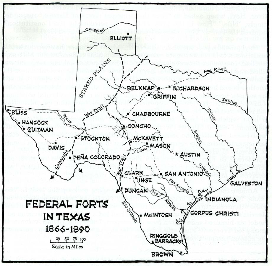
- "Federal Forts in Texas 1866-1890". Historical Maps of Texas ~ Perry-Castañeda Library Map Collection. The University of Texas at Austin.
- Mooney, James (1898). "Calendar History of the Kiowa Indians" [Ankopaaingyadete ~ Winter 1877-78]. Internet Archive. Washington, D.C.: U.S. Government Printing Office. p. 342. OCLC 963677.
- "Battle of Camp Supply ~ June 11, 1870". Fort Supply Historic Site. Oklahoma Historical Society.
- "Warren Wagon Train Massacre - Graham ~ Marker Number: 5721". Texas Historic Sites Atlas. Texas Historical Commission. 1977.
- Dickerson, W. E .S. "American Indian Relations". Handbook of Texas Online. Texas State Historical Association.
- "Captain Wyllys Lyman". Texas Beyond History ~ Battles of the Red River War. University of Texas at Austin.
- "Lyman Wagon Train". Kiowas Besiege Wagon Train. Fort Tours Systems.
- "Gen. Nelson Miles Expedition (Headquarters Dugout) - Canadian ~ Marker Number: 2138". Texas Historic Sites Atlas. Texas Historical Commission. 1967.
- "Gen. Nelson Miles Expedition (Headquarters Dugout)" [Near Canadian in Hemphill County, Texas - The American South (West South Central)]. HMDB.org. The Historical Marker Database.
- Anderson, H. Allen. "Lyman's Wagontrain". Handbook of Texas Online. Texas State Historical Association.
- "Site of Lyman's Wagon Train Battle - Canadian - Hemphill County ~ Marker Number: 4826". Texas Historic Sites Atlas. Texas Historical Commission. 1967.
- "Site of Lyman's Wagon Train Battle" [Canadian in Hemphill County, Texas - The American South (West South Central)]. HMDB.org. The Historical Marker Database.
- "Major Battles of the Red River War". Texas Beyond History ~ Battles of the Red River War. University of Texas at Austin.
- "50 Yards West to Routes of Historic Trails - Canadian ~ Marker Number: 41". Texas Historic Sites Atlas. Texas Historical Commission. 1969.
- "Historic Trails" [Near Canadian in Hemphill County, Texas - The American South (West South Central)]. HMDB.org. The Historical Marker Database.
- "Blockhouse on Signal Mountain ~ 78002228". National Register Digital Assets. National Park Service. November 29, 1978.
- "Blockhouse on Signal Mountain ~ 78002228" [National Register of Historic Places Inventory - Nomination Form for Federal Properties] (PDF). NPGallery HRHP PDF. National Park Service. November 29, 1978.
Bibliography
- Gregg, Josiah (1855). Commerce of the Prairies. Internet Archive. Philadelphia, Pennsylvania: J.W. Moore. LCCN 05037595. OCLC 15470464.
- Custer, George Armstrong (1874). My Life on the Plains: Or, Personal Experiences with Indians. Internet Archive (Librivox Audiobook). New York, N.Y.: Sheldon and Company. LCCN 01016759. OCLC 2451821.
- Allen, Joel Asaph (1876). American Bisons, Living and Extinct [Memoirs of the Museum of Comparative Zoology at Harvard College]. Internet Archive. Vol. IV. Cambridge, Massachusetts: University Press, Cambridge: Welch, Bigelow, & Co. ISBN 0405057016. LCCN 73017790. OCLC 6578281.
- Dodge, Richard Irving; Blackmore, William (1877). The Hunting Grounds of the Great West: a Description of the Plains, Game, and Indians of the Great North American Desert. Internet Archive. London, U.K.: Chatto & Windus. LCCN 41031883. OCLC 3386087.
- Custer, Elizabeth Bacon (1885). Boots and Saddles: or, Life in Dakota with General Custer. Internet Archive (Librivox Audiobook). New York, N.Y.: Harper & Brothers. LCCN 04022950. OCLC 213519450.
- United States War Department (1886). "Lieutenant General of the Army ~ Apache Campaign" [Annual Report of the Secretary of War 1886 ~ Volume 1]. HathiTrust Digital Library. Washington, D.C.: United States Government Office. pp. 143–146.
- Welsh, Herbert (1887). "The Apache Prisoners in Fort Marion, St. Augustine, Florida". Internet Archive. Philadelphia, Pennsylvania: Office of the Indian Rights Association. OCLC 61141514.
- Hornaday, William Temple (1889). The Extermination of the American Bison : with a Sketch of Its Discovery and Life History. Internet Archive. Washington, D.C.: United States Government Printing Office. OCLC 38907610.
- Brown, John Henry (1890). "Indian Wars and Pioneers of Texas". Internet Archive. Austin, Texas: L.E. Daniell. LCCN 03014078. OCLC 1342204122.
- Wilbarger, John Wesley (1890). Colonel Jack Hays [Indian Depredations in Texas: Reliable Accounts of Battles, Wars, Adventures, Forays, Murders, Massacres, etc.]. Austin, Texas: Hutchings Printing House. pp. 71–79. OCLC 2694641.
- 53rd United States Congress (1894). "Army Appropriations Act of 1894 ~ P.L. 53-228" [28 Stat. 238 ~ Subsistence Department - Removal of Indian Prisoners, Etc. Mount Vernon Barracks, Alabama] (PDF). 28 Stat. 233, Chapter 228 ~ August 6, 1894. United States Library of Congress.
- 53rd United States Congress (1895). "Army Appropriations Act of 1895 ~ P.L. 53-83" [28 Stat. 658 ~ Subsistence Department - Apache Indian Prisoners Support, Etc.] (PDF). 28 Stat. 654, Chapter 83 ~ February 12, 1895. United States Library of Congress.
- 57th United States Congress (1902). "Sundry Civil Appropriations Act of 1902 ~ P.L. 57-182" [32 Stat. 467-468 ~ Fort Sill, Oklahoma Apache Prisoners] (PDF). 32 Stat. 419, Chapter 1301 ~ June 28, 1902. United States Library of Congress.
- 58th United States Congress (1904). "Urgent Deficiencies Appropriations Act of 1904 ~ P.L. 58-22" [33 Stat. 26 ~ Military Establishment & Office of the Quartermaster General - Fort Sill, Oklahoma Maintenance of Apache Prisoners] (PDF). 33 Stat. 15, Chapter 160 ~ House Bill 10954 - February 18, 1904. United States Library of Congress.
- Cook, John R. (1907). The Border and the Buffalo : an Untold Story of the Southwest Plains. Internet Archive. Topeka, Kansas: Crane and Company. LCCN 12002506. OCLC 10334692.
- Crittenden, H.L. (October 31, 1907). "An Unknown Grave ~ Lawton, Okla., Oct. 21". Mangum Sun-Monitor (Newspaper). Vol. 17, no. 46 (1 ed.). Mangum, Oklahoma: Oklahoma Historical Society. p. 2. LCCN sn96087866. OCLC 34975177.
- 62nd United States Congress (1912). "Indian Department Appropriations Act of 1912 ~ P.L. 62-335" [37 Stat. 534 § 17 ~ Oklahoma - Apache Indian Prisoners Relief and Settlement Of] (PDF). 37 Stat. 518, Chapter 388 ~ House Bill 20723 - August 24, 1912. United States Library of Congress.
- Custer, Elizabeth Bacon (1928). "Letter from Elizabeth Custer to Dr. C. C. Rister, July 28, 1928" [Letter from Elizabeth Custer to Dr. C. C. Rister, discussing General George Armstrong Custer's attitude and interactions with the Native Americans]. University of North Texas Libraries ~ The Portal to Texas History. Hardin-Simmons University Library.
- Rister, Carl Coke (1929). "The Significance of the Destruction of the Buffalo in the Southwest". Southwestern Historical Quarterly. Texas State Historical Association. 33 (1): 34–49. JSTOR 30237207.
- Hume, C. Ross (1938). "Historic Sites Around Anadarko". The Chronicles of Oklahoma. Oklahoma Historical Society. 16 (4 - December 1938): 410–424. LCCN 23027299. OCLC 655582328.
- Foreman, Grant (1941). "Historical Background of the Kiowa Comanche Reservation". The Chronicles of Oklahoma. Oklahoma Historical Society. 19 (2 - June 1941): 129–140. LCCN 23027299. OCLC 655582328.
- Schmitt, Karl (1950). "Wichita-Kiowa Relations and the 1874 Outbreak". The Chronicles of Oklahoma. Oklahoma Historical Society. 28 (2 - Summer 1950): 154–160. LCCN 23027299. OCLC 655582328.
- Mitchell, Sara Brown (1950). "The Early Days of Anadarko". The Chronicles of Oklahoma. Oklahoma Historical Society. 28 (4 - Winter 1950): 390–398. LCCN 23027299. OCLC 655582328.
- Griswold, Gillett (1958). "Old Fort Sill: The First Seven Years". The Chronicles of Oklahoma. Oklahoma Historical Society. 36 (1 - Spring, 1958): 2–14. LCCN 23027299. OCLC 655582328.
- Johze, Benedick (1961). "A Brief History of the Fort Sill Apache Tribe". The Chronicles of Oklahoma. Oklahoma Historical Society. 39 (4 - Winter 1961-62): 427–432. LCCN 23027299. OCLC 655582328.
- Monahan, Forrest D. (1967). "The Kiowa-Comanche Reservation" [The Kiowa-Comanche Reservation in the 1890's]. The Chronicles of Oklahoma. Oklahoma Historical Society. 45 (4 - Winter 1967-68): 451–463. LCCN 23027299. OCLC 655582328.
- Nye, Wilbur Sturtevant (1969). Carbine and Lance: The Story of Old Fort Sill. Norman, Oklahoma: University of Oklahoma Press. ISBN 978-0806187181. LCCN 79013137. OCLC 778993468.
- Fischer, LeRoy H. (1975). "Oklahoma Territory, 1890-1907". The Chronicles of Oklahoma. Oklahoma Historical Society. 53 (1 - Spring 1975): 3–8. LCCN 23027299. OCLC 655582328.
- Turcheneske, Jr., John Anthony (1976). "The United States Congress and the Release of the Apache Prisoners of War at Fort Sill". The Chronicles of Oklahoma. Oklahoma Historical Society. 54 (2 - Summer 1976): 199–226. LCCN 23027299. OCLC 655582328.
- Faulk, Odie B.; Franks, Kenny Arthur; Lambert, Paul F. (1978). Early Military Forts and Posts in Oklahoma. Gateway to Oklahoma History. Oklahoma City, Oklahoma: Oklahoma Historical Society. ISBN 978-0941498081. LCCN 78-70038. OCLC 982028838.
- Haes, Brenda L. (2000). "Fort Sill, the Chiricahua Apaches, and the Government's Promise of Permanent Residence". The Chronicles of Oklahoma. Oklahoma Historical Society. 78 (1 - Spring 2000): 28–43. LCCN 23027299. OCLC 655582328.
- Woolley, Bryan (2004). "The Frontier Forts of Texas". Texas Almanac. Texas State Historical Association.
- Beemer, Rod (2012). "Custer's Last Campaign of Sheridan's 1868-69 Winter Offensive". The Chronicles of Oklahoma. Oklahoma Historical Society. 90 (4 - Winter 2012-13): 440–461. LCCN 23027299. OCLC 655582328.
- Megehee, Mark K. (2018). Fort Sill ~ Images of America. Charleston, South Carolina: Arcadia Publishing. ISBN 978-1467129640. OCLC 1079066884.
Video Media Archive
- ☆ Fort Sill National Historic Landmark and Museum on YouTube
- ☆ "17164 The Signal Corps Basic Signal Communication ~ Field Wire Line Construction". United States Department of War. Periscope Film. The Signal Corps. 1941.
- ☆ Indians of Oklahoma: Exposition in Anadarko, Oklahoma c. 1950 on YouTube
- ☆ American Indian Dances at Indian City USA Circa 1950s on YouTube
- ☆ Anadarko Indian Exposition Parade: Late 1940s Early 1950s on YouTube
- ☆ Native American Missions in Oklahoma - 1932 on YouTube
- ☆ Oklahoma Indians: We Are Who We Were on YouTube
- ☆ Oklahoma: A Past Preserved - 1975 on YouTube
American Bison and Plains Indians Experience
- ☆ A Celebration of Heritage: Native Americans - Bison & the Great Plains on YouTube
- ☆ "American Buffalo : Spirit of a Nation". Internet Archive. New York, N.Y.: Thirteen/WNET. 1998. OCLC 42243992.
- ☆ Facing the Storm: Story of the American Bison on YouTube
- ☆ Hunting Buffalo (1910) on YouTube
- ☆ People of the Bison on YouTube
- ☆ Return of the American Bison on YouTube
External links
 Media related to Signal Mountain Blockhouse at Wikimedia Commons
- "Fort Smith-Santa Fe Trail" [Map of Route Pursued by U.S. troops from Fort Smith, Arkansas, to Santa Fé, New Mexico, via South Side of Canadian River in the Year 1849]. Internet Archive. E. Weber & Co., Balto. 1849.
- United States Army Corps of Engineers (1873). "Progress Map of Lines and Areas of Explorations and Surveys Conducted under the Auspices of the War Department". The Portal of Texas History ~ University of North Texas Libraries. Washington, D.C.: United States Department of War.
- Monteith, James (1878). "Texas and Indian Territory Map". University of North Texas Libraries ~ The Portal to Texas History. University of Texas at Arlington Library.
- Okamura, Ryoko. "California Road". Encyclopedia of Oklahoma History and Culture. Oklahoma Historical Society.
- Carroll, H. Bailey. "Santa Fe Trail". Handbook of Texas Online. Texas State Historical Association.
- Boissoneault, Lorraine (October 23, 2017). "How the 1867 Medicine Lodge Treaty Changed the Plains Indian Tribes Forever". Smithsonian Magazine History. Smithsonian Institution.
| Cache |
| |
|---|---|---|
| Elgin |
| |
| Fort Sill |
| |
| Indiahoma |
| |
| Lawton |
| |
| Medicine Park |
| |
| Meers | ||