Colinroobie
Colinroobie is a rural community in the central part of the Riverina in southern New South Wales, Australia. Previously referred to as Bents Hill its name was changed in January 2005.[3]
| Colinroobie New South Wales | |
|---|---|
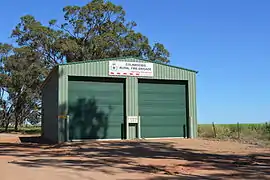 Rural Fire Service shed | |
Colinroobie | |
| Coordinates | 34°32′19″S 146°35′36″E |
| Population | 51 (SAL 2021)[1] |
| Postcode(s) | 2700 |
| Elevation | 291 m (955 ft) |
| Location |
|
| LGA(s) | Narrandera Shire |
| County | Cooper |
| State electorate(s) | Cootamundra |
| Federal division(s) | Riverina |
It is situated by road, about 33 kilometres (21 mi) north of Narrandera and 27 kilometres (17 mi) south of Barellan.
Colinroobie Post Office opened on 5 November 1895 and closed in 1952.[4]
Notes and references
- Australian Bureau of Statistics (28 June 2022). "Colinroobie (Suburb and Locality)". Australian Census 2021 QuickStats. Retrieved 28 June 2022.
- Travelmate Archived 24 March 2007 at the Wayback Machine
- "Colinroobie". Geographical Names Register (GNR) of NSW. Geographical Names Board of New South Wales.
- Phoenix Auctions History, Post Office List, retrieved 26 March 2021
External links
![]() Media related to Colinroobie at Wikimedia Commons
Media related to Colinroobie at Wikimedia Commons
This article is issued from Wikipedia. The text is licensed under Creative Commons - Attribution - Sharealike. Additional terms may apply for the media files.